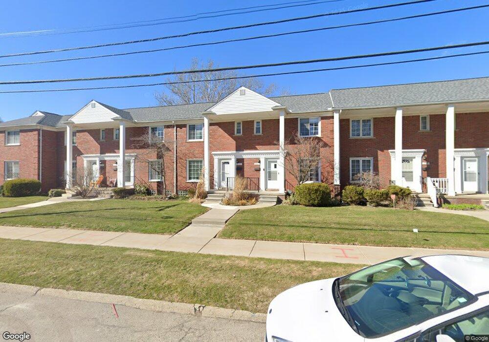
1522 W Webster Rd Unit Bldg-Unit Royal Oak, MI 48073
Estimated Value: $200,606 - $216,000
2
Beds
1
Bath
976
Sq Ft
$213/Sq Ft
Est. Value
About This Home
This home is located at 1522 W Webster Rd Unit Bldg-Unit, Royal Oak, MI 48073 and is currently estimated at $208,152, approximately $213 per square foot. 1522 W Webster Rd Unit Bldg-Unit is a home located in Oakland County with nearby schools including Addams Elementary, Royal Oak Middle School, and Royal Oak High School.
Ownership History
Date
Name
Owned For
Owner Type
Purchase Details
Closed on
Jul 23, 2020
Sold by
Jce Holdings Llc
Bought by
Wilusz David and Lovins Dotti
Current Estimated Value
Purchase Details
Closed on
May 28, 2014
Sold by
Depeal Michael R
Bought by
Jce Holdings Llc
Purchase Details
Closed on
Jun 15, 2012
Sold by
Schmansky Robert
Bought by
Depeal Michael R
Purchase Details
Closed on
Mar 23, 2007
Sold by
Serenko Nicole
Bought by
Schmansky Robert
Purchase Details
Closed on
Sep 26, 2002
Sold by
Romano R
Bought by
Serenko Nicole
Purchase Details
Closed on
Aug 30, 1999
Sold by
Biafora Jean A
Bought by
Romano Ronald E
Create a Home Valuation Report for This Property
The Home Valuation Report is an in-depth analysis detailing your home's value as well as a comparison with similar homes in the area
Home Values in the Area
Average Home Value in this Area
Purchase History
| Date | Buyer | Sale Price | Title Company |
|---|---|---|---|
| Wilusz David | $150,000 | None Available | |
| Jce Holdings Llc | $115,000 | Embassy Title Agency Inc | |
| Depeal Michael R | $53,000 | Embassy Title Agency Inc | |
| Schmansky Robert | $129,900 | Devon Title Agency | |
| Serenko Nicole | $127,250 | -- | |
| Romano Ronald E | $110,000 | -- |
Source: Public Records
Tax History Compared to Growth
Tax History
| Year | Tax Paid | Tax Assessment Tax Assessment Total Assessment is a certain percentage of the fair market value that is determined by local assessors to be the total taxable value of land and additions on the property. | Land | Improvement |
|---|---|---|---|---|
| 2024 | $3,709 | $86,920 | $0 | $0 |
| 2022 | $4,045 | $72,430 | $0 | $0 |
| 2020 | $3,578 | $0 | $0 | $0 |
| 2018 | $4,045 | $51,810 | $0 | $0 |
| 2017 | $2,931 | $51,810 | $0 | $0 |
| 2015 | -- | $68,120 | $0 | $0 |
| 2014 | -- | $66,410 | $0 | $0 |
| 2011 | -- | $58,050 | $0 | $0 |
Source: Public Records
Map
Nearby Homes
- 2438 Evergreen Dr
- 2814 Crooks Rd
- 1433 Royal Ave
- 2714 Glenview Ave
- 2423 Crooks Rd
- 1211 Smith Ave
- 1123 Royal Ave
- 2015 Alicia Ln
- 922 Butternut Ave
- 817 Magnolia Ave
- 816 Royal Ave
- 2303 Linwood Ave
- 1915 Northwood Blvd
- 1507 Roseland Ave
- 1304 W Windemere Ave
- 3100 Linwood Ave Unit B, 28
- 1631 Roseland Ave
- 2916 Clawson Ave
- 1212 W Windemere Ave
- 3402 Woodland Ave
- 1526 W Webster Rd Unit Bldg-Unit
- 1520 W Webster Rd Unit Bldg-Unit
- 1610 W Webster Rd
- 1608 W Webster Rd
- 1606 W Webster Rd Unit F23
- 2507 Galpin Ave
- 1518 W Webster Rd
- 1520 W Webster Rd
- 1522 W Webster Rd Unit D16
- 1524 W Webster Rd
- 1526 W Webster Rd Unit D14
- 1528 W Webster Rd Unit D13
- 2512 Galpin Ave Unit C11
- 2514 Galpin Ave
- 2516 Galpin Ave
- 2518 Galpin Ave
- 2520 Galpin Ave
- 2524 Galpin Ave Unit B5
- 2526 Galpin Ave Unit A4
- 1520 W Webster Rd Unit D 17