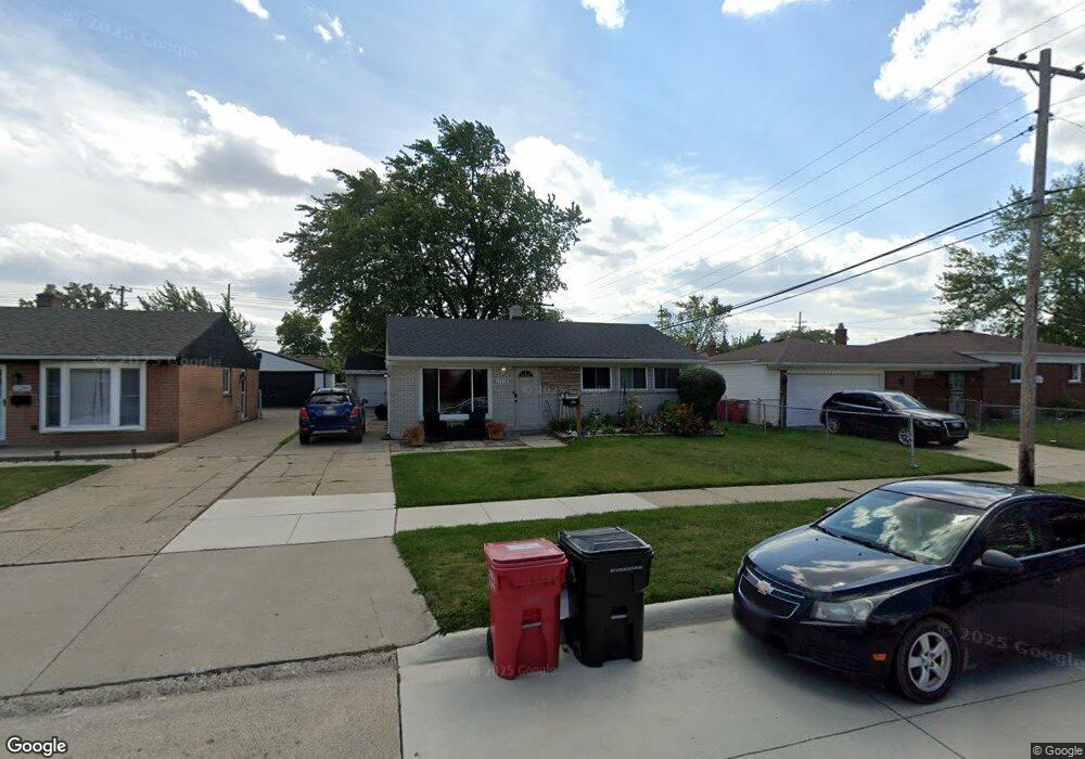
15228 Rudland St Roseville, MI 48066
Estimated Value: $202,000 - $209,322
3
Beds
1
Bath
1,323
Sq Ft
$156/Sq Ft
Est. Value
About This Home
This home is located at 15228 Rudland St, Roseville, MI 48066 and is currently estimated at $206,331, approximately $155 per square foot. 15228 Rudland St is a home located in Macomb County with nearby schools including Mark Twain Elementary School, Richards Middle School, and Fraser High School.
Ownership History
Date
Name
Owned For
Owner Type
Purchase Details
Closed on
Jan 1, 2022
Sold by
Kelsey Mark A
Bought by
Kelsey Marie
Current Estimated Value
Purchase Details
Closed on
Nov 5, 2002
Sold by
Haight Peter D
Bought by
Kelsey Mark A
Home Financials for this Owner
Home Financials are based on the most recent Mortgage that was taken out on this home.
Original Mortgage
$130,000
Interest Rate
6.01%
Purchase Details
Closed on
Nov 15, 2000
Sold by
Haight David R
Bought by
Haight Peter D
Home Financials for this Owner
Home Financials are based on the most recent Mortgage that was taken out on this home.
Original Mortgage
$60,000
Interest Rate
7.18%
Create a Home Valuation Report for This Property
The Home Valuation Report is an in-depth analysis detailing your home's value as well as a comparison with similar homes in the area
Home Values in the Area
Average Home Value in this Area
Purchase History
| Date | Buyer | Sale Price | Title Company |
|---|---|---|---|
| Kelsey Marie | -- | -- | |
| Kelsey Mark A | $131,000 | -- | |
| Haight Peter D | $75,000 | -- |
Source: Public Records
Mortgage History
| Date | Status | Borrower | Loan Amount |
|---|---|---|---|
| Previous Owner | Kelsey Mark A | $130,000 | |
| Previous Owner | Haight Peter D | $60,000 |
Source: Public Records
Tax History Compared to Growth
Tax History
| Year | Tax Paid | Tax Assessment Tax Assessment Total Assessment is a certain percentage of the fair market value that is determined by local assessors to be the total taxable value of land and additions on the property. | Land | Improvement |
|---|---|---|---|---|
| 2025 | $2,382 | $87,100 | $0 | $0 |
| 2024 | $1,423 | $80,800 | $0 | $0 |
| 2023 | $1,364 | $74,400 | $0 | $0 |
| 2022 | $2,125 | $66,100 | $0 | $0 |
| 2021 | $2,064 | $63,300 | $0 | $0 |
| 2020 | $1,323 | $57,300 | $0 | $0 |
| 2019 | $1,714 | $52,000 | $0 | $0 |
| 2018 | $1,764 | $0 | $0 | $0 |
| 2017 | $1,727 | $40,268 | $7,444 | $32,824 |
| 2016 | $1,714 | $40,268 | $0 | $0 |
| 2015 | $1,226 | $35,634 | $0 | $0 |
| 2013 | -- | $34,280 | $0 | $0 |
| 2011 | -- | $41,352 | $0 | $0 |
Source: Public Records
Map
Nearby Homes
- 15225 Common Rd
- 30324 Glenwood Cir
- 30464 Hayes Rd
- 30607 Glenwood Cir
- 15102 Raphael Terrace Unit K67
- 29448 El Dorado Plaza
- 30644 Hayes Rd
- 15797 Common Rd
- 29201 Hayes Rd Unit G-1
- 29273 Rd
- 29249 Hayes #74 Rd Unit 74
- 29304 Gloede Dr
- 15867 Loreto St
- 14625 Bade Dr
- 29101 Hayes Rd
- 30214 J Carls St
- 31070 Hayes Rd
- 14219 Harrison Dr
- 31263 Hayes Rd
- 30729 Mayflower St
- 15240 Rudland St
- 30048 Hayes Rd
- 30036 Hayes Rd
- 30024 Hayes Rd
- 15205 Common Rd
- 15211 Common Rd
- 15264 Rudland St
- 15219 Common Rd
- 30012 Hayes Rd
- 30110 Hayes Rd
- 15229 Rudland St
- 15241 Rudland St
- 15276 Rudland St
- 15253 Rudland St
- 30122 Hayes Rd
- 15231 Common Rd
- 15265 Rudland St
- 15288 Rudland St
- 15277 Rudland St
- 15237 Common Rd