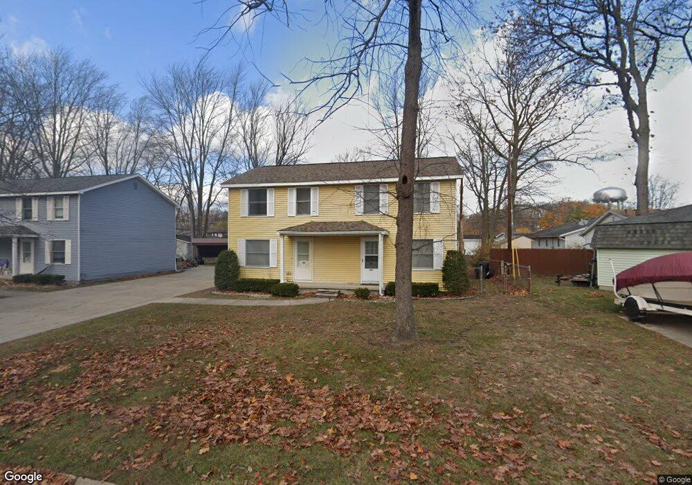
1523 Hazelwood Ln Unit 1529-1531 Hazelwood Port Huron, MI 48060
Estimated Value: $233,000 - $256,854
8
Beds
4
Baths
3,744
Sq Ft
$64/Sq Ft
Est. Value
About This Home
This home is located at 1523 Hazelwood Ln Unit 1529-1531 Hazelwood, Port Huron, MI 48060 and is currently estimated at $240,714, approximately $64 per square foot. 1523 Hazelwood Ln Unit 1529-1531 Hazelwood is a home located in St. Clair County with nearby schools including Garfield Elementary School, Holland Woods Middle School, and Port Huron Northern High School.
Ownership History
Date
Name
Owned For
Owner Type
Purchase Details
Closed on
Jan 18, 2019
Sold by
Rogers Barbara
Bought by
Coral Bay Properties Llc
Current Estimated Value
Home Financials for this Owner
Home Financials are based on the most recent Mortgage that was taken out on this home.
Original Mortgage
$416,216
Outstanding Balance
$365,939
Interest Rate
4.6%
Mortgage Type
New Conventional
Estimated Equity
-$125,225
Purchase Details
Closed on
May 20, 2015
Sold by
Rogers Harold Douglas and Rogers Barbara J
Bought by
The Harold Douglas Rogers & Barbara J Ro
Purchase Details
Closed on
Apr 5, 2013
Sold by
Barrett Charles Edward and Barrett Bonnie J
Bought by
Rogers Harold Douglas and Rogers Barbara Jo
Create a Home Valuation Report for This Property
The Home Valuation Report is an in-depth analysis detailing your home's value as well as a comparison with similar homes in the area
Home Values in the Area
Average Home Value in this Area
Purchase History
| Date | Buyer | Sale Price | Title Company |
|---|---|---|---|
| Coral Bay Properties Llc | $415,000 | Liberty Title | |
| The Harold Douglas Rogers & Barbara J Ro | -- | None Available | |
| Rogers Harold Douglas | $71,000 | Huron Title |
Source: Public Records
Mortgage History
| Date | Status | Borrower | Loan Amount |
|---|---|---|---|
| Open | Coral Bay Properties Llc | $416,216 |
Source: Public Records
Tax History Compared to Growth
Tax History
| Year | Tax Paid | Tax Assessment Tax Assessment Total Assessment is a certain percentage of the fair market value that is determined by local assessors to be the total taxable value of land and additions on the property. | Land | Improvement |
|---|---|---|---|---|
| 2025 | $5,267 | $99,500 | $0 | $0 |
| 2024 | $4,286 | $90,700 | $0 | $0 |
| 2023 | $4,071 | $80,300 | $0 | $0 |
| 2022 | $4,214 | $69,200 | $0 | $0 |
| 2021 | $4,211 | $63,300 | $0 | $0 |
| 2020 | $3,978 | $60,800 | $60,800 | $0 |
| 2019 | $2,863 | $53,500 | $0 | $0 |
| 2018 | $2,668 | $53,500 | $0 | $0 |
| 2017 | $2,448 | $49,000 | $0 | $0 |
| 2016 | $2,190 | $49,000 | $0 | $0 |
| 2015 | $2,149 | $43,600 | $43,600 | $0 |
| 2014 | $2,149 | $39,900 | $39,900 | $0 |
| 2013 | -- | $38,900 | $0 | $0 |
Source: Public Records
Map
Nearby Homes
- 1424 Hazelwood Ln
- 3214 Poplar St
- 3321 Stone St
- 1020 Sanborn St
- 3208 Mount Vernon Rd
- 3419 Riverside Dr
- 3455 Gratiot Ave
- 2913 11th Ave
- 1531 Robinson St
- 1202 Palmer Ct
- 3850 Butternut Ct
- 1434 Schumaker St
- 1218 Garfield St
- 2812 19th Ave
- 3515 Strawberry Ln
- 2857 Riverside Dr
- 1116 Hancock St
- 2215 Hancock St
- 2400 Stone St Unit 2414
- 2419 Cherry St
- 1529 Hazelwood Ln Unit 1531
- 0 Hazelwood Ln
- 3515 Williamsburg Dr Unit 3517
- 3505 Williamsburg Dr
- 1537 Hazelwood Ln
- 1535 Hazelwood Ln
- 1535 Hazelwood Ln Unit 1537
- 1524 Continental Ct Unit 1526
- 3519 Williamsburg Dr
- 3519 Williamsburg Dr Unit 3521
- 3519 Williamsburg Dr
- 1512 Continental Ct Unit 1514
- 1444 Hazelwood Ln Unit Bldg-Unit
- 1444 Hazelwood Ln
- 3460 Appomattox Dr Unit 3462
- 1536 Continental Ct Unit 1538
- 1541 Hazelwood Ln Unit 1543
- 3529 Williamsburg Dr
- 0 Williamsburg Dr
- 0 Williamsburgh Dr Unit G31197150