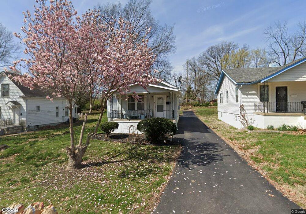
1523 Purdue Ave Saint Louis, MO 63133
Estimated Value: $51,000 - $92,000
2
Beds
1
Bath
936
Sq Ft
$70/Sq Ft
Est. Value
About This Home
This home is located at 1523 Purdue Ave, Saint Louis, MO 63133 and is currently estimated at $65,740, approximately $70 per square foot. 1523 Purdue Ave is a home located in St. Louis County with nearby schools including Normandy High School, The Leadership School, and Christ The King Catholic School.
Ownership History
Date
Name
Owned For
Owner Type
Purchase Details
Closed on
Sep 15, 2023
Sold by
Swinney Lola
Bought by
Rockett Shelly
Current Estimated Value
Home Financials for this Owner
Home Financials are based on the most recent Mortgage that was taken out on this home.
Original Mortgage
$33,400
Outstanding Balance
$32,709
Interest Rate
7.09%
Mortgage Type
New Conventional
Estimated Equity
$33,031
Purchase Details
Closed on
Oct 29, 2010
Sold by
Hines Nicole
Bought by
Swinney Lola
Purchase Details
Closed on
Oct 7, 2002
Sold by
Hines Clara
Bought by
Williams Maurice
Create a Home Valuation Report for This Property
The Home Valuation Report is an in-depth analysis detailing your home's value as well as a comparison with similar homes in the area
Home Values in the Area
Average Home Value in this Area
Purchase History
| Date | Buyer | Sale Price | Title Company |
|---|---|---|---|
| Rockett Shelly | -- | None Listed On Document | |
| Swinney Lola | $3,835 | None Available | |
| Williams Maurice | $500 | -- |
Source: Public Records
Mortgage History
| Date | Status | Borrower | Loan Amount |
|---|---|---|---|
| Open | Rockett Shelly | $33,400 |
Source: Public Records
Tax History Compared to Growth
Tax History
| Year | Tax Paid | Tax Assessment Tax Assessment Total Assessment is a certain percentage of the fair market value that is determined by local assessors to be the total taxable value of land and additions on the property. | Land | Improvement |
|---|---|---|---|---|
| 2025 | $906 | $11,330 | $2,380 | $8,950 |
| 2024 | $906 | $9,620 | $400 | $9,220 |
| 2023 | $946 | $9,620 | $400 | $9,220 |
| 2022 | $635 | $5,400 | $1,200 | $4,200 |
| 2021 | $610 | $5,400 | $1,200 | $4,200 |
| 2020 | $511 | $4,130 | $840 | $3,290 |
| 2019 | $500 | $4,130 | $840 | $3,290 |
| 2018 | $677 | $5,320 | $870 | $4,450 |
| 2017 | $681 | $5,320 | $870 | $4,450 |
| 2016 | $972 | $7,410 | $1,630 | $5,780 |
| 2015 | $943 | $7,410 | $1,630 | $5,780 |
| 2014 | $1,228 | $9,760 | $1,480 | $8,280 |
Source: Public Records
Map
Nearby Homes
- 1604 Quendo Ave
- 7346 Canton Ave
- 7339 Wayne Ave
- 7171 White Oak Ln
- 7336 Milan Ave
- 1542 Faris Ave
- 1529 Nixon Ave
- 7335 Trenton Ave
- 1545 Moore Place
- 1251 Waldron Ave
- 7372 Liberty Ave
- 7060 Canton Ave
- 1118 George St
- 7032 Canton Ave
- 7525 Dajoby Ln
- 7048 Raymond Ave
- 7529 Melrose Ave
- 7259 Teal Ave
- 7507 Liberty Ave
- 7631 Lynn Ave
- 1519 Purdue Ave
- 1525 Purdue Ave
- 1527 Purdue Ave
- 1517 Purdue Ave
- 1533 Purdue Ave
- 1513 Purdue Ave
- 1535 Purdue Ave
- 1520 Quendo Ave
- 1518 Quendo Ave
- 1522 Purdue Ave
- 1516 Quendo Ave
- 1524 Quendo Ave
- 1520 Purdue Ave
- 1528 Purdue Ave
- 1539 Purdue Ave
- 1518 Purdue Ave
- 1532 Purdue Ave
- 1530 Quendo Ave
- 1512 Quendo Ave
- 1516 Purdue Ave