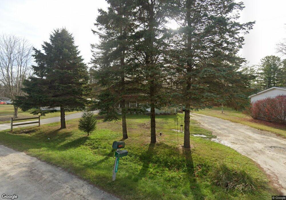
1523 Sturdevant Rd Kimball, MI 48074
Estimated Value: $132,105 - $181,000
3
Beds
1
Bath
972
Sq Ft
$155/Sq Ft
Est. Value
About This Home
This home is located at 1523 Sturdevant Rd, Kimball, MI 48074 and is currently estimated at $150,526, approximately $154 per square foot. 1523 Sturdevant Rd is a home located in St. Clair County with nearby schools including Kimball Elementary School, Central Middle School, and Port Huron High School.
Ownership History
Date
Name
Owned For
Owner Type
Purchase Details
Closed on
Dec 6, 2022
Sold by
Erdman Dennis G and Erdman Michele A
Bought by
Erdman Dennis G and Erdman Michele A
Current Estimated Value
Home Financials for this Owner
Home Financials are based on the most recent Mortgage that was taken out on this home.
Original Mortgage
$91,575
Outstanding Balance
$88,892
Interest Rate
7.08%
Mortgage Type
FHA
Estimated Equity
$61,634
Create a Home Valuation Report for This Property
The Home Valuation Report is an in-depth analysis detailing your home's value as well as a comparison with similar homes in the area
Home Values in the Area
Average Home Value in this Area
Purchase History
| Date | Buyer | Sale Price | Title Company |
|---|---|---|---|
| Erdman Dennis G | -- | Source Title | |
| Erdman Dennis G | -- | Source Title |
Source: Public Records
Mortgage History
| Date | Status | Borrower | Loan Amount |
|---|---|---|---|
| Open | Erdman Dennis G | $91,575 | |
| Closed | Erdman Dennis G | $91,575 |
Source: Public Records
Tax History Compared to Growth
Tax History
| Year | Tax Paid | Tax Assessment Tax Assessment Total Assessment is a certain percentage of the fair market value that is determined by local assessors to be the total taxable value of land and additions on the property. | Land | Improvement |
|---|---|---|---|---|
| 2025 | $997 | $49,200 | $0 | $0 |
| 2024 | $565 | $46,200 | $0 | $0 |
| 2023 | $517 | $45,200 | $0 | $0 |
| 2022 | $891 | $39,900 | $0 | $0 |
| 2021 | $804 | $34,000 | $0 | $0 |
| 2020 | $804 | $39,200 | $39,200 | $0 |
| 2019 | $789 | $35,800 | $0 | $0 |
| 2018 | $770 | $40,900 | $0 | $0 |
| 2017 | $755 | $37,700 | $0 | $0 |
| 2016 | $421 | $37,700 | $0 | $0 |
| 2015 | -- | $37,300 | $37,300 | $0 |
| 2014 | -- | $29,600 | $29,600 | $0 |
| 2013 | -- | $39,200 | $0 | $0 |
Source: Public Records
Map
Nearby Homes
- 6417 Dove Rd
- 1371 Sturdevant Rd
- 1688 Sturdevant Rd
- 1261 Sturdevant Rd
- 1533 Richman Rd
- 1671 Ditty Rd
- 00 Griswold Rd
- 1900 Burns Rd
- 0 Sparling Rd Unit 2210034403
- 1876 Morningstar Ave
- 2019 Edward Ln E
- 6928 Smiths Creek Rd
- VL Lambs Rd
- I-69 vac Taylor Dr
- 355 Henry St
- 7710 Sparling Rd
- 6153 Birch Creek Ct
- 0 Sparling Unit 20230091288
- 599 Trout Lake Ct
- 0 Wadhams Rd Unit 50155021
- 1529 Sturdevant Rd
- 1515 Sturdevant Rd
- 1540 Sturdevant Rd
- 1553 Sturdevant Rd
- 6551 Dove Rd
- 6551 Dove Rd
- 1514 Sturdevant Rd
- 6574 Dove Rd
- 6509 Dove Rd
- 1559 Sturdevant Rd
- 6575 Dove Rd
- 6575 Dove Rd
- 6539 Dove Rd
- 6480 Dove Rd
- 1560 Sturdevant Rd
- 6483 Dove Rd
- 1581 Sturdevant Rd
- 1455 Sturdevant Rd
- 1580 Sturdevant Rd
- 6450 Dove Rd