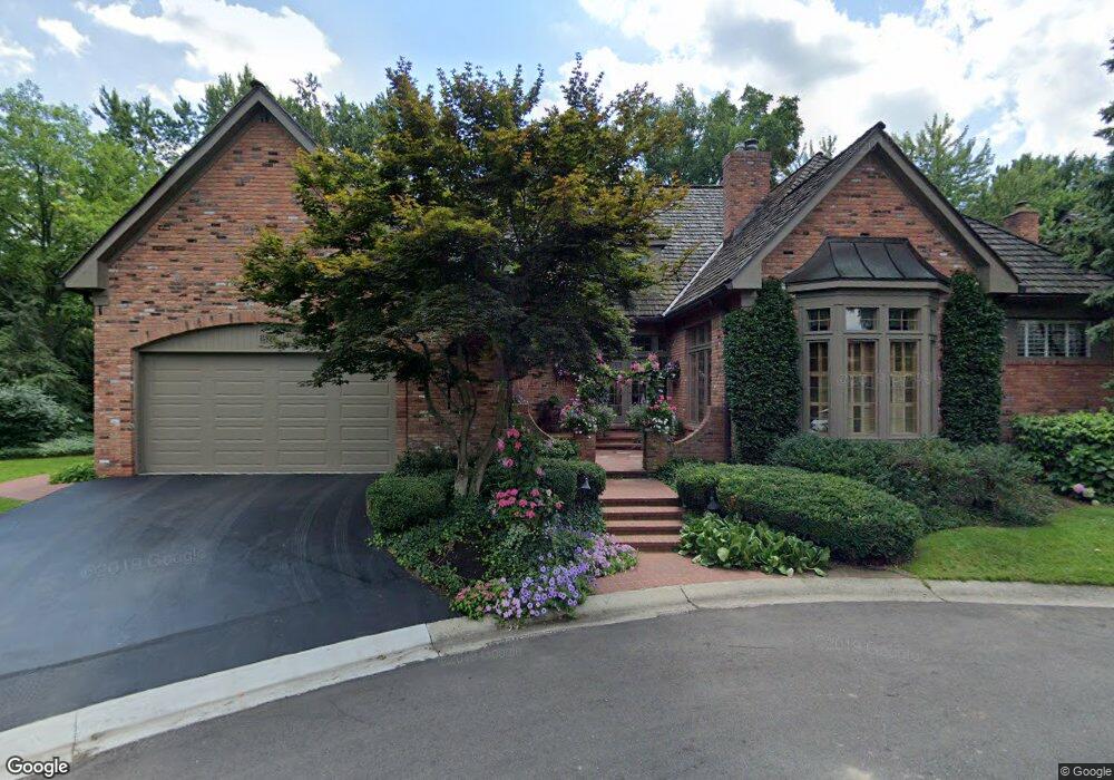
1524 Ashford Ln Birmingham, MI 48009
Estimated Value: $1,245,000 - $2,059,000
3
Beds
3
Baths
4,082
Sq Ft
$397/Sq Ft
Est. Value
About This Home
This home is located at 1524 Ashford Ln, Birmingham, MI 48009 and is currently estimated at $1,619,900, approximately $396 per square foot. 1524 Ashford Ln is a home located in Oakland County with nearby schools including Pierce Elementary School, Ernest W. Seaholm High School, and Holy Name School.
Ownership History
Date
Name
Owned For
Owner Type
Purchase Details
Closed on
Jun 3, 2025
Sold by
Lewis Lassie M
Bought by
Lewis Lassie M and Olson Amy R
Current Estimated Value
Purchase Details
Closed on
Jun 22, 2023
Sold by
Lewis Lassie M
Bought by
Lewis Lassie M
Purchase Details
Closed on
Aug 3, 2017
Sold by
Lewis Jerry B and Lewis Lassie M
Bought by
Lewis Jerry B and Lewis Lassie M
Purchase Details
Closed on
May 16, 2012
Sold by
Lewis Jerry B and Lewis Lassie M
Bought by
Lewis Jerry B and Jerry B Lewis Revocable Living Trust
Create a Home Valuation Report for This Property
The Home Valuation Report is an in-depth analysis detailing your home's value as well as a comparison with similar homes in the area
Home Values in the Area
Average Home Value in this Area
Purchase History
| Date | Buyer | Sale Price | Title Company |
|---|---|---|---|
| Lewis Lassie M | -- | None Listed On Document | |
| Lewis Lassie M | -- | None Listed On Document | |
| Lewis Lassie M | -- | None Listed On Document | |
| Lewis Lassie M | -- | None Listed On Document | |
| Lewis Lassie Ni | -- | None Listed On Document | |
| Lewis Jerry B | -- | None Available | |
| Lewis Jerry B | -- | None Available | |
| Lewis Jerry B | -- | None Available |
Source: Public Records
Tax History Compared to Growth
Tax History
| Year | Tax Paid | Tax Assessment Tax Assessment Total Assessment is a certain percentage of the fair market value that is determined by local assessors to be the total taxable value of land and additions on the property. | Land | Improvement |
|---|---|---|---|---|
| 2024 | $11,786 | $586,370 | $0 | $0 |
| 2023 | $11,294 | $506,460 | $0 | $0 |
| 2022 | $12,109 | $403,060 | $0 | $0 |
| 2021 | $12,217 | $396,760 | $0 | $0 |
| 2020 | $10,885 | $385,320 | $0 | $0 |
| 2019 | $12,318 | $373,130 | $0 | $0 |
| 2018 | $12,223 | $354,030 | $0 | $0 |
| 2017 | $12,203 | $344,900 | $0 | $0 |
| 2016 | $12,225 | $326,940 | $0 | $0 |
| 2015 | -- | $300,970 | $0 | $0 |
| 2014 | -- | $297,990 | $0 | $0 |
| 2011 | -- | $424,150 | $0 | $0 |
Source: Public Records
Map
Nearby Homes
- 1510 Ashford Ln Unit 6
- 1548 Ashford Ln
- 1536 Ashford Ln
- 1560 Ashford Ln Unit 9
- 1573 Ashford Ln
- 1595 Ashford Ln
- 1584 Ashford Ln
- 1584 Ashford Ln Unit 2
- 1219 Quarton Rd
- 1530 Pilgrim Ave
- 1280 Redding Rd
- 1450 Redding Rd
- 1470 Pilgrim Ave
- 1570 Pilgrim Ave
- 1586 Redding Rd
- 1450 Pilgrim Ave
- 1250 Redding Rd
- 1483 Old Salem Ct
- 1501 Old Salem Ct
- 1592 Redding Rd