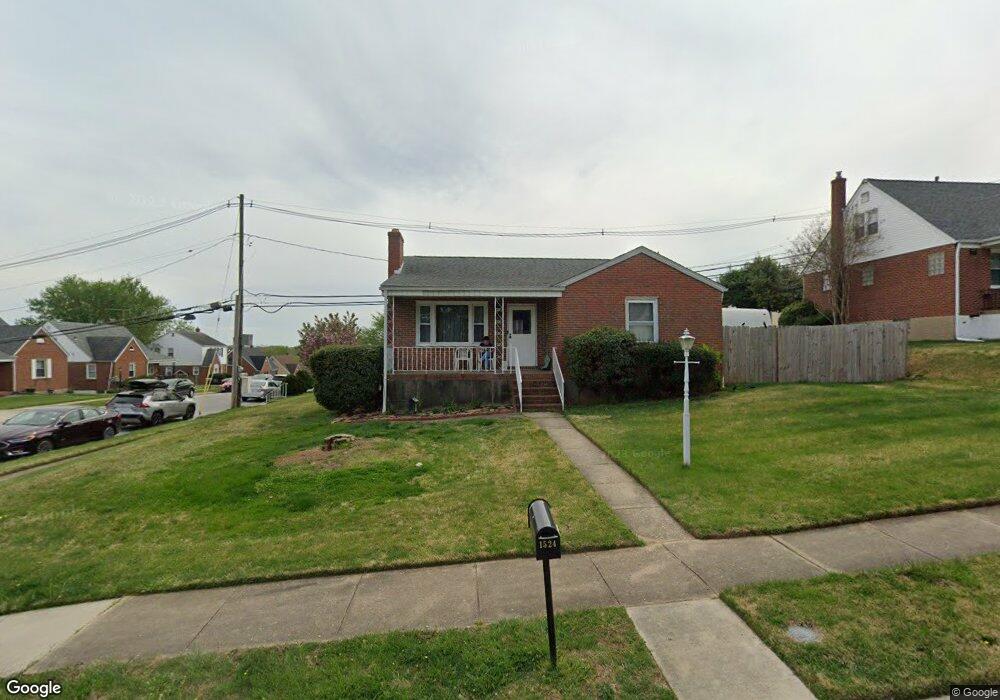
1524 Neighbors Ave Rosedale, MD 21237
Estimated Value: $265,000 - $342,000
2
Beds
1
Bath
1,020
Sq Ft
$284/Sq Ft
Est. Value
About This Home
This home is located at 1524 Neighbors Ave, Rosedale, MD 21237 and is currently estimated at $290,144, approximately $284 per square foot. 1524 Neighbors Ave is a home located in Baltimore County with nearby schools including Red House Run Elementary School, Golden Ring Middle School, and Overlea High School.
Ownership History
Date
Name
Owned For
Owner Type
Purchase Details
Closed on
Nov 28, 2023
Sold by
Curran Kathleen D
Bought by
Curran Kathleen D and Lofstad Alexa K
Current Estimated Value
Purchase Details
Closed on
Oct 25, 2011
Sold by
Undisclosed
Bought by
Curran Kathleen D
Home Financials for this Owner
Home Financials are based on the most recent Mortgage that was taken out on this home.
Original Mortgage
$50,000
Interest Rate
4.15%
Mortgage Type
New Conventional
Purchase Details
Closed on
Oct 6, 2011
Sold by
Generose Catherine H
Bought by
Curran Kathleen D
Home Financials for this Owner
Home Financials are based on the most recent Mortgage that was taken out on this home.
Original Mortgage
$50,000
Interest Rate
4.15%
Mortgage Type
New Conventional
Create a Home Valuation Report for This Property
The Home Valuation Report is an in-depth analysis detailing your home's value as well as a comparison with similar homes in the area
Home Values in the Area
Average Home Value in this Area
Purchase History
| Date | Buyer | Sale Price | Title Company |
|---|---|---|---|
| Curran Kathleen D | -- | None Listed On Document | |
| Curran Kathleen D | $153,000 | -- | |
| Curran Kathleen D | $153,000 | Goldstar Title Company | |
| Curran Kathleen D | $153,000 | -- |
Source: Public Records
Mortgage History
| Date | Status | Borrower | Loan Amount |
|---|---|---|---|
| Previous Owner | Curran Kathleen D | $50,000 | |
| Previous Owner | Curran Kathleen D | $50,000 |
Source: Public Records
Tax History Compared to Growth
Tax History
| Year | Tax Paid | Tax Assessment Tax Assessment Total Assessment is a certain percentage of the fair market value that is determined by local assessors to be the total taxable value of land and additions on the property. | Land | Improvement |
|---|---|---|---|---|
| 2025 | $2,975 | $200,400 | -- | -- |
| 2024 | $2,975 | $188,100 | $0 | $0 |
| 2023 | $1,321 | $175,800 | $77,100 | $98,700 |
| 2022 | $2,576 | $171,333 | $0 | $0 |
| 2021 | $2,432 | $166,867 | $0 | $0 |
| 2020 | $2,432 | $162,400 | $77,100 | $85,300 |
| 2019 | $2,308 | $159,167 | $0 | $0 |
| 2018 | $2,248 | $155,933 | $0 | $0 |
| 2017 | $2,139 | $152,700 | $0 | $0 |
| 2016 | $235 | $151,267 | $0 | $0 |
| 2015 | $235 | $149,833 | $0 | $0 |
| 2014 | $235 | $148,400 | $0 | $0 |
Source: Public Records
Map
Nearby Homes
- 1520 Neighbors Ave
- 8205 Dorset Ave
- 8220 Analee Ave
- 8020 Neighbors Ave
- 8105 Candle Ln
- 8003 Woodhaven Rd
- 8113 Callo Ln
- 1535 Rosewick Ave
- 1263 Neighbors Ave
- 3 Weyburn Ct
- 1236 Primrose Ave
- 8020 Old Philadelphia Rd
- 1239 Hilldale Rd
- 5207 Mccormick Ave
- 8125 Bartholomew Ct
- 8131 Bartholomew Ct
- Canton I Plan at McCormick Place
- Davidson Plan at McCormick Place
- 8133 Bartholomew Ct
- 8135 Bartholomew Ct
- 1526 Neighbors Ave
- 8118 Edwill Ave
- 1523 Neighbors Ave
- 8116 Edwill Ave
- 1525 Neighbors Ave
- 8121 Edwill Ave
- 1528 Neighbors Ave
- 1519 Neighbors Ave
- 8115 Sagramore Rd
- 8119 Edwill Ave
- 1518 Neighbors Ave
- 8113 Sagramore Rd
- 1527 Neighbors Ave
- 8114 Edwill Ave
- 8202 Edwill Ave
- 8203 Edwill Ave
- 8117 Edwill Ave
- 8111 Sagramore Rd
- 8205 Edwill Ave
- 8112 Edwill Ave