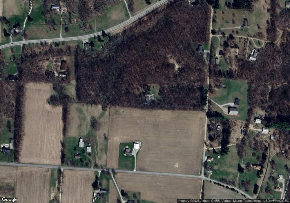
15241 Fronce Rd Mount Vernon, OH 43050
Estimated Value: $258,000 - $425,000
2
Beds
1
Bath
2,320
Sq Ft
$155/Sq Ft
Est. Value
About This Home
This home is located at 15241 Fronce Rd, Mount Vernon, OH 43050 and is currently estimated at $358,735, approximately $154 per square foot. 15241 Fronce Rd is a home located in Knox County with nearby schools including Mount Vernon High School.
Ownership History
Date
Name
Owned For
Owner Type
Purchase Details
Closed on
Dec 17, 2014
Sold by
Scott Perry G
Bought by
Scott Perry G and Scott Jeri L
Current Estimated Value
Home Financials for this Owner
Home Financials are based on the most recent Mortgage that was taken out on this home.
Original Mortgage
$110,800
Outstanding Balance
$36,915
Interest Rate
3.18%
Mortgage Type
Construction
Estimated Equity
$321,820
Purchase Details
Closed on
Sep 14, 2000
Sold by
Scott Perry G and Scott Beatrice
Bought by
Scott Perry G
Create a Home Valuation Report for This Property
The Home Valuation Report is an in-depth analysis detailing your home's value as well as a comparison with similar homes in the area
Home Values in the Area
Average Home Value in this Area
Purchase History
| Date | Buyer | Sale Price | Title Company |
|---|---|---|---|
| Scott Perry G | -- | None Available | |
| Scott Perry G | -- | -- |
Source: Public Records
Mortgage History
| Date | Status | Borrower | Loan Amount |
|---|---|---|---|
| Open | Scott Perry G | $110,800 |
Source: Public Records
Tax History Compared to Growth
Tax History
| Year | Tax Paid | Tax Assessment Tax Assessment Total Assessment is a certain percentage of the fair market value that is determined by local assessors to be the total taxable value of land and additions on the property. | Land | Improvement |
|---|---|---|---|---|
| 2024 | $3,738 | $87,570 | $28,190 | $59,380 |
| 2023 | $3,738 | $87,570 | $28,190 | $59,380 |
| 2022 | $2,795 | $60,390 | $19,440 | $40,950 |
| 2021 | $2,795 | $60,390 | $19,440 | $40,950 |
| 2020 | $2,728 | $60,390 | $19,440 | $40,950 |
| 2019 | $2,544 | $52,320 | $14,010 | $38,310 |
| 2018 | $2,544 | $52,320 | $14,010 | $38,310 |
| 2017 | $2,503 | $52,320 | $14,010 | $38,310 |
| 2016 | $2,342 | $48,450 | $12,970 | $35,480 |
| 2015 | $2,342 | $48,450 | $12,970 | $35,480 |
| 2014 | $2,407 | $48,450 | $12,970 | $35,480 |
| 2013 | $2,573 | $47,840 | $10,150 | $37,690 |
Source: Public Records
Map
Nearby Homes
- 17970 Scott Rd
- 15770 Pleasant View Rd
- 14702 Wooster Rd
- 14021 Gilchrist Rd
- 14499 Wooster Rd
- 13618 Gilchrist Rd
- 0 N Liberty Rd
- 13999 Wooster Rd
- 14914 N Liberty Rd
- 12627 Upper Gilchrist Rd
- 15066 Monroe Mills Rd
- 15014 Monroe Mills Rd
- 14594 Monroe Mills Rd
- 0 Monroe Mills Rd
- 0 Greenlawn Dr Unit 225012211
- 0 Greenlawn Dr Unit 20250232
- 843 Country Club Dr
- 0 Berry Rd
- 15220 Fronce Rd
- 15315 Fronce Rd
- 15162 Fronce Rd
- 15346 Wooster Rd
- 15328 Fronce Rd
- 15202 Fronce Rd
- 18509 Scott Rd
- 18296 Scott Rd
- 15320 Wooster Rd
- 18599 Scott Rd
- 18306 Scott Rd
- 15441 Wooster Rd
- 14983 Fronce Rd
- 15375 Wooster Rd
- 15331 Wooster Rd
- 15400 Fronce Rd
- 18573 Scott Rd
- 15280 Wooster Rd
- 15478 Wooster Rd
- 18111 Scott Rd
