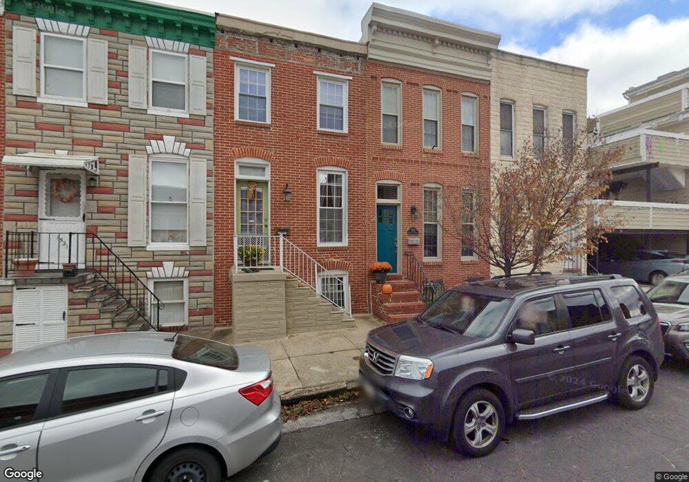
1525 Battery Ave Baltimore, MD 21230
Riverside NeighborhoodEstimated Value: $370,000 - $437,000
3
Beds
1
Bath
1,738
Sq Ft
$232/Sq Ft
Est. Value
About This Home
This home is located at 1525 Battery Ave, Baltimore, MD 21230 and is currently estimated at $403,772, approximately $232 per square foot. 1525 Battery Ave is a home located in Baltimore City with nearby schools including Thomas Johnson Elementary School, Booker T. Washington Middle School, and Digital Harbor High School.
Ownership History
Date
Name
Owned For
Owner Type
Purchase Details
Closed on
Jan 30, 2006
Sold by
Jamall Development Llc
Bought by
Digges Edward S and Digges Amy Q
Current Estimated Value
Home Financials for this Owner
Home Financials are based on the most recent Mortgage that was taken out on this home.
Original Mortgage
$265,500
Outstanding Balance
$147,171
Interest Rate
6.33%
Mortgage Type
Purchase Money Mortgage
Estimated Equity
$256,601
Purchase Details
Closed on
Mar 19, 2001
Sold by
Jamal Llc
Bought by
Jamall Development Llc
Purchase Details
Closed on
Mar 7, 2000
Sold by
Hosking Ross
Bought by
Jamal Llc
Create a Home Valuation Report for This Property
The Home Valuation Report is an in-depth analysis detailing your home's value as well as a comparison with similar homes in the area
Home Values in the Area
Average Home Value in this Area
Purchase History
| Date | Buyer | Sale Price | Title Company |
|---|---|---|---|
| Digges Edward S | $295,000 | -- | |
| Jamall Development Llc | -- | -- | |
| Jamal Llc | $77,500 | -- |
Source: Public Records
Mortgage History
| Date | Status | Borrower | Loan Amount |
|---|---|---|---|
| Open | Digges Edward S | $265,500 |
Source: Public Records
Tax History
| Year | Tax Paid | Tax Assessment Tax Assessment Total Assessment is a certain percentage of the fair market value that is determined by local assessors to be the total taxable value of land and additions on the property. | Land | Improvement |
|---|---|---|---|---|
| 2025 | $6,771 | $318,100 | -- | -- |
| 2024 | $6,771 | $311,900 | -- | -- |
| 2023 | $6,658 | $305,700 | $110,000 | $195,700 |
| 2022 | $6,672 | $305,700 | $110,000 | $195,700 |
| 2021 | $7,215 | $305,700 | $110,000 | $195,700 |
| 2020 | $6,356 | $318,500 | $110,000 | $208,500 |
| 2019 | $6,067 | $314,433 | $0 | $0 |
| 2018 | $5,919 | $310,367 | $0 | $0 |
| 2017 | $5,773 | $306,300 | $0 | $0 |
| 2016 | $4,927 | $287,533 | $0 | $0 |
| 2015 | $4,927 | $268,767 | $0 | $0 |
| 2014 | $4,927 | $250,000 | $0 | $0 |
Source: Public Records
Map
Nearby Homes
- 1523 William St
- 214 E Fort Ave
- 1452 Battery Ave
- 1447 William St
- 1519 Henry St
- 1513 Byrd St
- 442 E Fort Ave
- 405 E Clement St
- 1520 Byrd St
- 1603 Covington St
- 432 E Clement St
- 438 E Clement St
- 1720 Byrd St
- 232 E Barney St
- 1726 Byrd St
- 443 E Gittings St
- 1519 Marshall St
- 1271 Battery Ave
- 117 Bloomsberry St
- 1601 Marshall St
- 1523 Battery Ave
- 1527 Battery Ave
- 1521 Battery Ave
- 1519 Battery Ave
- 1517 Battery Ave
- 304 E Randall St
- 306 E Randall St
- 302 E Randall St
- 308 E Randall St
- 1515 Battery Ave
- 310 E Randall St
- 300 E Randall St
- 1513 Battery Ave
- 1511 Battery Ave
- 1524 Riverside Ave
- 1522 Riverside Ave
- 1520 Riverside Ave
- 1526 Riverside Ave
- 1518 Riverside Ave
- 1528 Riverside Ave
Your Personal Tour Guide
Ask me questions while you tour the home.