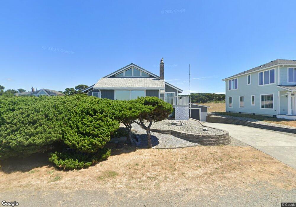
1525 Beach Loop Dr SW Bandon, OR 97411
Estimated Value: $930,442 - $1,015,000
3
Beds
2
Baths
1,976
Sq Ft
$492/Sq Ft
Est. Value
About This Home
This home is located at 1525 Beach Loop Dr SW, Bandon, OR 97411 and is currently estimated at $972,721, approximately $492 per square foot. 1525 Beach Loop Dr SW is a home located in Coos County with nearby schools including Ocean Crest Elementary School, Harbor Lights Middle School, and Bandon Senior High School.
Ownership History
Date
Name
Owned For
Owner Type
Purchase Details
Closed on
May 30, 2018
Sold by
Christie Molly Rodriguez and The 2013 Christie Living Trust
Bought by
Campbell Darrell
Current Estimated Value
Home Financials for this Owner
Home Financials are based on the most recent Mortgage that was taken out on this home.
Original Mortgage
$400,000
Outstanding Balance
$343,673
Interest Rate
4.4%
Mortgage Type
New Conventional
Estimated Equity
$629,048
Purchase Details
Closed on
Aug 1, 2013
Sold by
Christie Jay D and Christie Molly R
Bought by
2013 Christie Living Trust
Create a Home Valuation Report for This Property
The Home Valuation Report is an in-depth analysis detailing your home's value as well as a comparison with similar homes in the area
Home Values in the Area
Average Home Value in this Area
Purchase History
| Date | Buyer | Sale Price | Title Company |
|---|---|---|---|
| Campbell Darrell | $559,000 | Ticor Title | |
| 2013 Christie Living Trust | -- | None Available |
Source: Public Records
Mortgage History
| Date | Status | Borrower | Loan Amount |
|---|---|---|---|
| Open | Campbell Darrell | $400,000 |
Source: Public Records
Tax History Compared to Growth
Tax History
| Year | Tax Paid | Tax Assessment Tax Assessment Total Assessment is a certain percentage of the fair market value that is determined by local assessors to be the total taxable value of land and additions on the property. | Land | Improvement |
|---|---|---|---|---|
| 2025 | $5,760 | $522,830 | -- | -- |
| 2024 | $5,698 | $507,610 | -- | -- |
| 2023 | $5,549 | $492,830 | $0 | $0 |
| 2022 | $5,571 | $478,480 | $0 | $0 |
| 2021 | $5,353 | $464,550 | $0 | $0 |
| 2020 | $4,860 | $464,550 | $0 | $0 |
| 2019 | $4,844 | $437,890 | $0 | $0 |
| 2018 | $4,555 | $425,140 | $0 | $0 |
| 2017 | $4,181 | $412,760 | $0 | $0 |
| 2016 | $4,052 | $400,740 | $0 | $0 |
| 2015 | $3,825 | $389,070 | $0 | $0 |
| 2014 | $3,825 | $377,740 | $0 | $0 |
Source: Public Records
Map
Nearby Homes
- 1575 Beach Loop Dr SW
- 1950 Beach Loop Dr SW
- 1312 Village Loop
- 1313 Village Loop
- 1323 Village Loop
- 2131 Beach Loop Dr SW
- 875 12th St SW
- 0 Beach Loop Dr SW Unit 201837812
- 1257 7th St SW
- 835 SW 11th
- 2485 Beach Loop Rd
- 1280 Ocean Dr SW
- 00 Harrison Ave Lot B
- 737 11th St SW
- 0 Whale Watch Way Unit 602 722957860
- 0 Franklin Rd SW Unit 6-10
- 0 Eighth St SW Unit 797186006
- 0 SW Eighth at Harrison Ave
- 2732 Lincoln Ave SW Unit 500
- 0 Franklin Ave SW Unit 23128327
- 1555 Beach Loop Dr SW
- 1515 Beach Loop Dr SW Unit 1600
- 1515 Beach Loop Dr SW
- 1485 Beach Loop Dr SW
- 1515 Beach Loop Rd Unit 1600
- 1515 Beach Loop Rd
- 1495 Beach Loop Dr SW
- 1530 Beach Loop Dr SW
- 1605 Beach Loop Dr SW
- 1490 Beach Loop Dr SW
- 1455 Beach Loop Dr SW
- 1465 Beach Loop Dr SW
- 1445 Beach Loop Dr SW
- 1640 Beach Loop Dr SW
- 1425 Beach Loop Dr SW
- 1650 Beach Loop Dr SW
- 0 Sunrise Ave
- 1660 Beach Loop Dr SW
- 1430 Beach Loop Dr SW
- 1405 Beach Loop Dr SW