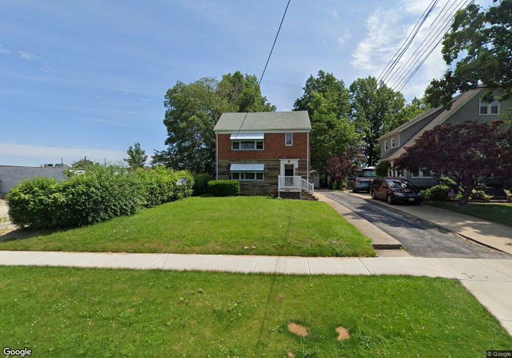
1525 E 291st St Wickliffe, OH 44092
Estimated Value: $176,000 - $222,000
4
Beds
3
Baths
945
Sq Ft
$213/Sq Ft
Est. Value
About This Home
This home is located at 1525 E 291st St, Wickliffe, OH 44092 and is currently estimated at $201,558, approximately $213 per square foot. 1525 E 291st St is a home located in Lake County with nearby schools including Wickliffe Elementary School, Wickliffe Middle School, and Wickliffe High School.
Ownership History
Date
Name
Owned For
Owner Type
Purchase Details
Closed on
Sep 28, 2009
Sold by
Hribar John A and Hribar Anne K
Bought by
Mattanna Group Llc
Current Estimated Value
Purchase Details
Closed on
Oct 31, 2005
Sold by
Lemponen Craig A
Bought by
Hribar John A
Home Financials for this Owner
Home Financials are based on the most recent Mortgage that was taken out on this home.
Original Mortgage
$137,250
Interest Rate
5.89%
Mortgage Type
Fannie Mae Freddie Mac
Create a Home Valuation Report for This Property
The Home Valuation Report is an in-depth analysis detailing your home's value as well as a comparison with similar homes in the area
Home Values in the Area
Average Home Value in this Area
Purchase History
| Date | Buyer | Sale Price | Title Company |
|---|---|---|---|
| Mattanna Group Llc | -- | Attorney | |
| Hribar John A | $152,500 | Accent Ohio Land Title |
Source: Public Records
Mortgage History
| Date | Status | Borrower | Loan Amount |
|---|---|---|---|
| Previous Owner | Hribar John A | $137,250 |
Source: Public Records
Tax History Compared to Growth
Tax History
| Year | Tax Paid | Tax Assessment Tax Assessment Total Assessment is a certain percentage of the fair market value that is determined by local assessors to be the total taxable value of land and additions on the property. | Land | Improvement |
|---|---|---|---|---|
| 2025 | -- | $56,710 | $17,290 | $39,420 |
| 2024 | -- | $56,710 | $17,290 | $39,420 |
| 2023 | $5,684 | $46,220 | $14,610 | $31,610 |
| 2022 | $4,038 | $46,220 | $14,610 | $31,610 |
| 2021 | $4,614 | $46,220 | $14,610 | $31,610 |
| 2020 | $4,453 | $41,090 | $11,970 | $29,120 |
| 2019 | $3,552 | $41,090 | $11,970 | $29,120 |
| 2018 | $3,074 | $38,420 | $13,120 | $25,300 |
| 2017 | $2,770 | $38,420 | $13,120 | $25,300 |
| 2016 | $2,757 | $38,420 | $13,120 | $25,300 |
| 2015 | $2,709 | $38,420 | $13,120 | $25,300 |
| 2014 | $2,395 | $38,420 | $13,120 | $25,300 |
| 2013 | $2,393 | $38,420 | $13,120 | $25,300 |
Source: Public Records
Map
Nearby Homes
- 1541 Old School Way
- Birch Plan at Old School Village
- Elder Plan at Old School Village
- Cedar Plan at Old School Village
- L 32 S Lincoln Rd
- Aspen Plan at Old School Village
- Tupelo Plan at Old School Village
- 28900 Euclid Ave
- 1836 E 294th St
- 28785 Hazel Ave
- 1807 E 294th St
- 1820 Rockefeller Rd
- 0 Green Ridge Dr
- 1354 Craneing Rd
- 1824 Robindale St
- 1526 E 298th St
- 29131 Norman Ave
- 1031 Gary Ct
- 29038 Fuller Ave
- 2715 Cabin Dr
- 1529 E 291st St
- 1533 E 291st St
- 29114 Euclid Ave
- 1701 E 291st St
- 1526 Maple St
- 1528 Maple St
- 1705 E 291st St
- 29124 Euclid Ave
- 1532 Maple St
- 1536 Maple St
- 29118 Euclid Ave
- 1711 E 291st St
- 1532 E 291st St
- 1536 E 291st St
- 1715 E 291st St
- 1700 E 291st St
- 1708 Maple St
- 1706 E 291st St Unit Down
- 1706 E 291st St
- 1706 E 291st St Unit Upper