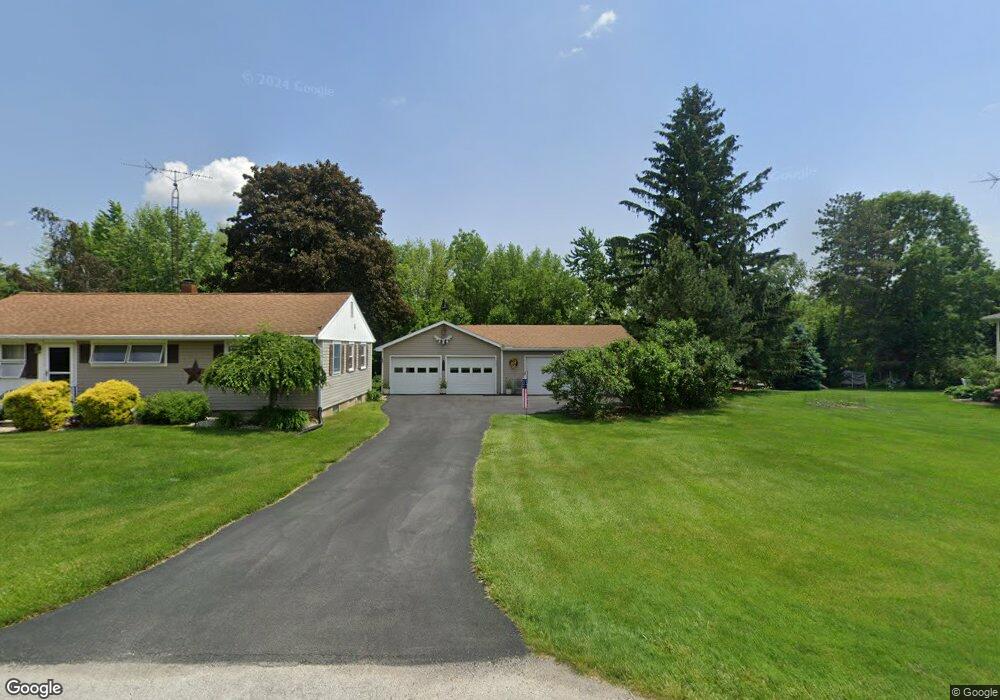
1525 Edwards Dr Fremont, OH 43420
Estimated Value: $156,166 - $183,000
3
Beds
1
Bath
1,056
Sq Ft
$160/Sq Ft
Est. Value
About This Home
This home is located at 1525 Edwards Dr, Fremont, OH 43420 and is currently estimated at $169,292, approximately $160 per square foot. 1525 Edwards Dr is a home located in Sandusky County with nearby schools including Fremont Ross High School, Bishop Hoffman Catholic School - This is St Joe's School now, and St. Joseph School.
Ownership History
Date
Name
Owned For
Owner Type
Purchase Details
Closed on
Apr 7, 2003
Sold by
Fisher Carl W
Bought by
Mierke David F
Current Estimated Value
Home Financials for this Owner
Home Financials are based on the most recent Mortgage that was taken out on this home.
Original Mortgage
$71,705
Interest Rate
6.01%
Mortgage Type
New Conventional
Purchase Details
Closed on
Feb 6, 2003
Sold by
Fisher Martha
Bought by
Trst Carl W Fisher
Home Financials for this Owner
Home Financials are based on the most recent Mortgage that was taken out on this home.
Original Mortgage
$71,705
Interest Rate
6.01%
Mortgage Type
New Conventional
Create a Home Valuation Report for This Property
The Home Valuation Report is an in-depth analysis detailing your home's value as well as a comparison with similar homes in the area
Home Values in the Area
Average Home Value in this Area
Purchase History
| Date | Buyer | Sale Price | Title Company |
|---|---|---|---|
| Mierke David F | $74,250 | Midland Title | |
| Trst Carl W Fisher | $71,705 | -- |
Source: Public Records
Mortgage History
| Date | Status | Borrower | Loan Amount |
|---|---|---|---|
| Previous Owner | Trst Carl W Fisher | $71,705 |
Source: Public Records
Tax History Compared to Growth
Tax History
| Year | Tax Paid | Tax Assessment Tax Assessment Total Assessment is a certain percentage of the fair market value that is determined by local assessors to be the total taxable value of land and additions on the property. | Land | Improvement |
|---|---|---|---|---|
| 2024 | $1,817 | $48,170 | $13,690 | $34,480 |
| 2023 | $1,817 | $38,540 | $10,960 | $27,580 |
| 2022 | $1,545 | $38,540 | $10,960 | $27,580 |
| 2021 | $1,594 | $38,540 | $10,960 | $27,580 |
| 2020 | $1,501 | $35,670 | $10,960 | $24,710 |
| 2019 | $1,499 | $35,670 | $10,960 | $24,710 |
| 2018 | $1,457 | $35,670 | $10,960 | $24,710 |
| 2017 | $1,413 | $33,430 | $10,960 | $22,470 |
| 2016 | $1,245 | $33,430 | $10,960 | $22,470 |
| 2015 | $1,225 | $33,430 | $10,960 | $22,470 |
| 2014 | $1,440 | $37,450 | $11,830 | $25,620 |
| 2013 | $1,410 | $37,450 | $11,830 | $25,620 |
Source: Public Records
Map
Nearby Homes
- 711 Bloom Rd
- 263 Saint Paul Dr
- 335 Cottage St
- 612 2nd St
- 251 Saint Paul Dr
- 315 Ethan Dr
- 318 Ethan Dr
- 533 Sandusky Ave Unit 535
- 230 N Pennsylvania Ave
- 199 Saint Thomas Dr
- 433 Sandusky Ave
- 1730 Port Clinton Rd Unit 41
- 1730 Port Clinton Rd
- 1730 Port Clinton Rd Unit 33
- 322 4th St
- 340 340 Sandusky Ave
- 714 E State St
- 2248 E State St
- 224 Sandusky Ave Unit 226
- 309 S Collinwood Blvd
- 1533 Edwards Dr
- 1515 Edwards Dr
- 1524 Edwards Dr
- 1532 Edwards Dr
- 1503 Edwards Dr
- 1607 Edwards Dr
- 1508 Edwards Dr
- 1613 Edwards Dr
- 1608 Edwards Dr
- 1433 Edwards Dr
- 1621 Edwards Dr
- 1426 Edwards Dr
- 2021 N 5th St
- 1419 Edwards Dr
- 2037 N Fifth
- 2053 N 5th St
- 2037 N 5th St
- 1422 Edwards Dr
- 1422 S Edwards Rd
- 1631 Edwards Dr