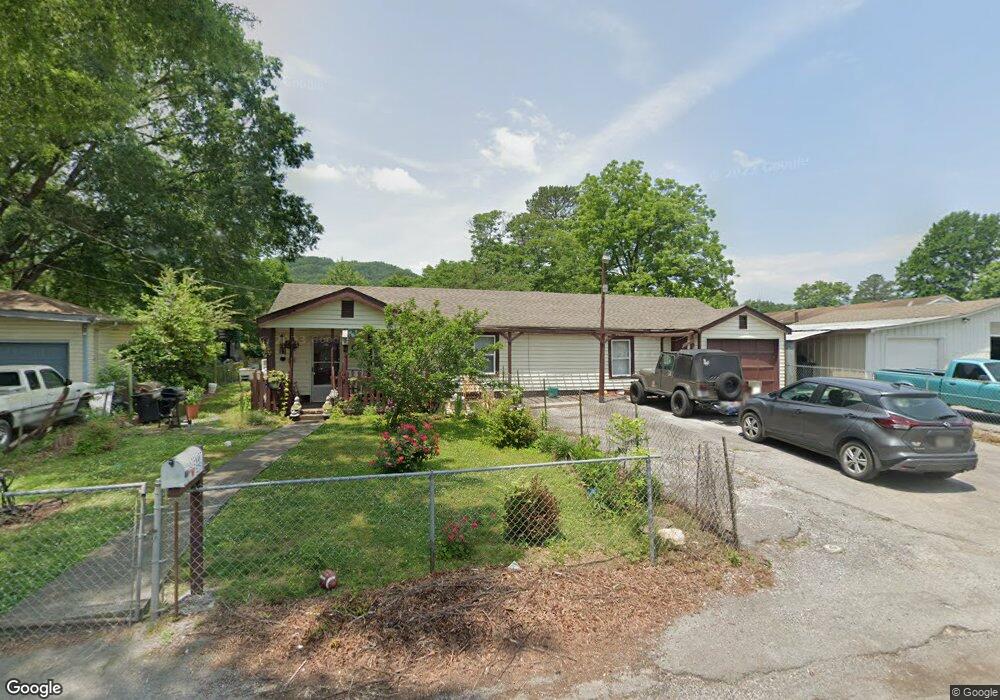
1525 Myrt St Rossville, GA 30741
Estimated Value: $139,172 - $178,000
--
Bed
1
Bath
1,080
Sq Ft
$154/Sq Ft
Est. Value
About This Home
This home is located at 1525 Myrt St, Rossville, GA 30741 and is currently estimated at $166,293, approximately $153 per square foot. 1525 Myrt St is a home located in Walker County with nearby schools including Stone Creek Elementary School, Rossville Middle School, and Ridgeland High School.
Ownership History
Date
Name
Owned For
Owner Type
Purchase Details
Closed on
Oct 9, 2008
Sold by
Wilson Terry R
Bought by
Stewart Jackie E and Stewart Kathy A
Current Estimated Value
Purchase Details
Closed on
Mar 24, 1989
Sold by
Pierce David Randall
Bought by
Wilson Terry
Purchase Details
Closed on
Mar 7, 1989
Sold by
Pell Tony
Bought by
Pierce David Randall
Purchase Details
Closed on
Sep 6, 1988
Sold by
Pierce David Randall
Bought by
Pell Tony
Purchase Details
Closed on
May 7, 1982
Sold by
Anna Stansell B and Anna Ruth
Bought by
Pierce David Randall
Purchase Details
Closed on
Apr 11, 1975
Sold by
Pierce David Randall
Bought by
Anna Stansell B and Anna Ruth
Purchase Details
Closed on
Oct 4, 1966
Bought by
Pierce David Randall
Create a Home Valuation Report for This Property
The Home Valuation Report is an in-depth analysis detailing your home's value as well as a comparison with similar homes in the area
Home Values in the Area
Average Home Value in this Area
Purchase History
| Date | Buyer | Sale Price | Title Company |
|---|---|---|---|
| Stewart Jackie E | -- | -- | |
| Wilson Terry | $25,000 | -- | |
| Pierce David Randall | $33,400 | -- | |
| Pell Tony | $33,900 | -- | |
| Pierce David Randall | -- | -- | |
| Anna Stansell B | -- | -- | |
| Pierce David Randall | -- | -- |
Source: Public Records
Tax History Compared to Growth
Tax History
| Year | Tax Paid | Tax Assessment Tax Assessment Total Assessment is a certain percentage of the fair market value that is determined by local assessors to be the total taxable value of land and additions on the property. | Land | Improvement |
|---|---|---|---|---|
| 2024 | $151 | $43,776 | $2,500 | $41,276 |
| 2023 | $151 | $41,699 | $2,500 | $39,199 |
| 2022 | $108 | $36,081 | $2,500 | $33,581 |
| 2021 | $507 | $23,557 | $1,700 | $21,857 |
| 2020 | $437 | $20,226 | $1,700 | $18,526 |
| 2019 | $445 | $20,226 | $1,700 | $18,526 |
| 2018 | $535 | $20,226 | $1,700 | $18,526 |
| 2017 | $509 | $20,226 | $1,700 | $18,526 |
| 2016 | $393 | $12,756 | $1,700 | $11,056 |
| 2015 | $560 | $18,511 | $1,968 | $16,543 |
| 2014 | $482 | $18,511 | $1,968 | $16,543 |
| 2013 | -- | $18,510 | $1,968 | $16,542 |
Source: Public Records
Map
Nearby Homes
- 732 Salem Rd
- 211 Pat Webb Cir
- 724 Shelly Ln
- 610 Union Ave
- 717 W James St
- 715 W James St
- 601 James St
- 635 N Sherry Dr
- 275 Quarter St
- 58 Quarter St
- 52 Quarter St
- 44 Quarter St
- 33 Quarter St
- 27 Quarter St
- 19 Quarter St
- 11 Quarter St
- Penwell Plan at Hawk's Ridge
- Hanover Plan at Hawk's Ridge
- Edmon Plan at Hawk's Ridge
- Cali Plan at Hawk's Ridge
- 1527 Myrt St
- 711 Mary Agnes Dr
- 709 Mary Agnes Dr
- 1529 Myrt St
- 713 Mary Agnes Dr
- 1526 Myrt St
- 707 Mary Agnes Dr
- 1531 Myrt St
- 715 Mary Agnes Dr
- 705 Mary Agnes Dr
- 1530 Myrt St
- 714 Mary Agnes Dr
- 716 Mary Agnes Dr
- 712 Mary Agnes Dr
- 1533 Myrt St
- 717 Mary Agnes Dr
- 718 Mary Agnes Dr
- 703 Mary Agnes Dr
- 710 Dorothy St
- 712 Dorothy St