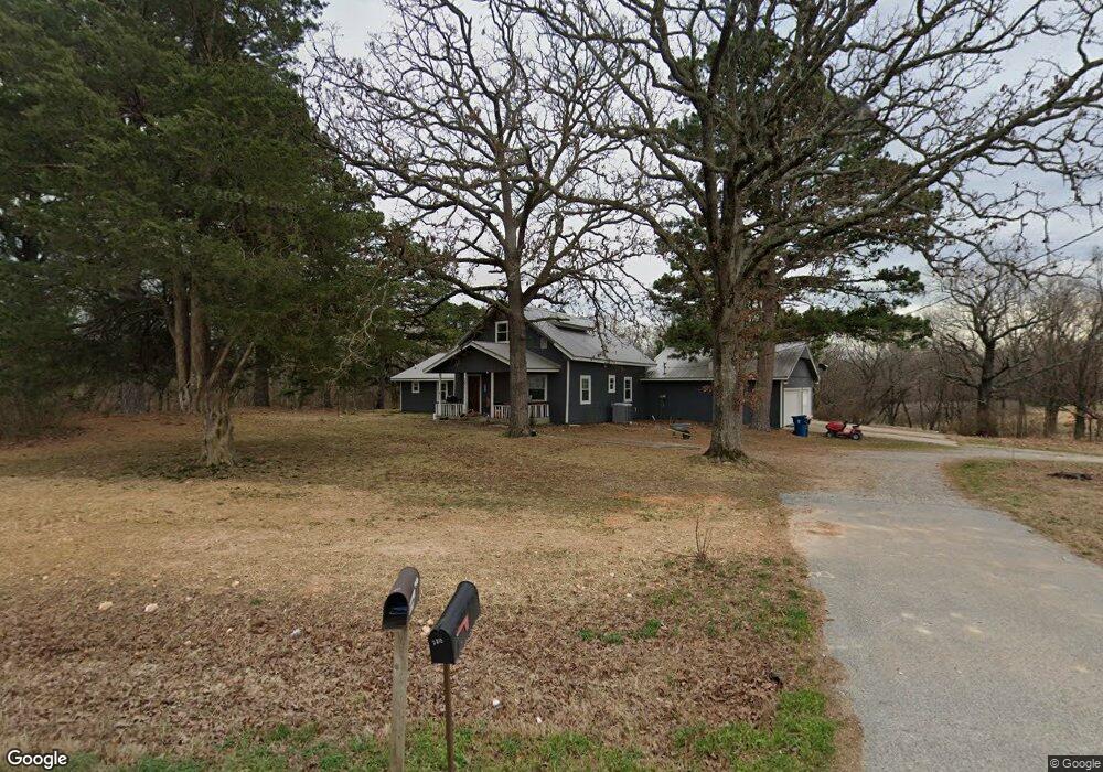
15251 W Highway 12 Gentry, AR 72734
Estimated Value: $321,000 - $486,634
--
Bed
2
Baths
2,076
Sq Ft
$201/Sq Ft
Est. Value
About This Home
This home is located at 15251 W Highway 12, Gentry, AR 72734 and is currently estimated at $416,409, approximately $200 per square foot. 15251 W Highway 12 is a home located in Benton County with nearby schools including Gentry Intermediate School, Gentry Primary School, and Gentry Middle School.
Ownership History
Date
Name
Owned For
Owner Type
Purchase Details
Closed on
Oct 19, 2017
Sold by
Hendrix Dale
Bought by
Hendrix Dale and Hendrix Angela
Current Estimated Value
Purchase Details
Closed on
Jun 30, 2006
Sold by
Apogee Corp
Bought by
Jjj & D Enterprises Llc
Purchase Details
Closed on
Oct 21, 2004
Bought by
Hendrix 120Ac
Purchase Details
Closed on
Oct 18, 2004
Bought by
Hendrix 120Ac
Purchase Details
Closed on
Jan 4, 1996
Bought by
Hendrix Fam Ltd Ptnrshp
Purchase Details
Closed on
Aug 11, 1978
Bought by
Drain
Purchase Details
Closed on
Oct 7, 1968
Bought by
Gordon Floyd 17Ac
Purchase Details
Closed on
Oct 29, 1953
Bought by
Hendrix
Create a Home Valuation Report for This Property
The Home Valuation Report is an in-depth analysis detailing your home's value as well as a comparison with similar homes in the area
Home Values in the Area
Average Home Value in this Area
Purchase History
| Date | Buyer | Sale Price | Title Company |
|---|---|---|---|
| Hendrix Dale | -- | None Available | |
| Jjj & D Enterprises Llc | $1,530,000 | Heritage Land Title Of Ar | |
| Apogee Corp | $1,200,000 | Heritage Land Title Of Ar | |
| Hendrix 120Ac | -- | -- | |
| Hendrix 120Ac | -- | -- | |
| Hendrix Fam Ltd Ptnrshp | -- | -- | |
| Drain | $75,000 | -- | |
| Gordon Floyd 17Ac | -- | -- | |
| Hendrix | -- | -- |
Source: Public Records
Tax History Compared to Growth
Tax History
| Year | Tax Paid | Tax Assessment Tax Assessment Total Assessment is a certain percentage of the fair market value that is determined by local assessors to be the total taxable value of land and additions on the property. | Land | Improvement |
|---|---|---|---|---|
| 2025 | $2,025 | $61,489 | $8,067 | $53,422 |
| 2024 | $1,910 | $61,489 | $8,067 | $53,422 |
| 2023 | $1,819 | $40,290 | $4,200 | $36,090 |
| 2022 | $1,462 | $40,290 | $4,200 | $36,090 |
| 2021 | $1,376 | $40,290 | $4,200 | $36,090 |
| 2020 | $1,302 | $28,860 | $3,190 | $25,670 |
| 2019 | $1,302 | $28,860 | $3,190 | $25,670 |
| 2018 | $1,327 | $28,860 | $3,190 | $25,670 |
| 2017 | $1,291 | $28,860 | $3,190 | $25,670 |
| 2016 | $1,291 | $28,860 | $3,190 | $25,670 |
| 2015 | $1,481 | $26,930 | $2,630 | $24,300 |
| 2014 | $1,131 | $26,930 | $2,630 | $24,300 |
Source: Public Records
Map
Nearby Homes
- Lots 2, 3, 9 & 10 Snyder Estates Rurban Phase 3
- 405 NW Pinwheel St
- 407 NW Pinwheel St
- 15670 Malone Rd
- 1257 NW Malone Rd
- 12502 Hamilton Dr
- TBD Lot 2 The Preserve
- 9300 S Pleasant Valley Rd
- 9236 S Pleasant Valley Rd
- 9112 S Pleasant Valley Rd
- 9124 S Pleasant Valley Rd
- TBD Lot 4 The Preserve
- 796 NW Holland Ave
- Lot 3 Digby Dr
- Lot 2 Digby Dr
- Lot 1 Digby Dr
- 9307 Digby Dr
- TBD Bryant Rd
- 12713 S Pleasant Valley Rd
- 16.75 Acres Bryant Rd
- 15251 W Highway 12
- 188 NW Highfill Ridge Rd
- 15207 W Highway 12
- 2753 W Highway 12
- 15405 W Highway 12
- 15405 W Hwy 12
- 131 NW Gailey Hollow Rd
- TBD Gailey Hollow
- 11601 Digby Dr
- 655 NW Gailey Hollow Rd
- 0 Gaileyhollow Rd Unit 1192575
- 15415 W Highway 12
- 15415 W Highway 12
- 15435 W Highway 12
- 1 1 Rd
- 0 Gailey Hollow Rd Unit 686499
- 0 Gailey Hollow Rd Unit 1049457
- 0 Digby Dr Unit 1269071
- 0 Digby Dr Unit 1227040
- 0 Digby Dr Unit 1218477