Estimated Value: $150,000 - $215,000
3
Beds
1
Bath
1,092
Sq Ft
$160/Sq Ft
Est. Value
About This Home
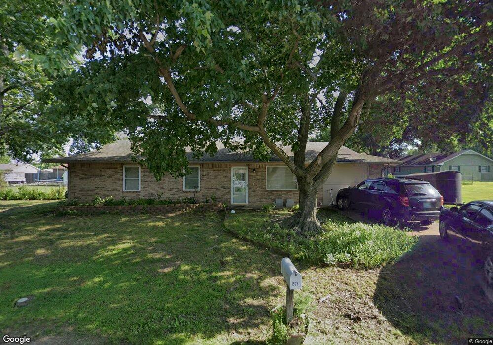
This home is located at 1526 102nd St NW, Grove, OK 74344 and is currently estimated at $174,787, approximately $160 per square foot. 1526 102nd St NW is a home located in Delaware County with nearby schools including Grove Lower Elementary School, Grove Upper Elementary School, and Grove Middle School.
Ownership History
Date
Name
Owned For
Owner Type
Purchase Details
Closed on
Dec 20, 2010
Sold by
Brown Ryan L and Brown Shannon N
Bought by
Johnston Zackary M and Johnston Nina Lauren
Current Estimated Value
Home Financials for this Owner
Home Financials are based on the most recent Mortgage that was taken out on this home.
Original Mortgage
$103,626
Outstanding Balance
$68,857
Interest Rate
4.41%
Mortgage Type
New Conventional
Estimated Equity
$105,930
Purchase Details
Closed on
Apr 22, 2008
Sold by
Casper S Steven and Shook Connie
Bought by
Brown Ryan L and Brown Shannon N
Home Financials for this Owner
Home Financials are based on the most recent Mortgage that was taken out on this home.
Original Mortgage
$86,541
Interest Rate
6.11%
Mortgage Type
FHA
Purchase Details
Closed on
Sep 3, 1996
Sold by
Keith Garret R and Keith Geneva G
Purchase Details
Closed on
Oct 26, 1995
Sold by
Housing Authority Of Peoria
Create a Home Valuation Report for This Property
The Home Valuation Report is an in-depth analysis detailing your home's value as well as a comparison with similar homes in the area
Home Values in the Area
Average Home Value in this Area
Purchase History
| Date | Buyer | Sale Price | Title Company |
|---|---|---|---|
| Johnston Zackary M | $94,000 | -- | |
| Brown Ryan L | $88,000 | -- | |
| -- | -- | -- | |
| -- | -- | -- |
Source: Public Records
Mortgage History
| Date | Status | Borrower | Loan Amount |
|---|---|---|---|
| Open | Johnston Zackary M | $103,626 | |
| Previous Owner | Brown Ryan L | $86,541 |
Source: Public Records
Tax History Compared to Growth
Tax History
| Year | Tax Paid | Tax Assessment Tax Assessment Total Assessment is a certain percentage of the fair market value that is determined by local assessors to be the total taxable value of land and additions on the property. | Land | Improvement |
|---|---|---|---|---|
| 2025 | $862 | $11,996 | $1,605 | $10,391 |
| 2024 | $862 | $11,646 | $1,558 | $10,088 |
| 2023 | $862 | $11,307 | $1,519 | $9,788 |
| 2022 | $833 | $11,307 | $1,509 | $9,798 |
| 2021 | $805 | $10,977 | $1,509 | $9,468 |
| 2020 | $792 | $10,347 | $1,509 | $8,838 |
| 2019 | $774 | $10,101 | $1,509 | $8,592 |
| 2018 | $748 | $9,819 | $1,509 | $8,310 |
| 2017 | $732 | $9,640 | $1,509 | $8,131 |
| 2016 | $708 | $9,315 | $1,394 | $7,921 |
| 2015 | $718 | $9,315 | $1,394 | $7,921 |
| 2014 | $721 | $9,315 | $1,394 | $7,921 |
Source: Public Records
Map
Nearby Homes
- 10005 Wolf Creek Dr
- 10401 Wolf Creek Dr
- 1530 Grand Regatta Dr
- 0 Tbd Hwy 59 - 911 Address Tbd
- 000 Highway 59 911 Address Tbd
- 1530 Grand Regatta #27 Dr
- 827 Chatsworth Dr
- 827 Apple Dr
- 822 Chatsworth Dr
- 816 Chatsworth Dr
- 4 S 613 Rd
- 25123 S 613 Rd
- 25990 S 585 Rd Unit 2
- TBD N N
- 25421 Us-59 (Tbd)4
- 25421 Us-59 (Tbd)3
- 25421
- 25421 Us-59 (Tbd)1
- 27400 S 614 Rd
- 703 N 36th St
- 1528 102nd St NW
- 1527 104th St NW
- 1527 104th St NW
- 10210 Wolf Creek Dr
- 10206 Wolf Creek Dr
- 1530 102nd St NW
- 1529 104th St NW
- 1526 104th St NW
- 1525 NW 104
- 10010 Wolf Creek Dr
- 1525 104th St NW
- 1524 104th St NW
- 1528 104th St NW
- 10203 Wolf Creek Dr
- 10209 Wolf Creek Dr
- 10004 Wolf Creek Dr
- 1529 102nd St NW
- 1532 102nd St NW
- 1531 104th St NW
- 10011 Wolf Creek Dr