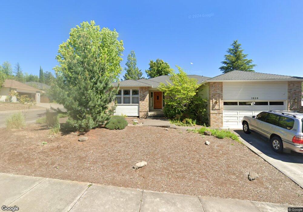
1526 Cypress Point Dr Medford, OR 97504
Estimated Value: $498,645 - $511,000
3
Beds
2
Baths
1,886
Sq Ft
$269/Sq Ft
Est. Value
About This Home
This home is located at 1526 Cypress Point Dr, Medford, OR 97504 and is currently estimated at $506,411, approximately $268 per square foot. 1526 Cypress Point Dr is a home located in Jackson County with nearby schools including Abraham Lincoln Elementary School, Hedrick Middle School, and North Medford High School.
Ownership History
Date
Name
Owned For
Owner Type
Purchase Details
Closed on
Nov 8, 2000
Sold by
Mcvey Daryl W and Mcvey Sally M
Bought by
Baker Nicholas P and Baker Susan G
Current Estimated Value
Home Financials for this Owner
Home Financials are based on the most recent Mortgage that was taken out on this home.
Original Mortgage
$134,900
Outstanding Balance
$49,708
Interest Rate
7.88%
Estimated Equity
$456,703
Create a Home Valuation Report for This Property
The Home Valuation Report is an in-depth analysis detailing your home's value as well as a comparison with similar homes in the area
Home Values in the Area
Average Home Value in this Area
Purchase History
| Date | Buyer | Sale Price | Title Company |
|---|---|---|---|
| Baker Nicholas P | $179,900 | Crater Title Insurance |
Source: Public Records
Mortgage History
| Date | Status | Borrower | Loan Amount |
|---|---|---|---|
| Open | Baker Nicholas P | $134,900 |
Source: Public Records
Tax History Compared to Growth
Tax History
| Year | Tax Paid | Tax Assessment Tax Assessment Total Assessment is a certain percentage of the fair market value that is determined by local assessors to be the total taxable value of land and additions on the property. | Land | Improvement |
|---|---|---|---|---|
| 2025 | $4,605 | $317,500 | $154,240 | $163,260 |
| 2024 | $4,605 | $308,260 | $149,740 | $158,520 |
| 2023 | $4,464 | $299,290 | $145,380 | $153,910 |
| 2022 | $4,355 | $299,290 | $145,380 | $153,910 |
| 2021 | $4,242 | $290,580 | $141,140 | $149,440 |
| 2020 | $4,153 | $282,120 | $137,030 | $145,090 |
| 2019 | $4,055 | $265,940 | $129,160 | $136,780 |
| 2018 | $3,951 | $258,200 | $125,400 | $132,800 |
| 2017 | $3,879 | $258,200 | $125,400 | $132,800 |
| 2016 | $3,905 | $243,380 | $118,200 | $125,180 |
| 2015 | $3,753 | $243,380 | $118,200 | $125,180 |
| 2014 | $3,687 | $229,420 | $111,420 | $118,000 |
Source: Public Records
Map
Nearby Homes
- 4553 Wolf Run Dr
- 1508 Summit Ridge Cir
- 1594 Angelcrest Dr
- 4708 Cloudcrest Dr
- 1476 Angel Crest Dr Unit 3
- 1457 Angelcrest Dr
- 4760 Torrey Pines Dr
- 138 Monterey Dr
- 4522 Pinnacle Dr
- 270 Dunthorpe Dr
- 1409 Highcrest Dr
- 107 Monterey Dr
- 282 Dunthorpe Dr
- 4506 Pinnacle Dr
- 4400 Hillcrest Rd
- 4286 Aerial Heights Dr Unit TL1000
- 5633 Fallbrook Ln
- 4933 Summerview Dr
- 5651 Autumn Park Dr
- 4388 Innsbruck Ridge
- 1518 Cypress Point Dr
- 0 Vilas Rd Unit 23809880
- 0 Innsbruck Ridge Unit 100994547
- 0 Vilas Rd Unit 102925524
- 0 Vilas Rd Unit 102930562
- 0 Enterprise Dr Unit 102946621
- 0 Aerial Heights Unit 220110964
- 0 Aerial Heights Unit 102949777
- 0 Aerial Heights Unit 102949788
- 0 Enterprise Dr Unit 102946378
- 0 Innsbruck Ridge Unit 102944994
- 0 Vilas Rd Unit 102930675
- 3266 Torrent
- 0 Payne Road Tx Lot 1102 Rd Unit 103010192
- 4632 Merion Ct
- 4627 Merion Ct
- 4627 Merion Ct Unit 1-078676-8
- 0 37w08cc Lot 4700 Unit 220109560
- 0 Confidential Unit 100221098
- 0 Confidential Unit 220123932