Estimated Value: $521,000 - $618,000
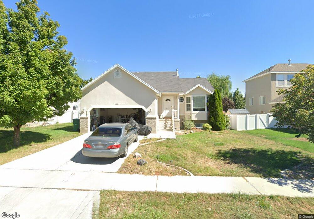
About This Home
Now offering 20-month leases. Sign today and lock in today’s low rate for the next 20 months! Disclaimer: Offer valid for new applicants who sign a 20-month lease, limited to the first 500 executed leases. Base rent will remain at the 12-month lease rate for the duration of the 20-month term. Offer is contingent on application approval and execution of a lease agreement. Other terms and conditions may apply. This property is professionally managed by American Homes 4 Rent, a leading single-family rental company. We work to simplify your rental experience by offering self-guided tours and a streamlined leasing process you can complete all online, all on your own schedule. Once moved in, we provide maintenance support that you can rely on, so you can enjoy your weekends stress-free. We look forward to welcoming you home! See Today, Sign Today™ Take a self-guided tour of this property using our Let Yourself In® service to view the space on your own schedule, without an agent. And if your documents are in order, you might even view a home and sign a lease on the same day! Utilities, taxes, and other fees may apply. Please verify and confirm all information before signing a lease. If you have questions, don’t hesitate to contact us at the telephone number on this property listing. All lease applications, documentation, and initial payments for this property, must be submitted directly through or by phone. The photos, renderings, or other images of the properties on our website, are for illustrative purposes only, and may vary from the features, amenities, or phase of construction. We do not advertise properties on Craigslist, Facebook Marketplace, or other classified advertising websites. If you believe one of our residences is listed there, please notify us. For further description of applicable fees, please go to our website.
Ownership History
Purchase Details
Purchase Details
Home Financials for this Owner
Home Financials are based on the most recent Mortgage that was taken out on this home.Purchase Details
Home Financials for this Owner
Home Financials are based on the most recent Mortgage that was taken out on this home.Home Values in the Area
Average Home Value in this Area
Purchase History
| Date | Buyer | Sale Price | Title Company |
|---|---|---|---|
| American Homes 4 Rent Properties Five Ll | -- | Inwest Title Services | |
| Follett James D | -- | Empire Land Title Inc | |
| Thompson Philip D | -- | Title West Title Co | |
| Thompson Philip D | -- | Title West Title Co |
Mortgage History
| Date | Status | Borrower | Loan Amount |
|---|---|---|---|
| Previous Owner | Follett James D | $212,087 | |
| Previous Owner | Thompson Philip D | $129,800 | |
| Previous Owner | Thompson Philip D | $32,477 |
Property History
| Date | Event | Price | List to Sale | Price per Sq Ft |
|---|---|---|---|---|
| 10/05/2025 10/05/25 | Off Market | $2,460 | -- | -- |
| 09/26/2025 09/26/25 | Price Changed | $2,460 | -1.0% | $1 / Sq Ft |
| 09/20/2025 09/20/25 | Price Changed | $2,485 | -2.5% | $1 / Sq Ft |
| 08/30/2025 08/30/25 | Price Changed | $2,550 | -1.5% | $1 / Sq Ft |
| 08/25/2025 08/25/25 | Price Changed | $2,590 | -1.5% | $1 / Sq Ft |
| 08/17/2025 08/17/25 | Price Changed | $2,630 | -1.5% | $1 / Sq Ft |
| 06/12/2025 06/12/25 | For Rent | $2,670 | -- | -- |
Tax History Compared to Growth
Tax History
| Year | Tax Paid | Tax Assessment Tax Assessment Total Assessment is a certain percentage of the fair market value that is determined by local assessors to be the total taxable value of land and additions on the property. | Land | Improvement |
|---|---|---|---|---|
| 2025 | $2,226 | $279,345 | $196,100 | $311,800 |
| 2024 | $2,226 | $260,535 | $0 | $0 |
| 2023 | $2,105 | $267,465 | $0 | $0 |
| 2022 | $2,198 | $270,765 | $0 | $0 |
| 2021 | $1,969 | $366,700 | $113,500 | $253,200 |
| 2020 | $1,856 | $341,700 | $105,100 | $236,600 |
| 2019 | $1,715 | $328,100 | $105,100 | $223,000 |
| 2018 | $1,580 | $285,900 | $92,000 | $193,900 |
| 2017 | $1,504 | $144,650 | $0 | $0 |
| 2016 | $1,491 | $133,045 | $0 | $0 |
| 2015 | $1,409 | $119,350 | $0 | $0 |
| 2014 | $1,366 | $115,005 | $0 | $0 |
Map
- 1755 N 250 W
- 1329 N 100 E Unit 21
- 1150 N 200 W Unit 6
- 1295 N 190 E
- 4333 N Baiken Ridge Dr Unit 1020
- 996 N 200 W
- 155 W State St Unit TRLR 3
- 1817 W Bad Rock Cir
- 902 W 1500 N
- 68 W State St
- 497 W 2200 N
- 1301 N 900 W Unit 12
- 7 E State St
- 595 W 2200 N
- 443 W 820 N
- 1011 W Mountain Way Unit 316
- 497 W 2280 N
- 1094 W 1425 N
- 1610 N 1125 W
- 192 E 2200 N