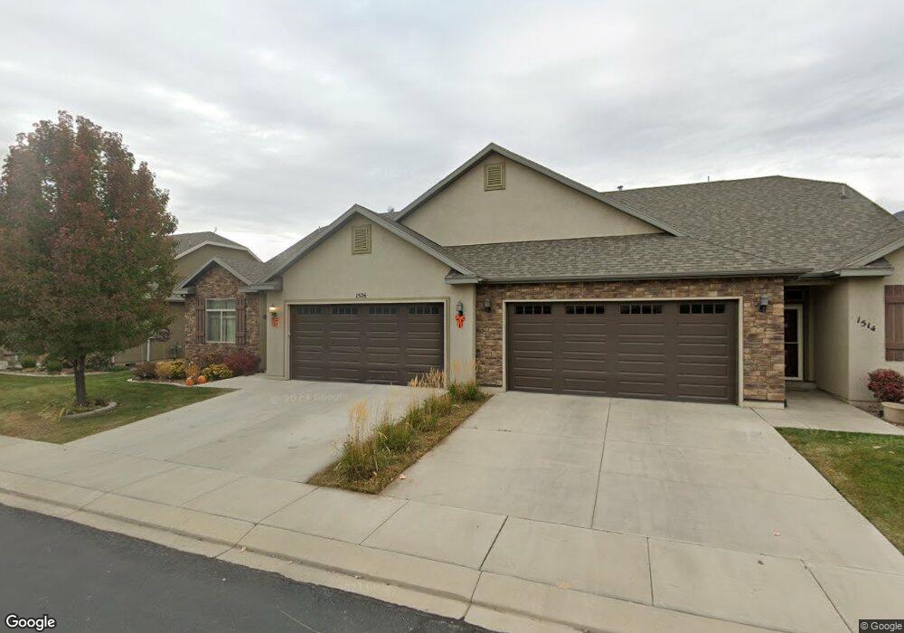
1526 W 480 N Unit 7 Lindon, UT 84042
Estimated Value: $526,000 - $625,000
3
Beds
2
Baths
2,339
Sq Ft
$237/Sq Ft
Est. Value
About This Home
This home is located at 1526 W 480 N Unit 7, Lindon, UT 84042 and is currently estimated at $554,041, approximately $236 per square foot. 1526 W 480 N Unit 7 is a home located in Utah County with nearby schools including Lindon Elementary School, Oak Canyon Junior High School, and Pleasant Grove High School.
Ownership History
Date
Name
Owned For
Owner Type
Purchase Details
Closed on
May 11, 2020
Sold by
Golding Marion E
Bought by
Golding Marion E and Golding Cynthia A
Current Estimated Value
Home Financials for this Owner
Home Financials are based on the most recent Mortgage that was taken out on this home.
Original Mortgage
$219,000
Outstanding Balance
$173,899
Interest Rate
3.3%
Mortgage Type
New Conventional
Estimated Equity
$380,142
Purchase Details
Closed on
Sep 9, 2013
Sold by
Golding Marion E
Bought by
Golding Marion E and Golding Cynthia A
Home Financials for this Owner
Home Financials are based on the most recent Mortgage that was taken out on this home.
Original Mortgage
$240,246
Interest Rate
4.27%
Mortgage Type
New Conventional
Create a Home Valuation Report for This Property
The Home Valuation Report is an in-depth analysis detailing your home's value as well as a comparison with similar homes in the area
Home Values in the Area
Average Home Value in this Area
Purchase History
| Date | Buyer | Sale Price | Title Company |
|---|---|---|---|
| Golding Marion E | -- | Access Title Company | |
| Golding Marion E | -- | Access Title Company | |
| Golding Marion E | -- | United Title Services | |
| Golding Marion E | -- | United West Title |
Source: Public Records
Mortgage History
| Date | Status | Borrower | Loan Amount |
|---|---|---|---|
| Open | Golding Marion E | $219,000 | |
| Closed | Golding Marion E | $240,246 |
Source: Public Records
Tax History Compared to Growth
Tax History
| Year | Tax Paid | Tax Assessment Tax Assessment Total Assessment is a certain percentage of the fair market value that is determined by local assessors to be the total taxable value of land and additions on the property. | Land | Improvement |
|---|---|---|---|---|
| 2025 | $2,319 | $518,100 | $149,300 | $368,800 |
| 2024 | $2,319 | $285,395 | $0 | $0 |
| 2023 | $2,259 | $298,650 | $0 | $0 |
| 2022 | $2,333 | $297,990 | $0 | $0 |
| 2021 | $1,740 | $335,000 | $135,000 | $200,000 |
| 2020 | $1,767 | $335,000 | $135,000 | $200,000 |
| 2019 | $1,694 | $335,000 | $135,000 | $200,000 |
| 2018 | $1,752 | $326,500 | $135,000 | $191,500 |
| 2017 | $1,715 | $171,325 | $0 | $0 |
| 2016 | $1,616 | $149,380 | $0 | $0 |
| 2015 | $1,618 | $141,350 | $0 | $0 |
| 2014 | $1,620 | $140,250 | $0 | $0 |
Source: Public Records
Map
Nearby Homes
- Washington Farmhouse Plan at Anderson Farms
- 3810 W Valley Dr
- 1424 Gala Ln
- 1434 W Watson Ln
- 264 N Old Farm Ln
- 1362 W Valley Dr
- 611 N Briarwood Ln
- 1430 W Kelsey Way
- 574 N Cornstalk Ln
- 556 N Cornstalk Ln
- 1277 W Sweet Corn Ln
- 557 N Buffalo Grass Ln
- 575 N Buffalo Grass Ln
- 554 N Buffalo Grass Ln
- 556 N Buffalo Grass Ln
- 564 N Buffalo Grass Ln Unit 1250
- 558 N Buffalo Grass Ln
- 560 N Buffalo Grass Ln
- 929 W 670 S Unit 9
- 963 W 670 S Unit 20
- 1526 W 480 N Unit 17
- 1514 W 480 N Unit 8
- 1538 W 480 N
- 1552 W 480 N Unit 5
- 1531 W 480 N Unit 42
- 1517 W 480 N Unit 43
- 1517 W 480 N
- 1543 W 480 N
- 1574 W 480 N Unit 4
- 517 N 1510 W
- 496 N 1510 W
- 484 N 1510 W Unit 10
- 484 N 1510 W
- 1561 W 480 N Unit 40
- 476 N 1510 W
- 1582 W 480 N Unit 3
- 1582 W 480 N
- 1552 W 500 N
- 1577 W 480 N
- 464 N 1510 W