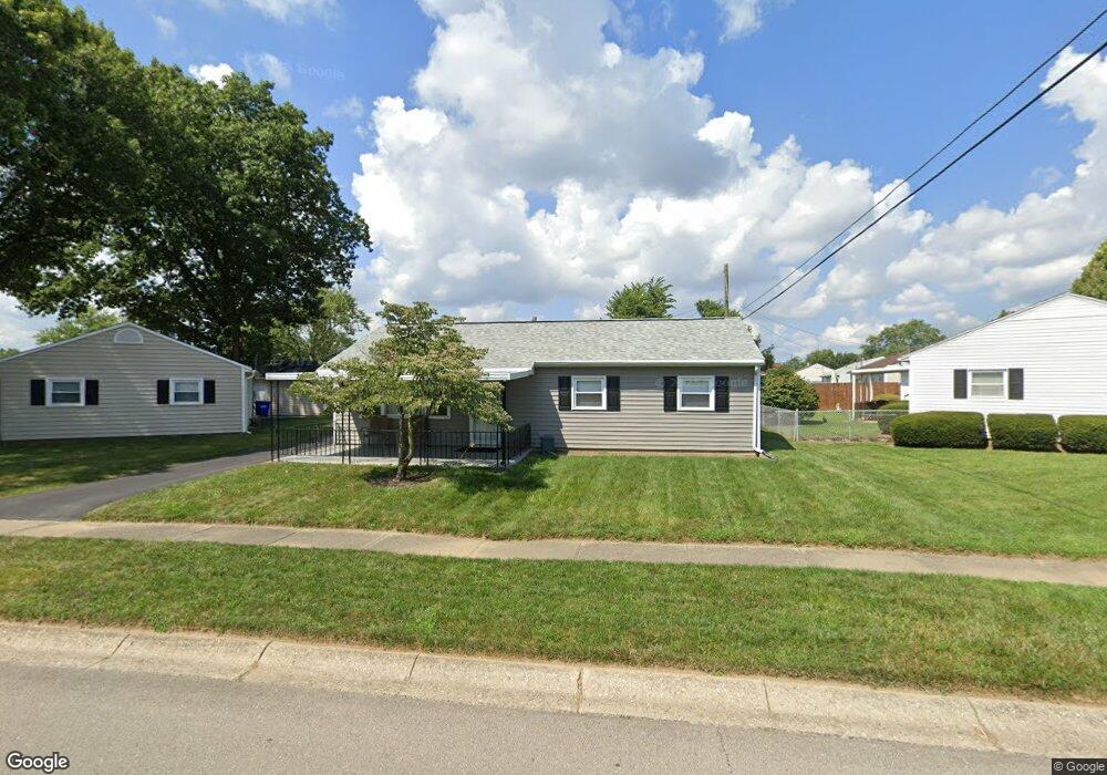
1527 Buffalo St Dayton, OH 45432
Eastmont NeighborhoodEstimated Value: $139,000 - $159,510
3
Beds
1
Bath
1,008
Sq Ft
$152/Sq Ft
Est. Value
About This Home
This home is located at 1527 Buffalo St, Dayton, OH 45432 and is currently estimated at $153,378, approximately $152 per square foot. 1527 Buffalo St is a home located in Montgomery County with nearby schools including Eastmont Elementary, Cleveland Elementary School, and Horace Mann Elementary School.
Ownership History
Date
Name
Owned For
Owner Type
Purchase Details
Closed on
Feb 7, 2020
Sold by
Jones Ronald J and Jones Patricia D
Bought by
Wallace Gregory R
Current Estimated Value
Home Financials for this Owner
Home Financials are based on the most recent Mortgage that was taken out on this home.
Original Mortgage
$88,271
Outstanding Balance
$78,188
Interest Rate
3.62%
Mortgage Type
FHA
Estimated Equity
$75,190
Purchase Details
Closed on
Jun 29, 2012
Sold by
Peck Kenneth W
Bought by
Jones Ronald J and Jones Patricia D
Home Financials for this Owner
Home Financials are based on the most recent Mortgage that was taken out on this home.
Original Mortgage
$68,000
Interest Rate
3.83%
Mortgage Type
VA
Create a Home Valuation Report for This Property
The Home Valuation Report is an in-depth analysis detailing your home's value as well as a comparison with similar homes in the area
Home Values in the Area
Average Home Value in this Area
Purchase History
| Date | Buyer | Sale Price | Title Company |
|---|---|---|---|
| Wallace Gregory R | $89,900 | Fidelity Lawyers Ttl Agcy Ll | |
| Jones Ronald J | $68,000 | None Available |
Source: Public Records
Mortgage History
| Date | Status | Borrower | Loan Amount |
|---|---|---|---|
| Open | Wallace Gregory R | $88,271 | |
| Previous Owner | Jones Ronald J | $68,000 |
Source: Public Records
Tax History Compared to Growth
Tax History
| Year | Tax Paid | Tax Assessment Tax Assessment Total Assessment is a certain percentage of the fair market value that is determined by local assessors to be the total taxable value of land and additions on the property. | Land | Improvement |
|---|---|---|---|---|
| 2024 | $2,484 | $43,160 | $9,370 | $33,790 |
| 2023 | $2,484 | $43,160 | $9,370 | $33,790 |
| 2022 | $2,063 | $27,680 | $6,010 | $21,670 |
| 2021 | $1,998 | $27,680 | $6,010 | $21,670 |
| 2020 | $1,371 | $27,680 | $6,010 | $21,670 |
| 2019 | $1,199 | $23,500 | $6,010 | $17,490 |
| 2018 | $1,200 | $23,500 | $6,010 | $17,490 |
| 2017 | $1,191 | $23,500 | $6,010 | $17,490 |
| 2016 | $1,116 | $21,850 | $6,010 | $15,840 |
| 2015 | $1,057 | $21,850 | $6,010 | $15,840 |
| 2014 | $1,057 | $21,850 | $6,010 | $15,840 |
| 2012 | -- | $21,440 | $6,030 | $15,410 |
Source: Public Records
Map
Nearby Homes
- 4733 Barnhart Ave
- 4869 Andes Dr
- 5042 Woodbine Ave
- 1592 Selkirk Rd
- 4214 Blue Rock Rd
- 1568 Garwood Dr
- 1918 Russet Ave
- 4515 Kingview Ave
- 4534 Woodcliffe Ave
- 4508 Varney Ave
- 1327 Renslar Ave
- 4513 Woodbine Ave
- 5302 Rawlings Dr
- 4435 Reading Rd
- 4438 Woodbine Ave
- 4677 Kolmar Ave
- 1808 Russet Ave
- 4643 Amesborough Rd
- 4527 Amesborough Rd
- 4549 Amesborough Rd
- 4829 Woodbine Ave
- 4822 Ozark Ave
- 4815 Woodbine Ave
- 4814 Ozark Ave
- 4809 Woodbine Ave
- 1542 Buffalo St
- 4808 Ozark Ave
- 1532 Buffalo St
- 4827 Ozark Ave
- 1526 Buffalo St
- 4803 Woodbine Ave
- 4802 Ozark Ave
- 4911 Woodbine Ave
- 4820 Woodbine Ave
- 4826 Woodbine Ave
- 4815 Ozark Ave
- 4814 Woodbine Ave
- 4832 Woodbine Ave
- 1520 Buffalo St
- 4808 Woodbine Ave