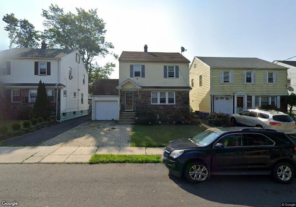
1527 Leslie St Hillside, NJ 07205
Estimated Value: $445,552 - $503,000
--
Bed
--
Bath
1,538
Sq Ft
$308/Sq Ft
Est. Value
About This Home
This home is located at 1527 Leslie St, Hillside, NJ 07205 and is currently estimated at $473,138, approximately $307 per square foot. 1527 Leslie St is a home located in Union County with nearby schools including Abram P. Morris-Saybrook Elementary School, Ola Edwards Community School, and Hurden Looker School.
Ownership History
Date
Name
Owned For
Owner Type
Purchase Details
Closed on
Sep 28, 2009
Sold by
Abramson Kyle K and Abramson Jenny J
Bought by
Jones Barbara Smith
Current Estimated Value
Home Financials for this Owner
Home Financials are based on the most recent Mortgage that was taken out on this home.
Original Mortgage
$139,600
Outstanding Balance
$91,435
Interest Rate
5.14%
Mortgage Type
New Conventional
Estimated Equity
$381,703
Purchase Details
Closed on
Jun 5, 1995
Sold by
Va
Bought by
Penny Melin Floyd and Penny Melvin
Create a Home Valuation Report for This Property
The Home Valuation Report is an in-depth analysis detailing your home's value as well as a comparison with similar homes in the area
Home Values in the Area
Average Home Value in this Area
Purchase History
| Date | Buyer | Sale Price | Title Company |
|---|---|---|---|
| Jones Barbara Smith | $234,600 | Multiple | |
| Penny Melin Floyd | $65,000 | -- |
Source: Public Records
Mortgage History
| Date | Status | Borrower | Loan Amount |
|---|---|---|---|
| Open | Jones Barbara Smith | $139,600 |
Source: Public Records
Tax History Compared to Growth
Tax History
| Year | Tax Paid | Tax Assessment Tax Assessment Total Assessment is a certain percentage of the fair market value that is determined by local assessors to be the total taxable value of land and additions on the property. | Land | Improvement |
|---|---|---|---|---|
| 2025 | $8,121 | $98,400 | $35,100 | $63,300 |
| 2024 | $7,885 | $98,400 | $35,100 | $63,300 |
| 2023 | $7,885 | $98,400 | $35,100 | $63,300 |
| 2022 | $7,812 | $98,400 | $35,100 | $63,300 |
| 2021 | $7,761 | $98,400 | $35,100 | $63,300 |
| 2020 | $7,716 | $98,400 | $35,100 | $63,300 |
| 2019 | $7,566 | $98,400 | $35,100 | $63,300 |
| 2018 | $7,490 | $98,400 | $35,100 | $63,300 |
| 2017 | $7,445 | $98,400 | $35,100 | $63,300 |
| 2016 | $7,436 | $98,400 | $35,100 | $63,300 |
| 2015 | $7,370 | $98,400 | $35,100 | $63,300 |
| 2014 | $7,254 | $98,400 | $35,100 | $63,300 |
Source: Public Records
Map
Nearby Homes
- 315 Winans Ave
- 1470B Liberty Ave
- 1451 Franklin St
- 1435 Leslie St Unit 7
- 327 Field Place
- 339 Hillside Ave
- 339 Hillside Ave Unit 2
- 334 Wainwright St
- 346 Florence Ave
- 319 Schley St
- 23 Crescent Ave Unit 25
- 1414 Boa Place Unit 2
- 286-288 Wainwright St
- 286 Wainwright St Unit 288
- 285 Wainwright St
- 628 Us Highway 22 and 3
- 1406 Maple Ave
- 47 Dupont Place
- 53 Paine Ave
- 1473 Center St
- 1525 Leslie St
- 1529 Leslie St
- 1523 Leslie St
- 1531 Leslie St
- 1516 Hiawatha Ave
- 1512 Hiawatha Ave
- 1518 Hiawatha Ave
- 1533 Leslie St
- 1522 Hiawatha Ave
- 1524 Hiawatha Ave
- 1528 Hiawatha Ave
- 1537 Leslie St
- 1499 Leslie St
- 1513 Hiawatha Ave
- 1519 Hiawatha Ave
- 1496 Hiawatha Ave
- 1511 Hiawatha Ave
- 1532 Hiawatha Ave
- 1532 Hiawatha Ave Unit 2
- 1497 Leslie St