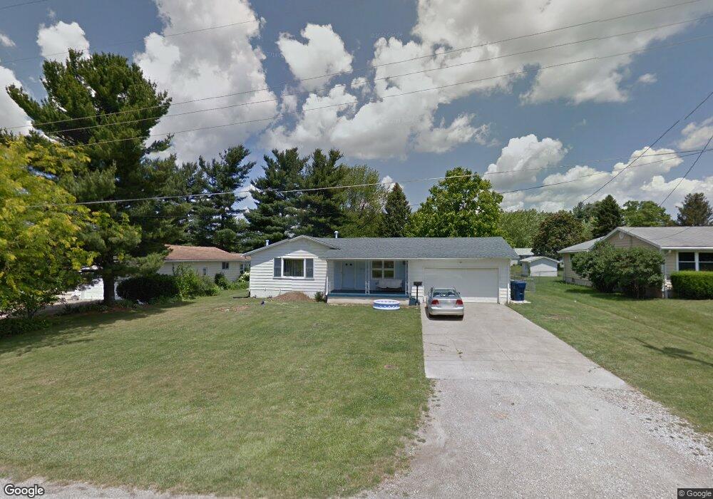
1527 Pear Place Mansfield, OH 44905
Estimated Value: $179,729 - $228,000
3
Beds
2
Baths
1,356
Sq Ft
$147/Sq Ft
Est. Value
About This Home
This home is located at 1527 Pear Place, Mansfield, OH 44905 and is currently estimated at $199,932, approximately $147 per square foot. 1527 Pear Place is a home located in Richland County with nearby schools including Madison High School, Temple-Christian School, and St. Mary Catholic School.
Ownership History
Date
Name
Owned For
Owner Type
Purchase Details
Closed on
Oct 20, 2008
Sold by
Fannie Mae
Bought by
Haring Jennifer D
Current Estimated Value
Home Financials for this Owner
Home Financials are based on the most recent Mortgage that was taken out on this home.
Original Mortgage
$76,885
Outstanding Balance
$50,285
Interest Rate
6.09%
Mortgage Type
FHA
Estimated Equity
$149,647
Purchase Details
Closed on
Apr 10, 2008
Sold by
Day Lucille J
Bought by
Federal National Mortgage Association
Create a Home Valuation Report for This Property
The Home Valuation Report is an in-depth analysis detailing your home's value as well as a comparison with similar homes in the area
Home Values in the Area
Average Home Value in this Area
Purchase History
| Date | Buyer | Sale Price | Title Company |
|---|---|---|---|
| Haring Jennifer D | $77,900 | Accutitle Agency Inc | |
| Federal National Mortgage Association | $70,000 | None Available |
Source: Public Records
Mortgage History
| Date | Status | Borrower | Loan Amount |
|---|---|---|---|
| Open | Haring Jennifer D | $76,885 |
Source: Public Records
Tax History Compared to Growth
Tax History
| Year | Tax Paid | Tax Assessment Tax Assessment Total Assessment is a certain percentage of the fair market value that is determined by local assessors to be the total taxable value of land and additions on the property. | Land | Improvement |
|---|---|---|---|---|
| 2024 | $2,623 | $38,800 | $6,680 | $32,120 |
| 2023 | $2,623 | $38,800 | $6,680 | $32,120 |
| 2022 | $2,570 | $34,070 | $6,070 | $28,000 |
| 2021 | $2,623 | $34,070 | $6,070 | $28,000 |
| 2020 | $2,432 | $34,070 | $6,070 | $28,000 |
| 2019 | $2,340 | $28,630 | $5,100 | $23,530 |
| 2018 | $2,252 | $28,630 | $5,100 | $23,530 |
| 2017 | $1,909 | $28,630 | $5,100 | $23,530 |
| 2016 | $2,153 | $28,550 | $4,850 | $23,700 |
| 2015 | $2,153 | $28,550 | $4,850 | $23,700 |
| 2014 | $2,493 | $28,550 | $4,850 | $23,700 |
| 2012 | $1,071 | $30,040 | $5,100 | $24,940 |
Source: Public Records
Map
Nearby Homes
- 419 N Mcelroy Rd
- 1628 Park Ave E
- 632 Coachman Rd
- 602 Champion Rd
- 671 Coachman Rd
- 683 Coachman Rd
- 1226 Evergreen Ave W
- 1282 Redman Ave
- 644 Skyline Rd
- 641 Laver Rd
- 155 Ford Rd N
- 155 Ford Rd N Unit Lot 30
- 536 Gordon Rd
- 1303 Park Ave E
- 1199 Evergreen Ave W
- 1183 Evergreen Ave W
- 903 Mayflower Ave
- 0 Mcelroy Rd
- 76 Ford Rd N
- 76 Ford Rd N Unit 20
- 1519 Pear Place
- 1535 Pear Place
- 1532 Plum Place
- 1511 Pear Place
- 1526 Pear Place
- 1540 Plum Place
- 1528 Pear Place
- 1528 Plum Place
- 1536 Pear Place
- 1524 Plum Place
- 1546 Plum Place
- 1514 Pear Place
- 1544 Pear Place
- 500 Esley Ln
- 501 Melody Ln
- 515 Melody Ln
- 508 Esley Ln
- 481 Melody Ln
- 516 Esley Ln
- 1502 Pear Place