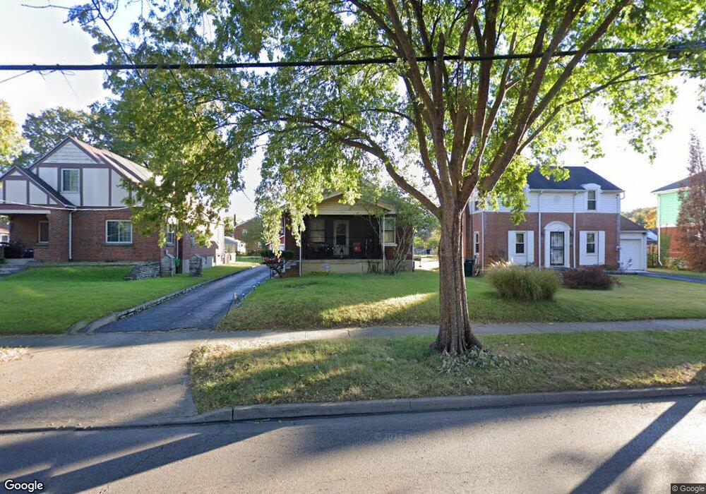
1527 Section Rd Cincinnati, OH 45237
Roselawn NeighborhoodEstimated Value: $180,000 - $231,000
2
Beds
1
Bath
1,066
Sq Ft
$191/Sq Ft
Est. Value
About This Home
This home is located at 1527 Section Rd, Cincinnati, OH 45237 and is currently estimated at $203,289, approximately $190 per square foot. 1527 Section Rd is a home located in Hamilton County with nearby schools including Roselawn Condon School, Shroder High School, and Clark Montessori High School.
Ownership History
Date
Name
Owned For
Owner Type
Purchase Details
Closed on
Mar 2, 2007
Sold by
Robertson Ethel Florence and Robertson Ethel
Bought by
Peterson Quinn
Current Estimated Value
Home Financials for this Owner
Home Financials are based on the most recent Mortgage that was taken out on this home.
Original Mortgage
$83,600
Interest Rate
6.19%
Mortgage Type
Unknown
Create a Home Valuation Report for This Property
The Home Valuation Report is an in-depth analysis detailing your home's value as well as a comparison with similar homes in the area
Home Values in the Area
Average Home Value in this Area
Purchase History
| Date | Buyer | Sale Price | Title Company |
|---|---|---|---|
| Peterson Quinn | $88,000 | Attorney |
Source: Public Records
Mortgage History
| Date | Status | Borrower | Loan Amount |
|---|---|---|---|
| Previous Owner | Peterson Quinn | $83,600 |
Source: Public Records
Tax History
| Year | Tax Paid | Tax Assessment Tax Assessment Total Assessment is a certain percentage of the fair market value that is determined by local assessors to be the total taxable value of land and additions on the property. | Land | Improvement |
|---|---|---|---|---|
| 2025 | $2,662 | $42,994 | $9,779 | $33,215 |
| 2024 | $2,585 | $42,994 | $9,779 | $33,215 |
| 2023 | $2,640 | $42,994 | $9,779 | $33,215 |
| 2022 | $1,447 | $21,036 | $8,544 | $12,492 |
| 2021 | $1,392 | $21,036 | $8,544 | $12,492 |
| 2020 | $1,430 | $21,036 | $8,544 | $12,492 |
| 2019 | $1,435 | $19,296 | $7,837 | $11,459 |
| 2018 | $1,437 | $19,296 | $7,837 | $11,459 |
| 2017 | $1,366 | $19,296 | $7,837 | $11,459 |
| 2016 | $1,304 | $18,172 | $7,994 | $10,178 |
| 2015 | $1,176 | $18,172 | $7,994 | $10,178 |
| 2014 | $1,184 | $18,172 | $7,994 | $10,178 |
| 2013 | $1,181 | $17,816 | $7,837 | $9,979 |
Source: Public Records
Map
Nearby Homes
- 1519 Section Rd
- 7505 Greenland Place
- 1622 Shenandoah Ave
- 1543 Corvallis Ave
- 1511 Summit Rd
- 1501 Summit Rd
- 1418 Lakeland Ave
- 1522 Kenova Ave
- 1535 Kenova Ave
- 1636 Summit Rd
- 1849 Greenbriar Place
- 7831 Glen Orchard Dr
- 7829 Sunfield Dr
- 1808 Crest Hill Ave
- 8081 Woodbine Ave
- 7871 Glenorchard Dr
- 6770 Elbrook Ave
- 6750 Elbrook Ave
- 3 W 73rd St
- 118 W North Bend Rd
- 1531 Section Rd
- 1523 Section Rd
- 1535 Section Rd
- 1526 Shenandoah Ave
- 1539 Section Rd
- 1530 Shenandoah Ave
- 1522 Shenandoah Ave
- 1534 Shenandoah Ave
- 1518 Shenandoah Ave
- 1543 Section Rd
- 1538 Shenandoah Ave
- 1514 Shenandoah Ave
- 1534 Section Rd
- 1526 Section Rd
- 1522 Section Rd
- 1547 Section Rd
- 1542 Shenandoah Ave
- 1518 Section Rd
- 1510 Shenandoah Ave
- 1507 Section Rd
