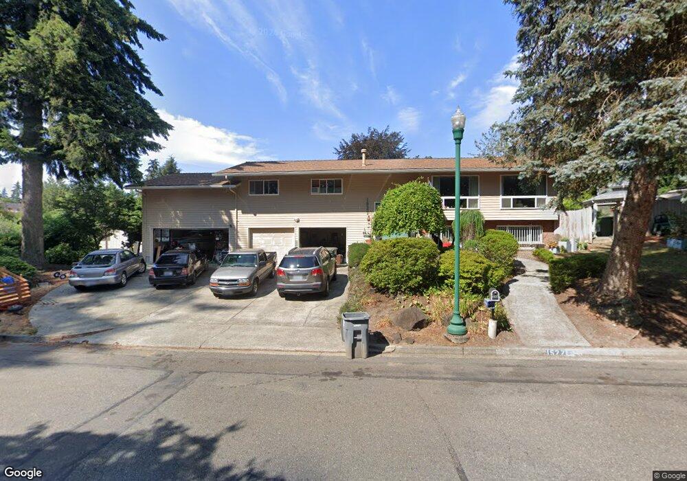
1527 Woodside Dr Fircrest, WA 98466
Estimated Value: $786,958 - $841,000
4
Beds
3
Baths
2,980
Sq Ft
$273/Sq Ft
Est. Value
About This Home
This home is located at 1527 Woodside Dr, Fircrest, WA 98466 and is currently estimated at $813,740, approximately $273 per square foot. 1527 Woodside Dr is a home located in Pierce County with nearby schools including Whittier Elementary School, Wainwright Intermediate School, and Foss High School.
Ownership History
Date
Name
Owned For
Owner Type
Purchase Details
Closed on
Feb 5, 1998
Sold by
Elfrink Loui D
Bought by
Ragan John M and Ragan Cherrilyn R
Current Estimated Value
Purchase Details
Closed on
May 25, 1994
Sold by
Tindall Leroy E
Bought by
Elfrink Loui D and Elfrink Anne Marie
Home Financials for this Owner
Home Financials are based on the most recent Mortgage that was taken out on this home.
Original Mortgage
$184,500
Interest Rate
8.12%
Create a Home Valuation Report for This Property
The Home Valuation Report is an in-depth analysis detailing your home's value as well as a comparison with similar homes in the area
Home Values in the Area
Average Home Value in this Area
Purchase History
| Date | Buyer | Sale Price | Title Company |
|---|---|---|---|
| Ragan John M | $226,862 | Commonwealth Title Company | |
| Elfrink Loui D | -- | -- |
Source: Public Records
Mortgage History
| Date | Status | Borrower | Loan Amount |
|---|---|---|---|
| Previous Owner | Elfrink Loui D | $184,500 |
Source: Public Records
Tax History Compared to Growth
Tax History
| Year | Tax Paid | Tax Assessment Tax Assessment Total Assessment is a certain percentage of the fair market value that is determined by local assessors to be the total taxable value of land and additions on the property. | Land | Improvement |
|---|---|---|---|---|
| 2025 | $6,393 | $707,900 | $318,300 | $389,600 |
| 2024 | $6,393 | $696,800 | $299,600 | $397,200 |
| 2023 | $6,393 | $670,500 | $292,100 | $378,400 |
| 2022 | $6,258 | $668,600 | $300,400 | $368,200 |
| 2021 | $5,993 | $516,200 | $211,200 | $305,000 |
| 2019 | $4,764 | $483,900 | $180,900 | $303,000 |
| 2018 | $5,283 | $442,600 | $153,000 | $289,600 |
| 2017 | $4,856 | $397,700 | $124,100 | $273,600 |
| 2016 | $4,532 | $321,500 | $90,200 | $231,300 |
| 2014 | $4,129 | $306,700 | $86,600 | $220,100 |
| 2013 | $4,129 | $274,300 | $78,000 | $196,300 |
Source: Public Records
Map
Nearby Homes
- 4311 67th Ave W Unit B
- 4221 67th Ave W Unit A
- 1322 W Mount Dr
- 4003 Flora Dr
- 1450 Alameda Ave Unit 1
- 3827 67th Avenue Ct W
- 4641 67th Avenue Ct W Unit 4643
- 4708 63rd Ave W
- 6910 38th Street Ct W Unit 6910
- 4211 Shoshone St W
- 3728 70th Avenue Ct W
- 4920 69th Avenue Ct W
- 1310 Boise St Unit 2
- 1324 Boise St
- 5208 66th Ave W
- 4601 73rd Avenue Ct W
- 6201 53rd Street Ct W
- 4509 74th Avenue Ct W
- 5013 70th Avenue Ct W Unit 6A
- 5310 66th Ave W
- 1559 Woodside Dr
- 1515 Woodside Dr
- 1503 Woodside Dr
- 1532 Woodside Ct
- 1576 Woodside Ct
- 1524 Woodside Dr
- 1516 Woodside Dr
- 1578 Woodside Dr
- 1439 Woodside Dr
- 1575 Woodside Dr
- 1508 Woodside Dr
- 1542 Woodside Ct
- 1433 Woodside Dr
- 1572 Woodside Ct
- 1577 Woodside Dr
- 1430 Woodside Dr
- 1549 Weathervane Ct
- 1545 Weathervane Ct
- 1584 Woodside Dr