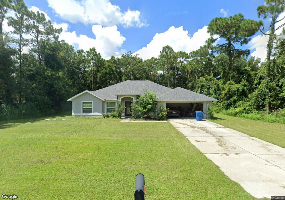
15279 Wilhelm Rd Brooksville, FL 34613
Estimated Value: $391,677 - $486,000
4
Beds
2
Baths
2,115
Sq Ft
$204/Sq Ft
Est. Value
About This Home
This home is located at 15279 Wilhelm Rd, Brooksville, FL 34613 and is currently estimated at $430,669, approximately $203 per square foot. 15279 Wilhelm Rd is a home with nearby schools including Pine Grove Elementary School, Hernando High School, and West Hernando Middle School.
Ownership History
Date
Name
Owned For
Owner Type
Purchase Details
Closed on
Dec 23, 2019
Sold by
Spano Gracie
Bought by
Spano Leonard J and Spano Gracie E
Current Estimated Value
Home Financials for this Owner
Home Financials are based on the most recent Mortgage that was taken out on this home.
Original Mortgage
$191,505
Outstanding Balance
$170,357
Interest Rate
3.7%
Mortgage Type
Construction
Estimated Equity
$260,312
Purchase Details
Closed on
Sep 20, 2019
Sold by
Allen Erin L
Bought by
Spano Gracie
Purchase Details
Closed on
Mar 14, 2005
Sold by
Lindsey Grace P
Bought by
Allen Erin L
Create a Home Valuation Report for This Property
The Home Valuation Report is an in-depth analysis detailing your home's value as well as a comparison with similar homes in the area
Home Values in the Area
Average Home Value in this Area
Purchase History
| Date | Buyer | Sale Price | Title Company |
|---|---|---|---|
| Spano Leonard J | -- | All Performance Title Inc | |
| Spano Gracie | -- | None Available | |
| Allen Erin L | -- | -- |
Source: Public Records
Mortgage History
| Date | Status | Borrower | Loan Amount |
|---|---|---|---|
| Open | Spano Leonard J | $191,505 |
Source: Public Records
Tax History Compared to Growth
Tax History
| Year | Tax Paid | Tax Assessment Tax Assessment Total Assessment is a certain percentage of the fair market value that is determined by local assessors to be the total taxable value of land and additions on the property. | Land | Improvement |
|---|---|---|---|---|
| 2024 | $2,874 | $203,396 | -- | -- |
| 2023 | $2,874 | $197,472 | $0 | $0 |
| 2022 | $2,785 | $191,720 | $0 | $0 |
| 2021 | $2,404 | $186,136 | $0 | $0 |
| 2020 | $445 | $18,613 | $18,613 | $0 |
| 2019 | $454 | $18,613 | $18,613 | $0 |
| 2018 | $269 | $17,518 | $17,518 | $0 |
| 2017 | $408 | $17,518 | $17,518 | $0 |
| 2016 | $407 | $17,518 | $0 | $0 |
| 2015 | $410 | $17,518 | $0 | $0 |
| 2014 | $408 | $17,518 | $0 | $0 |
Source: Public Records
Map
Nearby Homes
- 8163 Winter St
- 8270 Cresap St
- 8147 Cresap St
- 8026 Simmons St
- 8014 Simmons St
- 0 Simmons St
- 000 Grove Rd
- 8080 B W Stevenson Rd
- 15073 Brookridge Blvd
- 15061 Brookridge Blvd
- 15549 Cortez Blvd Unit 263
- 15133 Brookridge Blvd
- 8477 Foxfire Rd
- 16386 Sam C Rd
- 16108 Gupton St
- 7373 Fall St
- 15541 Cortez Blvd
- 8123 Dalavan Dr
- 15472 Brookridge Blvd
- 8144 Weatherford Ave
- 15287 Wilhelm Rd
- 15256 Merle Ct
- 15260 Merle Ct
- 8235 Cresap St
- 8219 Cresap St
- 8200 Cresap St
- 15299 Wilhelm Rd
- 8239 Cresap St
- 15264 Merle Ct
- 8211 Cresap St
- 8211 8211 Winter St
- 8243 Cresap St
- 8250 Cresap St
- 15303 Wilhelm Rd
- 15259 Merle Ct
- 8199 Cresap St
- 8188 Cresap St
- 15263 Merle Ct
- 15317 Wilhelm Rd
- 8187 Winter St