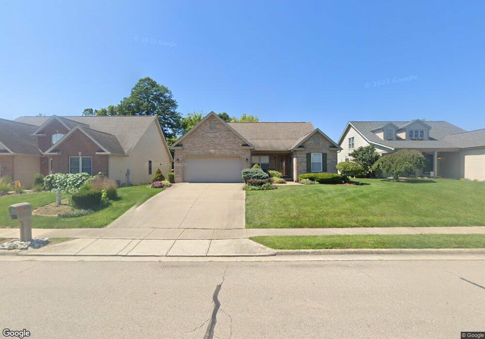
1528 Woodside Dr Wilmington, OH 45177
Estimated Value: $295,826 - $740,000
3
Beds
2
Baths
1,704
Sq Ft
$245/Sq Ft
Est. Value
About This Home
This home is located at 1528 Woodside Dr, Wilmington, OH 45177 and is currently estimated at $417,207, approximately $244 per square foot. 1528 Woodside Dr is a home located in Clinton County with nearby schools including East End Elementary School, Roy E. Holmes Elementary School, and Denver Place Elementary School.
Ownership History
Date
Name
Owned For
Owner Type
Purchase Details
Closed on
Oct 2, 2024
Sold by
Williams Cynthia A
Bought by
Austin Preservation Trust and Bryant
Current Estimated Value
Purchase Details
Closed on
Jun 26, 2024
Sold by
Hayes Dennis J
Bought by
Williams Cynthia A
Purchase Details
Closed on
Apr 22, 2018
Sold by
Hayes Yvonne C
Bought by
Williams Cynthia A and Hayes Dennis J
Purchase Details
Closed on
May 8, 2001
Sold by
Big Six
Bought by
Hayes James C and Hayes Yvonne C
Purchase Details
Closed on
Jan 1, 1990
Bought by
Big Six - A Partnership
Create a Home Valuation Report for This Property
The Home Valuation Report is an in-depth analysis detailing your home's value as well as a comparison with similar homes in the area
Home Values in the Area
Average Home Value in this Area
Purchase History
| Date | Buyer | Sale Price | Title Company |
|---|---|---|---|
| Austin Preservation Trust | $616,550 | None Listed On Document | |
| Williams Cynthia A | $140,000 | None Listed On Document | |
| Williams Cynthia A | -- | None Available | |
| Hayes James C | $27,500 | -- | |
| Big Six - A Partnership | -- | -- |
Source: Public Records
Tax History Compared to Growth
Tax History
| Year | Tax Paid | Tax Assessment Tax Assessment Total Assessment is a certain percentage of the fair market value that is determined by local assessors to be the total taxable value of land and additions on the property. | Land | Improvement |
|---|---|---|---|---|
| 2024 | $2,896 | $84,040 | $9,240 | $74,800 |
| 2023 | $2,896 | $84,040 | $9,240 | $74,800 |
| 2022 | $2,469 | $67,450 | $7,980 | $59,470 |
| 2021 | $2,500 | $67,450 | $7,980 | $59,470 |
| 2020 | $2,351 | $67,450 | $7,980 | $59,470 |
| 2019 | $1,551 | $50,320 | $7,980 | $42,340 |
| 2018 | $1,566 | $50,320 | $7,980 | $42,340 |
| 2017 | $1,521 | $50,320 | $7,980 | $42,340 |
| 2016 | $1,420 | $47,110 | $7,980 | $39,130 |
| 2015 | $1,393 | $47,110 | $7,980 | $39,130 |
| 2013 | $1,367 | $45,960 | $7,980 | $37,980 |
Source: Public Records
Map
Nearby Homes
- 629 Oakridge Dr
- 1244 Mayfair Dr
- 1624 Lakewood Dr
- 585 Silverado Dr
- 987 N Nelson Ave
- 909 W Main St
- 493 Mitchell Rd
- 423 Howard St
- 12 Peterson Place
- 373 Thorne Ave
- 584 Howard St
- 555 Cross Creek Dr
- 360 Summit St
- 62 Gallup St
- 0 US Route 68 Unit 1831183
- 1253 Us Route 68
- 0 US Route 68 Unit 1792385
- 146 N Spring St
- 136 N Spring St
- 157 Indiana Ave
- 1540 Woodside Dr
- 1516 Woodside Dr
- 1552 Woodside Dr
- 1504 Woodside Dr
- 1525 Woodside Dr
- 1511 Woodside Dr
- 1562 Woodside Dr
- 1537 Woodside Dr
- 1549 Woodside Dr
- 1494 Woodside Dr
- 1489 Woodside Dr
- 1563 Woodside Dr
- 1568 Woodside Dr
- 1469 Woodside Dr
- 1484 Woodside Dr
- 1589 Woodside Dr
- 568 Westwynd Cir
- 582 Westwynd Cir
- 1457 Woodside Dr
- 1578 Woodside Dr