Estimated Value: $107,000 - $221,000
3
Beds
1
Bath
1,371
Sq Ft
$122/Sq Ft
Est. Value
About This Home
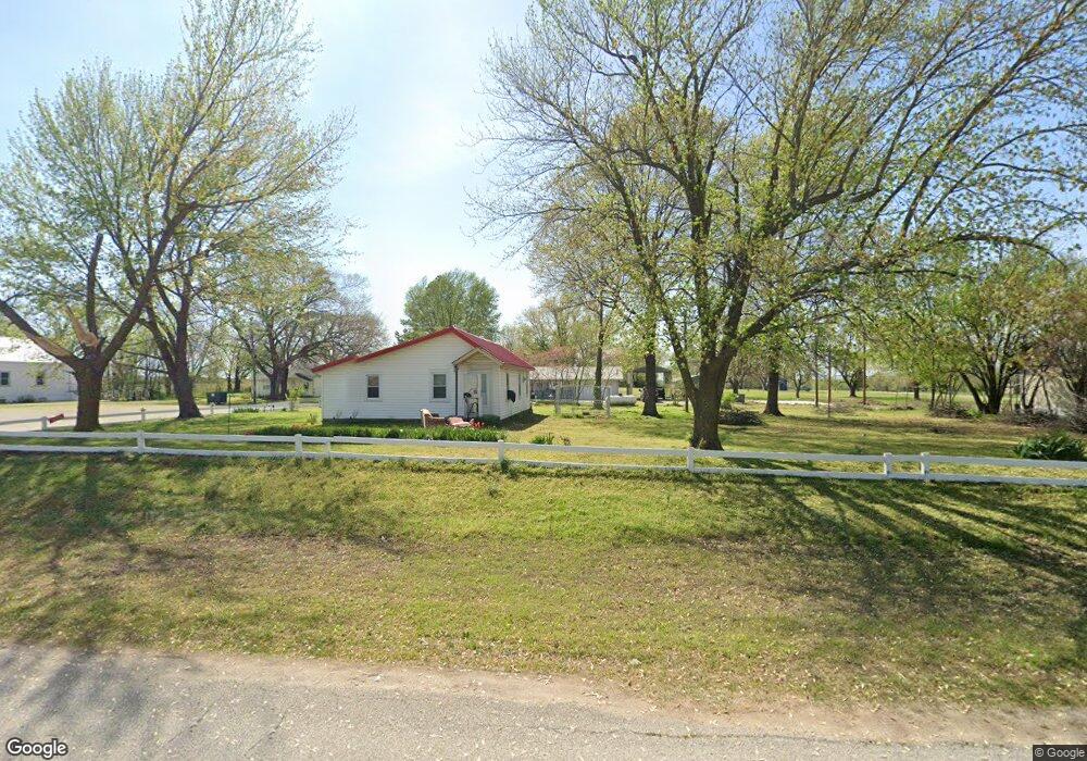
This home is located at 15285 S 529 Rd, Miami, OK 74354 and is currently estimated at $167,541, approximately $122 per square foot. 15285 S 529 Rd is a home located in Ottawa County with nearby schools including Afton Elementary School and Afton High School.
Ownership History
Date
Name
Owned For
Owner Type
Purchase Details
Closed on
Feb 23, 2023
Sold by
Gibson Earl Leroy and Gibson Nancy
Bought by
Gibson Phillip Brad and Gibson Melissa Dawn
Current Estimated Value
Purchase Details
Closed on
Aug 24, 2011
Sold by
Boyd Dale E and The Erma Joan Boyd Revocable T
Bought by
Gibson Earl L
Home Financials for this Owner
Home Financials are based on the most recent Mortgage that was taken out on this home.
Original Mortgage
$62,461
Interest Rate
4.54%
Mortgage Type
Purchase Money Mortgage
Create a Home Valuation Report for This Property
The Home Valuation Report is an in-depth analysis detailing your home's value as well as a comparison with similar homes in the area
Home Values in the Area
Average Home Value in this Area
Purchase History
| Date | Buyer | Sale Price | Title Company |
|---|---|---|---|
| Gibson Phillip Brad | $9,500 | -- | |
| Gibson Earl L | $81,000 | Ottawa County Abstract & Tit |
Source: Public Records
Mortgage History
| Date | Status | Borrower | Loan Amount |
|---|---|---|---|
| Previous Owner | Gibson Earl L | $62,461 |
Source: Public Records
Tax History Compared to Growth
Tax History
| Year | Tax Paid | Tax Assessment Tax Assessment Total Assessment is a certain percentage of the fair market value that is determined by local assessors to be the total taxable value of land and additions on the property. | Land | Improvement |
|---|---|---|---|---|
| 2024 | -- | $4,634 | $179 | $4,455 |
| 2023 | $0 | $4,499 | $179 | $4,320 |
| 2022 | $0 | $4,368 | $179 | $4,189 |
| 2021 | $287 | $4,020 | $179 | $3,841 |
| 2020 | $2,755 | $3,903 | $179 | $3,724 |
| 2019 | $165 | $3,789 | $178 | $3,611 |
| 2018 | $0 | $3,679 | $178 | $3,501 |
| 2017 | $0 | $3,572 | $178 | $3,394 |
| 2016 | $165 | $3,402 | $183 | $3,219 |
| 2015 | $209 | $3,054 | $183 | $2,871 |
| 2014 | $165 | $3,303 | $183 | $3,120 |
Source: Public Records
Map
Nearby Homes
- 12900 S Highway 69
- 16701 S 550 Rd
- 0 E 130 Rd Unit 22-974
- 14701 S 560 Rd
- 1133 Sunset Strip
- TBD 24th Ave SW
- 0 24th Ave SW
- 2216 M St SW
- 1101 22nd Place SW
- 2110 M St SW
- 1025 22nd Ave SW
- 805 23rd Ave SW
- Tract 3 U S 59
- 18801 S Highway 69
- 14502 S Spangler Dr
- 0 Tract 8 Hwy 59
- 53004 E 110 Rd
- 0 Lot 1 Hwy 59
- 0 Tract 2 Hwy 59
- 52150 E 110 Rd
- 52910 E 152 Rd
- 52850 E 152 Rd
- 15121 S 529 Rd
- 15240 S 528 Rd
- 15151 S 529 Rd
- 15021 S 529 Rd
- 15241 S Highway 69
- 15280 S 528 Rd
- 15271 S Highway 69
- 15289 S 528 Rd
- 15010 S 529 Rd
- 15230 S Highway 69
- 15050 S Highway 69
- 15270 S Highway 69
- 53101 E 150 Rd
- 52800 E 150 Rd
- 15350 S Highway 69
- 53870 E 150 Rd
- 14907 S Highway 69
- 14803 S Highway 69