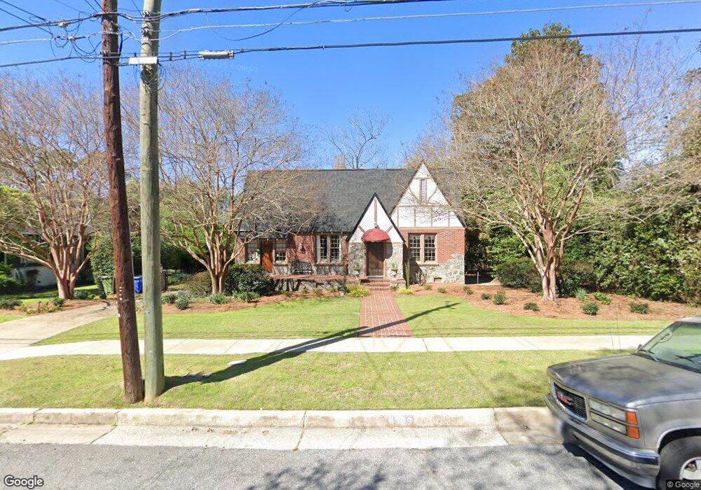
1529 Stark Ave Columbus, GA 31906
Wyntonn Grove NeighborhoodEstimated Value: $418,000 - $480,000
3
Beds
4
Baths
3,058
Sq Ft
$142/Sq Ft
Est. Value
About This Home
This home is located at 1529 Stark Ave, Columbus, GA 31906 and is currently estimated at $433,772, approximately $141 per square foot. 1529 Stark Ave is a home located in Muscogee County with nearby schools including Richards Middle School, Hardaway High School, and Wynnton Elementary School.
Ownership History
Date
Name
Owned For
Owner Type
Purchase Details
Closed on
Jul 16, 2013
Sold by
Mchale Tana M
Bought by
Mchale Tana M and Mchale Kevin
Current Estimated Value
Create a Home Valuation Report for This Property
The Home Valuation Report is an in-depth analysis detailing your home's value as well as a comparison with similar homes in the area
Home Values in the Area
Average Home Value in this Area
Purchase History
| Date | Buyer | Sale Price | Title Company |
|---|---|---|---|
| Mchale Tana M | -- | -- |
Source: Public Records
Tax History Compared to Growth
Tax History
| Year | Tax Paid | Tax Assessment Tax Assessment Total Assessment is a certain percentage of the fair market value that is determined by local assessors to be the total taxable value of land and additions on the property. | Land | Improvement |
|---|---|---|---|---|
| 2025 | $4,584 | $131,768 | $19,248 | $112,520 |
| 2024 | $4,583 | $131,768 | $19,248 | $112,520 |
| 2023 | $3,918 | $131,768 | $19,248 | $112,520 |
| 2022 | $4,780 | $105,204 | $19,248 | $85,956 |
| 2021 | $4,773 | $110,860 | $19,248 | $91,612 |
| 2020 | $4,775 | $110,860 | $19,248 | $91,612 |
| 2019 | $4,792 | $110,860 | $19,248 | $91,612 |
| 2018 | $4,792 | $110,860 | $19,248 | $91,612 |
| 2017 | $4,809 | $110,860 | $19,248 | $91,612 |
| 2016 | $4,827 | $130,295 | $11,808 | $118,487 |
| 2015 | $4,834 | $130,295 | $11,808 | $118,487 |
| 2014 | $4,840 | $130,295 | $11,808 | $118,487 |
| 2013 | -- | $130,295 | $11,808 | $118,487 |
Source: Public Records
Map
Nearby Homes
- 2227 15th St
- 1319 Hilton Ave
- 2125 13th St Unit 12
- 2133 13th St
- 2533 15th St
- 1700 Stark Ave
- 1706 Stark Ave
- 1227 Forest Ave Unit 4
- 1717 Stark Ave
- 1513 Wells Dr
- 1806 Stark Ave
- 1164 Tate Dr
- 1809 Carter Ave
- 2016 Poplar Dr
- 1400 Eberhart Ave
- 1310 S Dixon Dr
- 1500 Preston Dr
- 1917 Dimon St
- 2312 Marion St
- 2911 Gardenia St
- 1511 Stark Ave
- 1520 Wildwood Ave
- 1528 Wildwood Ave
- 1528 Wildwood Ave
- 1530 Stark Ave
- 1532 Stark Ave
- 1524 Stark Ave
- 1510 Wildwood Ave
- 1510 Wildwood Ave Unit 1
- 1510 Wildwood Ave Unit 2
- 1510 Wildwood Ave Unit 3
- 1510 Wildwood Ave Unit 5
- 1510 Wildwood Ave
- 1518 Stark Ave
- 1503 Stark Ave
- 1540 Stark Ave
- 1510 Stark Ave
- 2305 15th St
- 14021404 16th St
- 1502 Stark Ave