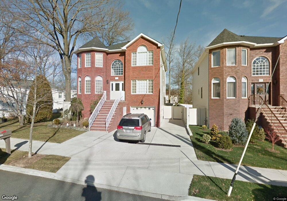
153-157 Adelaide Ave Staten Island, NY 10306
Oakwood NeighborhoodEstimated Value: $1,221,058 - $1,474,000
--
Bed
4
Baths
2,532
Sq Ft
$546/Sq Ft
Est. Value
About This Home
This home is located at 153-157 Adelaide Ave, Staten Island, NY 10306 and is currently estimated at $1,382,015, approximately $545 per square foot. 153-157 Adelaide Ave is a home located in Richmond County with nearby schools including P.S. 50 Frank Hankinson School, Myra S. Barnes Intermediate School 24, and New Dorp High School.
Ownership History
Date
Name
Owned For
Owner Type
Purchase Details
Closed on
Jul 27, 2010
Sold by
490 Pendale Llc
Bought by
Licata Salvatore T and Licata Antoinette
Current Estimated Value
Home Financials for this Owner
Home Financials are based on the most recent Mortgage that was taken out on this home.
Original Mortgage
$656,000
Outstanding Balance
$435,648
Interest Rate
4.63%
Mortgage Type
New Conventional
Estimated Equity
$946,367
Create a Home Valuation Report for This Property
The Home Valuation Report is an in-depth analysis detailing your home's value as well as a comparison with similar homes in the area
Home Values in the Area
Average Home Value in this Area
Purchase History
| Date | Buyer | Sale Price | Title Company |
|---|---|---|---|
| Licata Salvatore T | $834,965 | Lawyers Title Insurance Corp |
Source: Public Records
Mortgage History
| Date | Status | Borrower | Loan Amount |
|---|---|---|---|
| Open | Licata Salvatore T | $656,000 |
Source: Public Records
Tax History Compared to Growth
Tax History
| Year | Tax Paid | Tax Assessment Tax Assessment Total Assessment is a certain percentage of the fair market value that is determined by local assessors to be the total taxable value of land and additions on the property. | Land | Improvement |
|---|---|---|---|---|
| 2025 | $11,519 | $71,220 | $13,274 | $57,946 |
| 2024 | $11,531 | $75,360 | $11,835 | $63,525 |
| 2023 | $11,048 | $55,800 | $12,066 | $43,734 |
| 2022 | $10,852 | $68,880 | $15,180 | $53,700 |
| 2021 | $11,274 | $60,300 | $15,180 | $45,120 |
| 2020 | $10,689 | $64,740 | $15,180 | $49,560 |
| 2019 | $9,949 | $56,280 | $15,180 | $41,100 |
| 2018 | $9,181 | $46,500 | $15,180 | $31,320 |
| 2017 | $9,412 | $47,640 | $15,180 | $32,460 |
| 2016 | $8,854 | $45,842 | $13,906 | $31,936 |
| 2015 | -- | $43,248 | $13,175 | $30,073 |
| 2014 | -- | $40,800 | $13,380 | $27,420 |
Source: Public Records
Map
Nearby Homes
- 77 Acorn St
- 122 Guyon Ave
- 1915 N Railroad Ave
- 238 Montreal Ave
- 745 Clawson St
- 158 Malone Ave
- 28 Peter Ave
- 100 Savoy St Unit 1, 39, 43, 45, 46
- 14 Savoy St Unit 14
- 16 Savoy St Unit 16
- 2981 Hylan Blvd
- 4 Penn Ave
- 276 Fairbanks Ave
- 56 Brook Ave
- 45 Penn Ave
- 77 Penn Ave
- 44 Thomas St
- 390 Montreal Ave
- 2889 Amboy Rd
- 449 Medina St Unit 1B
- 153 Adelaide Ave Unit 157
- 157 Adelaide Ave
- 104 Tarring St
- 100 Tarring St
- 161 Adelaide Ave
- 107 Leeds St
- 103 Leeds St
- 96 Tarring St
- 152 Adelaide Ave
- 154 Adelaide Ave
- 150 Adelaide Ave
- 90 Tarring St
- 91 Leeds St
- 131 Platt St
- 148 Adelaide Ave
- 99 Tarring St
- 103 Tarring St
- 110 Leeds St
- 144 Adelaide Ave Unit 146
- 144-146 Adelaide Ave