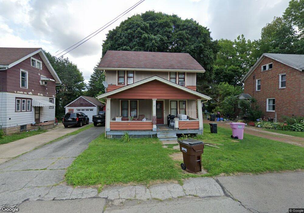
153 Bartley Ave Mansfield, OH 44903
Estimated Value: $45,000 - $102,000
3
Beds
1
Bath
1,248
Sq Ft
$68/Sq Ft
Est. Value
About This Home
This home is located at 153 Bartley Ave, Mansfield, OH 44903 and is currently estimated at $84,476, approximately $67 per square foot. 153 Bartley Ave is a home located in Richland County with nearby schools including Goal Digital Academy, St. Peter's Elementary/Montessori School, and Discovery School.
Ownership History
Date
Name
Owned For
Owner Type
Purchase Details
Closed on
Aug 30, 2021
Sold by
Lawhun Reed and Lawhun Mary E
Bought by
Lawhun Michale D and Lawhun Vicki L
Current Estimated Value
Purchase Details
Closed on
Feb 4, 2014
Sold by
Lawhun Reed and Lawhun Mary E
Bought by
Lawhun Reed and Lawhun Mary E
Purchase Details
Closed on
May 25, 2011
Sold by
Chitwood Ruth E
Bought by
Lawhun Reed and Lawhun Mary E
Purchase Details
Closed on
Mar 2, 2004
Sold by
Chitwood Ruth E
Bought by
Chitwood Ruth E and Vanriper Cheryl
Purchase Details
Closed on
Feb 11, 2004
Sold by
Chitwood Steve C and Chitwood Ruth E
Bought by
Chitwood Ruth E
Purchase Details
Closed on
Oct 24, 1994
Sold by
Cash Anne M
Bought by
Barbone Norman K and J' Nancy
Create a Home Valuation Report for This Property
The Home Valuation Report is an in-depth analysis detailing your home's value as well as a comparison with similar homes in the area
Home Values in the Area
Average Home Value in this Area
Purchase History
| Date | Buyer | Sale Price | Title Company |
|---|---|---|---|
| Lawhun Michale D | -- | None Available | |
| Lawhun Michael D | -- | Albright Al | |
| Lawhun Reed | -- | Attorney | |
| Lawhun Reed | $14,000 | Attorney | |
| Chitwood Ruth E | -- | -- | |
| Chitwood Ruth E | -- | -- | |
| Barbone Norman K | $31,000 | -- |
Source: Public Records
Tax History
| Year | Tax Paid | Tax Assessment Tax Assessment Total Assessment is a certain percentage of the fair market value that is determined by local assessors to be the total taxable value of land and additions on the property. | Land | Improvement |
|---|---|---|---|---|
| 2024 | $668 | $14,590 | $3,680 | $10,910 |
| 2023 | $683 | $14,590 | $3,680 | $10,910 |
| 2022 | $759 | $13,580 | $3,010 | $10,570 |
| 2021 | $781 | $13,580 | $3,010 | $10,570 |
| 2020 | $799 | $13,580 | $3,010 | $10,570 |
| 2019 | $886 | $13,580 | $3,010 | $10,570 |
| 2018 | $874 | $13,580 | $3,010 | $10,570 |
| 2017 | $958 | $13,580 | $3,010 | $10,570 |
| 2016 | $1,066 | $16,500 | $3,180 | $13,320 |
| 2015 | $1,066 | $16,500 | $3,180 | $13,320 |
| 2014 | $1,004 | $16,500 | $3,180 | $13,320 |
| 2012 | $810 | $17,370 | $3,350 | $14,020 |
Source: Public Records
Map
Nearby Homes
- 158 Vennum Ave
- 487 Davey Ave
- 31 Bartley Ave
- 119 Carpenter Rd
- 30 Douglas Ave
- 133 Stewart Ave S
- 282 Vennum Ave
- 455 Marion Ave
- 189 Westwood Ave
- 116 Stewart Ave S
- 108 Stewart Ave S
- 135 Wood St
- 24 Stewart Ave S
- 81 Penn Ave
- 458 W West Dickson Ave
- 131 Sturges Ave
- 679 Coleman Rd
- 616 Cline Ave
- 135 Fairlawn Ave
- 129 Fairlawn Ave
- 159 Bartley Ave
- 147 Bartley Ave
- 171 Bartley Ave
- 156 Bartley Ave
- 173 Bartley Ave
- 145 Bartley Ave
- 168 Bartley Ave
- 144 Bartley Ave
- 148 Bartley Ave
- 158 Poplar St
- 162 Poplar St
- 152 Poplar St
- 175 Bartley Ave
- 172 Bartley Ave
- 139 Bartley Ave
- 148 Poplar St
- 168 Poplar St
- 138 Bartley Ave
- 137 Bartley Ave
- 142 Poplar St
Your Personal Tour Guide
Ask me questions while you tour the home.