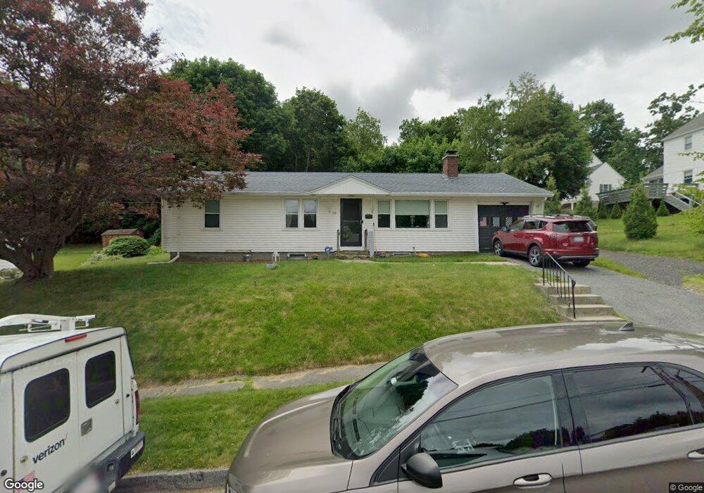
153 Bay State Rd Worcester, MA 01606
Burncoat NeighborhoodEstimated Value: $346,000 - $418,000
3
Beds
1
Bath
1,050
Sq Ft
$370/Sq Ft
Est. Value
About This Home
This home is located at 153 Bay State Rd, Worcester, MA 01606 and is currently estimated at $388,122, approximately $369 per square foot. 153 Bay State Rd is a home located in Worcester County with nearby schools including Jacob Hiatt Magnet School, Chandler Magnet, and Thorndyke Road School.
Ownership History
Date
Name
Owned For
Owner Type
Purchase Details
Closed on
Oct 10, 2002
Sold by
Est Allen John S Jr and Allen Rosalie
Bought by
Royal Shawn D and Royal Tiffany L
Current Estimated Value
Home Financials for this Owner
Home Financials are based on the most recent Mortgage that was taken out on this home.
Original Mortgage
$108,000
Outstanding Balance
$45,543
Interest Rate
6.24%
Mortgage Type
Purchase Money Mortgage
Estimated Equity
$342,579
Create a Home Valuation Report for This Property
The Home Valuation Report is an in-depth analysis detailing your home's value as well as a comparison with similar homes in the area
Home Values in the Area
Average Home Value in this Area
Purchase History
| Date | Buyer | Sale Price | Title Company |
|---|---|---|---|
| Royal Shawn D | $135,000 | -- |
Source: Public Records
Mortgage History
| Date | Status | Borrower | Loan Amount |
|---|---|---|---|
| Open | Royal Shawn D | $31,000 | |
| Open | Royal Shawn D | $108,000 |
Source: Public Records
Tax History Compared to Growth
Tax History
| Year | Tax Paid | Tax Assessment Tax Assessment Total Assessment is a certain percentage of the fair market value that is determined by local assessors to be the total taxable value of land and additions on the property. | Land | Improvement |
|---|---|---|---|---|
| 2025 | $4,511 | $342,000 | $118,600 | $223,400 |
| 2024 | $4,428 | $322,000 | $118,600 | $203,400 |
| 2023 | $4,269 | $297,700 | $103,100 | $194,600 |
| 2022 | $3,777 | $248,300 | $82,500 | $165,800 |
| 2021 | $3,614 | $222,000 | $66,000 | $156,000 |
| 2020 | $3,466 | $203,900 | $66,000 | $137,900 |
| 2019 | $3,260 | $181,100 | $59,400 | $121,700 |
| 2018 | $3,173 | $167,800 | $59,400 | $108,400 |
| 2017 | $3,212 | $167,100 | $59,400 | $107,700 |
| 2016 | $3,102 | $150,500 | $43,600 | $106,900 |
| 2015 | $3,021 | $150,500 | $43,600 | $106,900 |
| 2014 | $2,941 | $150,500 | $43,600 | $106,900 |
Source: Public Records
Map
Nearby Homes
- 29 Tylee Ave
- 8 Cherry Blossom Cir Unit 50
- 23 Viele Ave
- 276 Saint Nicholas Ave
- 80 Clark St
- 314 Burncoat St
- 3 Granville Ave
- 48 Wilkinson St
- 131 Airlie St
- 14 Housatonic St
- 15 Ericsson St
- 37 Kenwood Ave
- 21 Trinity Ave
- 3 Huron Ave
- 36 Melrose St
- 40 Francis St
- 43 Fales St
- 57 Pasadena Pkwy
- 13 Fatima Ln
- 37 Uncatena Ave
- 0 Hillsboro Rd Unit 64 72308891
- 0 Hillsboro Rd Unit 65 72257259
- 0 Hillsboro Rd Unit 37 72234446
- 0 Hillsboro Rd Unit 47 72203233
- 0 Hillsboro Rd Unit 11 72116242
- 0 Hillsboro Rd Unit 16 72154280
- 0 Hillsboro Rd Unit 19 72154131
- 0 Hillsboro Rd Unit 24 72096072
- 0 Hillsboro Rd Unit 23
- 0 Hillsboro Rd Unit 2
- 0 Hillsboro Rd Unit 17
- 0 Hillsboro Rd Unit 24
- 0 Hillsboro Rd Unit 31
- 0 Hillsboro Rd Unit 32
- 0 Hillsboro Rd
- 252 Beverly Rd
- 6 Hillsboro Rd
- 1 Hillsboro Rd Unit 1
- 1 Hillsboro Rd
- 148 Bay State Rd
