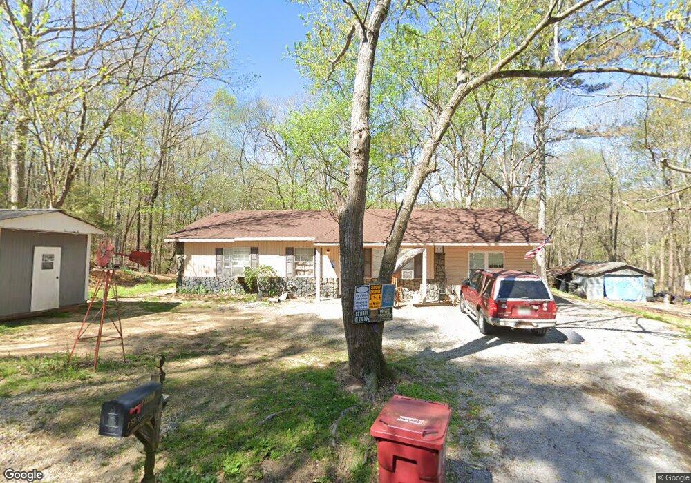
153 Brent St Hamilton, AL 35570
Estimated Value: $80,000 - $169,000
Studio
--
Bath
1,120
Sq Ft
$105/Sq Ft
Est. Value
About This Home
This home is located at 153 Brent St, Hamilton, AL 35570 and is currently estimated at $118,116, approximately $105 per square foot. 153 Brent St is a home located in Marion County.
Ownership History
Date
Name
Owned For
Owner Type
Purchase Details
Closed on
Sep 21, 2012
Sold by
Emerson Andrew and Armstrong Ashlie
Bought by
B And P Rental Properties Llc
Current Estimated Value
Home Financials for this Owner
Home Financials are based on the most recent Mortgage that was taken out on this home.
Original Mortgage
$36,851
Outstanding Balance
$25,667
Interest Rate
3.71%
Estimated Equity
$92,449
Purchase Details
Closed on
Feb 6, 2009
Sold by
Triplett Wilfred Jerome and Triplett Andrea D
Bought by
Emerson Andrew and Armstrong Ashlie
Home Financials for this Owner
Home Financials are based on the most recent Mortgage that was taken out on this home.
Original Mortgage
$32,958
Interest Rate
5.07%
Create a Home Valuation Report for This Property
The Home Valuation Report is an in-depth analysis detailing your home's value as well as a comparison with similar homes in the area
Home Values in the Area
Average Home Value in this Area
Purchase History
| Date | Buyer | Sale Price | Title Company |
|---|---|---|---|
| B And P Rental Properties Llc | $35,000 | -- | |
| Emerson Andrew | -- | -- |
Source: Public Records
Mortgage History
| Date | Status | Borrower | Loan Amount |
|---|---|---|---|
| Open | B And P Rental Properties Llc | $36,851 | |
| Previous Owner | Emerson Andrew | $32,958 |
Source: Public Records
Tax History
| Year | Tax Paid | Tax Assessment Tax Assessment Total Assessment is a certain percentage of the fair market value that is determined by local assessors to be the total taxable value of land and additions on the property. | Land | Improvement |
|---|---|---|---|---|
| 2024 | $589 | $16,380 | $1,480 | $14,900 |
| 2023 | $524 | $16,380 | $1,480 | $14,900 |
| 2022 | $444 | $13,880 | $1,480 | $12,400 |
| 2021 | $444 | $13,880 | $1,480 | $12,400 |
| 2020 | $349 | $10,900 | $1,440 | $9,460 |
| 2019 | $349 | $10,900 | $1,440 | $9,460 |
| 2018 | $329 | $10,280 | $1,440 | $8,840 |
| 2017 | $329 | $10,280 | $1,440 | $8,840 |
| 2016 | $317 | $10,940 | $1,840 | $9,100 |
| 2015 | $317 | $10,940 | $1,840 | $9,100 |
| 2014 | $317 | $10,940 | $1,840 | $9,100 |
| 2013 | $317 | $10,940 | $1,840 | $9,100 |
Source: Public Records
Map
Nearby Homes
- 275 Chippewa Dr
- 2319 Bexar Ave W
- 3511 Bexar Ave W
- 40 County Highway 25
- 214 Scarlet Dr
- 00 Regency Place
- 127 Walnut St
- 714 Robin St
- 32 Acres Hwy 43
- 145 Dutch Ave
- 703 Rock Cliff Rd
- 585 Ranch Rd
- 0 County Road 163
- 793 Bexar Ave W
- 241 Bama Rd
- 204 Slate Dr
- 183 Southvale Ave
- 2.3 Acres County Highway 29
- 114 Spring St
- 0 County Road 75
Your Personal Tour Guide
Ask me questions while you tour the home.