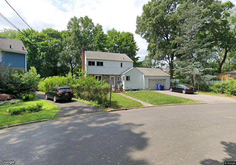
153 Durie Ct Englewood, NJ 07631
Estimated Value: $620,394 - $674,000
--
Bed
--
Bath
1,660
Sq Ft
$391/Sq Ft
Est. Value
About This Home
This home is located at 153 Durie Ct, Englewood, NJ 07631 and is currently estimated at $648,349, approximately $390 per square foot. 153 Durie Ct is a home located in Bergen County with nearby schools including Dr Mccloud Elementary School, Dr J Grieco Elementary School, and J.E. Dismus Middle School.
Ownership History
Date
Name
Owned For
Owner Type
Purchase Details
Closed on
Jun 27, 2012
Sold by
Barrett Bridgett
Bought by
Smith Ample D
Current Estimated Value
Home Financials for this Owner
Home Financials are based on the most recent Mortgage that was taken out on this home.
Original Mortgage
$323,040
Outstanding Balance
$223,938
Interest Rate
3.76%
Mortgage Type
FHA
Estimated Equity
$424,411
Create a Home Valuation Report for This Property
The Home Valuation Report is an in-depth analysis detailing your home's value as well as a comparison with similar homes in the area
Home Values in the Area
Average Home Value in this Area
Purchase History
| Date | Buyer | Sale Price | Title Company |
|---|---|---|---|
| Smith Ample D | $329,000 | -- |
Source: Public Records
Mortgage History
| Date | Status | Borrower | Loan Amount |
|---|---|---|---|
| Open | Smith Ample D | $323,040 |
Source: Public Records
Tax History Compared to Growth
Tax History
| Year | Tax Paid | Tax Assessment Tax Assessment Total Assessment is a certain percentage of the fair market value that is determined by local assessors to be the total taxable value of land and additions on the property. | Land | Improvement |
|---|---|---|---|---|
| 2025 | $9,188 | $299,000 | $179,800 | $119,200 |
| 2024 | $8,910 | $299,000 | $179,800 | $119,200 |
| 2023 | $8,818 | $299,000 | $179,800 | $119,200 |
| 2022 | $8,818 | $299,000 | $179,800 | $119,200 |
| 2021 | $8,641 | $299,000 | $179,800 | $119,200 |
| 2020 | $8,417 | $299,000 | $179,800 | $119,200 |
| 2019 | $8,339 | $299,000 | $179,800 | $119,200 |
| 2018 | $8,139 | $299,000 | $179,800 | $119,200 |
| 2017 | $7,815 | $295,900 | $179,800 | $116,100 |
| 2016 | $7,566 | $295,900 | $179,800 | $116,100 |
| 2015 | $7,501 | $295,900 | $179,800 | $116,100 |
| 2014 | $7,439 | $295,900 | $179,800 | $116,100 |
Source: Public Records
Map
Nearby Homes
- 325 Central Ave
- 224 W Hudson Ave
- 82 S Roosevelt Square
- 232 W Hudson Ave
- 421 Tenafly Rd
- 191 Knickerbocker Rd Unit 17
- 419 Conrad Rd
- 109 Slocum Ave
- 206 Central Ave
- 190 Central Ave
- 142 Slocum Ave
- 180 Central Ave
- 461 Tenafly Rd Unit A8
- 79 Slocum Ave
- 170 Knickerbocker Rd
- 51 W Hudson Ave Unit 16
- 471 Tenafly Rd Unit 9
- 254 Pindle Ave
- 15 W Hamilton Ave
- 43 Oak Ave
- 157 Durie Ct
- 149 Durie Ct
- 166 Saint Nicholas Ave
- 165 Durie Ct
- 170 Saint Nicholas Ave
- 162 Saint Nicholas Ave
- 160 Durie Ct
- 158 Saint Nicholas Ave
- 178 Saint Nicholas Ave
- 153 Tryon Ave
- 154 Saint Nicholas Ave
- 169 Durie Ct
- 141 Tryon Ave
- 157 Tryon Ave
- 182 Saint Nicholas Ave
- 150 Saint Nicholas Ave
- 133 Tryon Ave
- 161 Tryon Ave
- 186 Saint Nicholas Ave
- 146 Saint Nicholas Ave