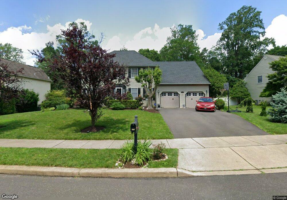
153 Hart Ave Doylestown, PA 18901
Estimated Value: $879,000 - $1,056,971
4
Beds
3
Baths
2,770
Sq Ft
$338/Sq Ft
Est. Value
About This Home
This home is located at 153 Hart Ave, Doylestown, PA 18901 and is currently estimated at $936,993, approximately $338 per square foot. 153 Hart Ave is a home located in Bucks County with nearby schools including Linden El School, Lenape Middle School, and Central Bucks High School-West.
Ownership History
Date
Name
Owned For
Owner Type
Purchase Details
Closed on
Nov 23, 2010
Sold by
Patterson John T and Patterson Dana H
Bought by
Patterson John T
Current Estimated Value
Home Financials for this Owner
Home Financials are based on the most recent Mortgage that was taken out on this home.
Original Mortgage
$376,000
Outstanding Balance
$247,700
Interest Rate
4.24%
Mortgage Type
New Conventional
Estimated Equity
$689,293
Purchase Details
Closed on
Oct 31, 1996
Sold by
Ernst Richard and Ernst Carol A
Bought by
Ernst Richard and Ernst Carol A
Create a Home Valuation Report for This Property
The Home Valuation Report is an in-depth analysis detailing your home's value as well as a comparison with similar homes in the area
Home Values in the Area
Average Home Value in this Area
Purchase History
| Date | Buyer | Sale Price | Title Company |
|---|---|---|---|
| Patterson John T | -- | None Available | |
| Ernst Richard | -- | -- |
Source: Public Records
Mortgage History
| Date | Status | Borrower | Loan Amount |
|---|---|---|---|
| Open | Patterson John T | $376,000 |
Source: Public Records
Tax History Compared to Growth
Tax History
| Year | Tax Paid | Tax Assessment Tax Assessment Total Assessment is a certain percentage of the fair market value that is determined by local assessors to be the total taxable value of land and additions on the property. | Land | Improvement |
|---|---|---|---|---|
| 2025 | $9,641 | $54,480 | $8,640 | $45,840 |
| 2024 | $9,641 | $54,480 | $8,640 | $45,840 |
| 2023 | $9,193 | $54,480 | $8,640 | $45,840 |
| 2022 | $9,091 | $54,480 | $8,640 | $45,840 |
| 2021 | $8,903 | $54,480 | $8,640 | $45,840 |
| 2020 | $8,863 | $54,480 | $8,640 | $45,840 |
| 2019 | $8,767 | $54,480 | $8,640 | $45,840 |
| 2018 | $8,740 | $54,480 | $8,640 | $45,840 |
| 2017 | $8,672 | $54,480 | $8,640 | $45,840 |
| 2016 | $8,617 | $54,480 | $8,640 | $45,840 |
| 2015 | -- | $54,480 | $8,640 | $45,840 |
| 2014 | -- | $54,480 | $8,640 | $45,840 |
Source: Public Records
Map
Nearby Homes
- 195 Lafayette St
- 3 Steeplechase Dr
- 272 Fox Chase Ln
- 403 S Main St Unit S201
- 9 Mill Creek Dr
- 89 Homestead Dr
- 236 Green St
- 37 N Clinton St
- 78 Tower Hill Rd
- 130 N Clinton St
- 110 E Ashland St
- 114 Progress Dr
- 69 E Oakland Ave
- 32 Hibiscus Ct Unit 32
- 20 E Court St
- 1 Barnes Ct
- 155 E Oakland Ave
- 2320 Turk Rd
- 146 E Court St
- 146 N Church St