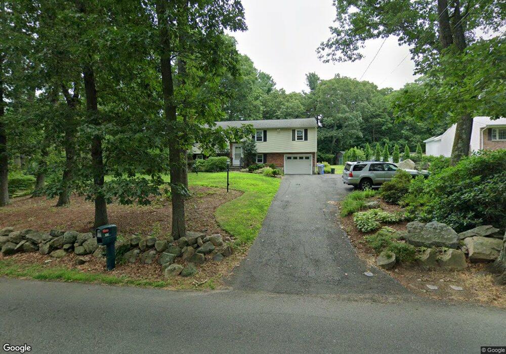
153 High St Holliston, MA 01746
Estimated Value: $621,000 - $681,000
3
Beds
3
Baths
1,193
Sq Ft
$547/Sq Ft
Est. Value
About This Home
This home is located at 153 High St, Holliston, MA 01746 and is currently estimated at $652,431, approximately $546 per square foot. 153 High St is a home located in Middlesex County with nearby schools including Miller Elementary School, Robert H. Adams Middle School, and Holliston High School.
Ownership History
Date
Name
Owned For
Owner Type
Purchase Details
Closed on
Jun 26, 2000
Sold by
Krasnoff Steven S and Krasnoff Lisa A
Bought by
Jensen Jeffrey S and Jensen Leah A
Current Estimated Value
Purchase Details
Closed on
Sep 28, 1992
Sold by
Nelson Mildred B
Bought by
Krasnoff Steven S and Krasnoff Lisa A
Create a Home Valuation Report for This Property
The Home Valuation Report is an in-depth analysis detailing your home's value as well as a comparison with similar homes in the area
Home Values in the Area
Average Home Value in this Area
Purchase History
| Date | Buyer | Sale Price | Title Company |
|---|---|---|---|
| Jensen Jeffrey S | $257,400 | -- | |
| Krasnoff Steven S | $168,000 | -- |
Source: Public Records
Mortgage History
| Date | Status | Borrower | Loan Amount |
|---|---|---|---|
| Open | Krasnoff Steven S | $176,500 | |
| Closed | Krasnoff Steven S | $231,000 |
Source: Public Records
Tax History Compared to Growth
Tax History
| Year | Tax Paid | Tax Assessment Tax Assessment Total Assessment is a certain percentage of the fair market value that is determined by local assessors to be the total taxable value of land and additions on the property. | Land | Improvement |
|---|---|---|---|---|
| 2025 | $9,033 | $616,600 | $261,400 | $355,200 |
| 2024 | $8,518 | $565,600 | $261,400 | $304,200 |
| 2023 | $7,318 | $475,200 | $218,000 | $257,200 |
| 2022 | $6,921 | $398,200 | $218,000 | $180,200 |
| 2021 | $6,965 | $390,200 | $210,000 | $180,200 |
| 2020 | $7,384 | $391,700 | $210,100 | $181,600 |
| 2019 | $6,826 | $362,500 | $182,800 | $179,700 |
| 2018 | $6,768 | $362,500 | $182,800 | $179,700 |
| 2017 | $6,532 | $352,700 | $175,600 | $177,100 |
| 2016 | $6,627 | $352,700 | $175,600 | $177,100 |
| 2015 | $6,153 | $317,500 | $137,700 | $179,800 |
Source: Public Records
Map
Nearby Homes
- 195 High St
- 56 Roy Ave
- 131 Jennings Rd
- 54 Westfield Dr
- 11 Francine Dr
- 32 Colonial Way
- 133 Brooksmont Dr Unit 43
- 95 Brooksmont Dr Unit 26
- 160 Winter St
- 150 Westfield Dr
- 151 Mohawk Path
- 59 Turner Rd
- 43 Bittersweet Cir Unit 43
- 107 Richard Rd
- 6 Brook St
- 147 Turner Rd Unit 80
- 152 Turner Rd Unit 43
- 152 Turner Rd Unit 14
- 1366 Washington St
- 306 Trailside Way