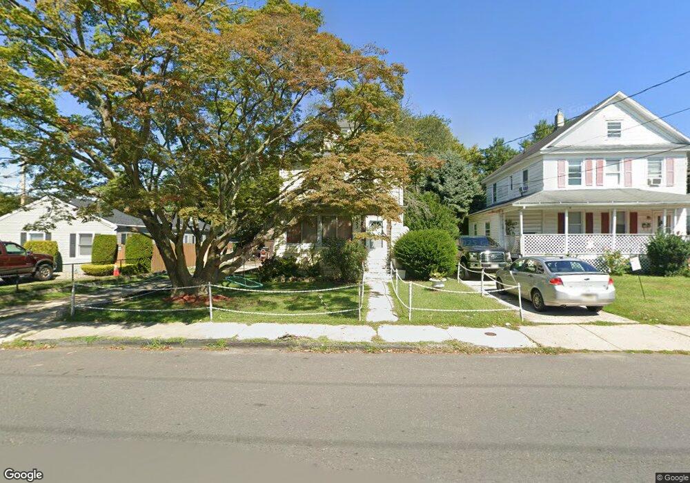
153 Liberty St Long Branch, NJ 07740
Estimated Value: $521,546 - $593,000
4
Beds
2
Baths
1,512
Sq Ft
$361/Sq Ft
Est. Value
About This Home
This home is located at 153 Liberty St, Long Branch, NJ 07740 and is currently estimated at $545,637, approximately $360 per square foot. 153 Liberty St is a home located in Monmouth County with nearby schools including Long Branch High School and Holy Trinity School.
Ownership History
Date
Name
Owned For
Owner Type
Purchase Details
Closed on
Nov 18, 2003
Sold by
Fellenz Diane
Bought by
Bowles Dorothy
Current Estimated Value
Purchase Details
Closed on
Jun 9, 2000
Sold by
Difalco Joseph
Bought by
Fellenz Diane
Home Financials for this Owner
Home Financials are based on the most recent Mortgage that was taken out on this home.
Original Mortgage
$104,100
Interest Rate
8.24%
Purchase Details
Closed on
Jan 25, 1999
Sold by
Us Bank Na
Bought by
Difalco Joseph
Create a Home Valuation Report for This Property
The Home Valuation Report is an in-depth analysis detailing your home's value as well as a comparison with similar homes in the area
Home Values in the Area
Average Home Value in this Area
Purchase History
| Date | Buyer | Sale Price | Title Company |
|---|---|---|---|
| Bowles Dorothy | $190,000 | -- | |
| Fellenz Diane | $109,600 | -- | |
| Difalco Joseph | $43,000 | -- |
Source: Public Records
Mortgage History
| Date | Status | Borrower | Loan Amount |
|---|---|---|---|
| Previous Owner | Fellenz Diane | $104,100 |
Source: Public Records
Tax History Compared to Growth
Tax History
| Year | Tax Paid | Tax Assessment Tax Assessment Total Assessment is a certain percentage of the fair market value that is determined by local assessors to be the total taxable value of land and additions on the property. | Land | Improvement |
|---|---|---|---|---|
| 2025 | $5,722 | $442,600 | $220,400 | $222,200 |
| 2024 | $5,322 | $372,300 | $159,800 | $212,500 |
| 2023 | $5,322 | $342,700 | $139,800 | $202,900 |
| 2022 | $3,905 | $268,500 | $89,800 | $178,700 |
| 2021 | $3,905 | $210,400 | $43,300 | $167,100 |
| 2020 | $4,253 | $203,500 | $37,300 | $166,200 |
| 2019 | $4,135 | $196,700 | $38,300 | $158,400 |
| 2018 | $3,951 | $186,900 | $34,300 | $152,600 |
| 2017 | $3,751 | $182,000 | $32,300 | $149,700 |
| 2016 | $3,622 | $179,200 | $33,300 | $145,900 |
| 2015 | $4,381 | $196,700 | $50,400 | $146,300 |
| 2014 | $4,144 | $196,100 | $66,300 | $129,800 |
Source: Public Records
Map
Nearby Homes
- 40 University Dr
- 40 Seaview Ave Unit A
- 231 Long Branch Ave
- 151 N 5th Ave
- 211 Rockwell Ave
- 184 N 5th Ave
- 138 Rosewood Ave
- 188 Chelton Ave
- 172 Chelton Ave
- 78 Ocean Terrace
- 33 Cooper Ave Unit 213
- 33 Cooper Ave Unit 410
- 22 Cooper Ave Unit 113
- 22 Cooper Ave Unit 309
- 22 Cooper Ave Unit 110
- 148 Sixth Ave
- 200 Ocean Ave N Unit 13
- 200 Ocean Ave N Unit 19
- 40 N 5th Ave
- 323 Florence Ave