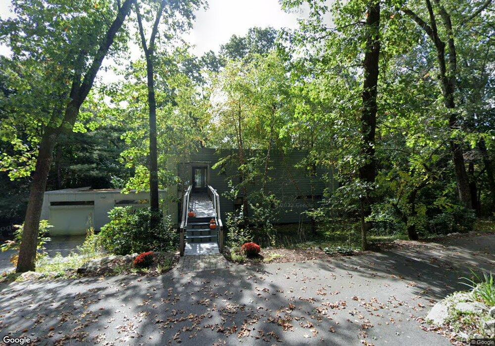
153 Lincoln Rd Sudbury, MA 01776
Estimated Value: $1,026,000 - $1,298,000
3
Beds
4
Baths
2,713
Sq Ft
$433/Sq Ft
Est. Value
About This Home
This home is located at 153 Lincoln Rd, Sudbury, MA 01776 and is currently estimated at $1,175,796, approximately $433 per square foot. 153 Lincoln Rd is a home located in Middlesex County with nearby schools including General John Nixon Elementary School, Ephraim Curtis Middle School, and Lincoln-Sudbury Regional High School.
Ownership History
Date
Name
Owned For
Owner Type
Purchase Details
Closed on
Nov 28, 2018
Sold by
Morris Ann M and Morris Richard A
Bought by
Ann M Morris T
Current Estimated Value
Purchase Details
Closed on
Jun 25, 2008
Sold by
Karn Gail Whitney
Bought by
Karn Gail W and Karn Robert M
Purchase Details
Closed on
Apr 20, 2005
Sold by
Karn Gail W and Karn Robert M
Bought by
Karn Gail W
Purchase Details
Closed on
Jan 16, 2002
Sold by
Cooper Ruth C
Bought by
Karn Robert M and Karn Gail W
Home Financials for this Owner
Home Financials are based on the most recent Mortgage that was taken out on this home.
Original Mortgage
$248,000
Interest Rate
6.84%
Mortgage Type
Purchase Money Mortgage
Create a Home Valuation Report for This Property
The Home Valuation Report is an in-depth analysis detailing your home's value as well as a comparison with similar homes in the area
Home Values in the Area
Average Home Value in this Area
Purchase History
| Date | Buyer | Sale Price | Title Company |
|---|---|---|---|
| Ann M Morris T | -- | -- | |
| Karn Gail W | -- | -- | |
| Karn Gail W | -- | -- | |
| Karn Robert M | $310,000 | -- |
Source: Public Records
Mortgage History
| Date | Status | Borrower | Loan Amount |
|---|---|---|---|
| Previous Owner | Karn Robert M | $248,000 |
Source: Public Records
Tax History Compared to Growth
Tax History
| Year | Tax Paid | Tax Assessment Tax Assessment Total Assessment is a certain percentage of the fair market value that is determined by local assessors to be the total taxable value of land and additions on the property. | Land | Improvement |
|---|---|---|---|---|
| 2025 | $14,463 | $987,900 | $373,600 | $614,300 |
| 2024 | $14,026 | $960,000 | $362,700 | $597,300 |
| 2023 | $13,053 | $827,700 | $335,800 | $491,900 |
| 2022 | $12,456 | $690,100 | $308,300 | $381,800 |
| 2021 | $11,968 | $635,600 | $308,300 | $327,300 |
| 2020 | $11,727 | $635,600 | $308,300 | $327,300 |
| 2019 | $11,899 | $664,400 | $308,300 | $356,100 |
| 2018 | $11,638 | $649,100 | $328,700 | $320,400 |
| 2017 | $10,550 | $594,700 | $312,700 | $282,000 |
| 2016 | $10,215 | $573,900 | $300,800 | $273,100 |
| 2015 | $10,317 | $586,200 | $306,200 | $280,000 |
| 2014 | -- | $571,000 | $297,200 | $273,800 |
Source: Public Records
Map
Nearby Homes
- Lot 5 Sailaway Ln
- 45 N Crescent Cir
- Lot 4 Sailaway Ln
- 2 Betts Way
- 8 Mina Way
- 0 Elm Unit 73282184
- Lot 9 Sailaway Ln
- 4 Betts Way
- 122 Sand Gully Rd N Unit B
- 941 Concord Rd
- 15 Lewis Path
- 14 Frost Ln
- 49 Birchwood Ln Unit 49
- 134 Chestnut Cir
- 50 Windingwood Ln
- 427 Concord Rd
- 401 Emery Ln Unit 304
- 17 Glezen Ln
- 56 Rookery Ln Unit 4
- 24 Rookery Ln Unit 6