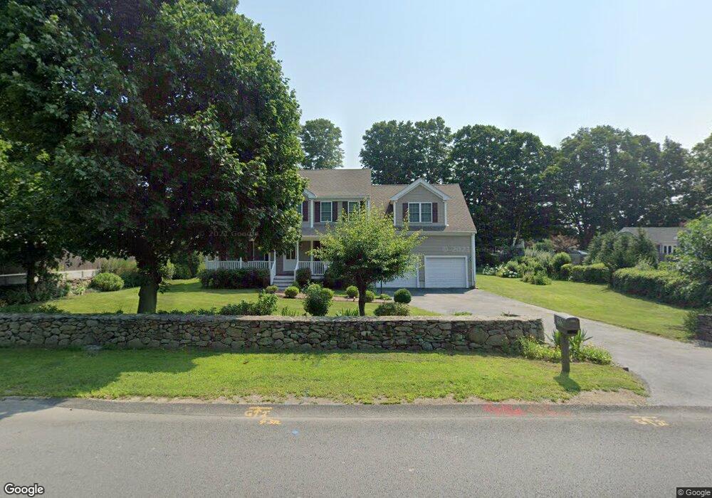
153 Maple Ave Swansea, MA 02777
Luther Corner NeighborhoodEstimated Value: $616,000 - $785,000
3
Beds
3
Baths
2,376
Sq Ft
$300/Sq Ft
Est. Value
About This Home
This home is located at 153 Maple Ave, Swansea, MA 02777 and is currently estimated at $711,740, approximately $299 per square foot. 153 Maple Ave is a home located in Bristol County with nearby schools including Joseph Case High School and Swansea Wood School.
Ownership History
Date
Name
Owned For
Owner Type
Purchase Details
Closed on
Oct 14, 2020
Sold by
L & M Soares Irt
Bought by
Soares Maria J and Soares Lamy L
Current Estimated Value
Purchase Details
Closed on
Sep 1, 2009
Sold by
Kam Corp
Bought by
Soares Lamy L and Soares Maria J
Home Financials for this Owner
Home Financials are based on the most recent Mortgage that was taken out on this home.
Original Mortgage
$100,000
Interest Rate
5.17%
Mortgage Type
Purchase Money Mortgage
Create a Home Valuation Report for This Property
The Home Valuation Report is an in-depth analysis detailing your home's value as well as a comparison with similar homes in the area
Home Values in the Area
Average Home Value in this Area
Purchase History
| Date | Buyer | Sale Price | Title Company |
|---|---|---|---|
| Soares Maria J | -- | None Available | |
| Soares Lamy L | $363,000 | -- |
Source: Public Records
Mortgage History
| Date | Status | Borrower | Loan Amount |
|---|---|---|---|
| Previous Owner | Soares Lamy L | $100,000 |
Source: Public Records
Tax History Compared to Growth
Tax History
| Year | Tax Paid | Tax Assessment Tax Assessment Total Assessment is a certain percentage of the fair market value that is determined by local assessors to be the total taxable value of land and additions on the property. | Land | Improvement |
|---|---|---|---|---|
| 2025 | $6,306 | $529,000 | $153,000 | $376,000 |
| 2024 | $6,415 | $535,000 | $153,000 | $382,000 |
| 2023 | $5,972 | $454,800 | $112,300 | $342,500 |
| 2022 | $5,516 | $383,300 | $102,100 | $281,200 |
| 2021 | $5,445 | $348,400 | $102,100 | $246,300 |
| 2020 | $5,512 | $353,800 | $102,100 | $251,700 |
| 2019 | $5,543 | $357,400 | $90,800 | $266,600 |
| 2018 | $5,386 | $352,500 | $88,900 | $263,600 |
| 2017 | $4,641 | $349,500 | $88,900 | $260,600 |
| 2016 | $4,540 | $335,800 | $76,900 | $258,900 |
| 2015 | $4,402 | $335,300 | $76,900 | $258,400 |
| 2014 | $4,052 | $315,600 | $76,900 | $238,700 |
Source: Public Records
Map
Nearby Homes
- 131 Maple Ave
- 20 Pearse Rd
- 1261 Gar Hwy
- 308 Old Warren Rd
- 526 Old Warren Rd
- 35 Lazywood Ln
- 30 Alsada Rd
- 105 Birchwood Dr
- 50 Obannon Place
- 0 Proprietors Way Unit 73324662
- 25 Inverness Rd
- 141 Milford Rd
- 55 Smoke Rise Cir
- 18 Stafford St
- 67 Jette St
- 41 James Ave
- 0 Hortonville Rd Unit 73242268
- 264 Hortonville Rd
- 420 Hortonville Rd
- 40 Clancy St
- 167 Maple Ave
- 164 Maple Ave
- 140 Maple Ave
- 104 Highland Rd
- 94 Highland Rd
- 164 Highland Rd
- 84 Highland Rd
- 128 Maple Ave
- 128 Maple Ave Unit 2
- 1044 Grand Army of the Republic Hwy
- 0 Fall River Ave (Ns) Unit 71061106
- 123 Maple Ave
- 21 Phillips Ln
- 19 Easterbrooks St
- 116 Maple Ave
- 91 Highland Rd
- 135 Maple Ave
- 2 Sheri Lynn Dr
- 39 Sheri Lynn Dr
- 105 Maple Ave