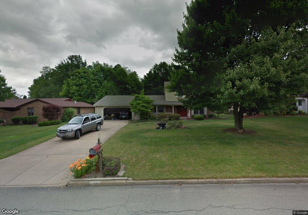
153 Maple Leaf Dr Hubbard, OH 44425
Estimated Value: $258,292 - $413,000
3
Beds
3
Baths
1,776
Sq Ft
$189/Sq Ft
Est. Value
About This Home
This home is located at 153 Maple Leaf Dr, Hubbard, OH 44425 and is currently estimated at $335,323, approximately $188 per square foot. 153 Maple Leaf Dr is a home located in Trumbull County with nearby schools including Hubbard Elementary School, Hubbard Middle School, and Hubbard High School.
Ownership History
Date
Name
Owned For
Owner Type
Purchase Details
Closed on
Oct 7, 2010
Sold by
Marando Curtis K and Marando Theresa L
Bought by
Reel David T and Reel Elizabeth A
Current Estimated Value
Home Financials for this Owner
Home Financials are based on the most recent Mortgage that was taken out on this home.
Original Mortgage
$158,860
Outstanding Balance
$110,786
Interest Rate
5.5%
Mortgage Type
FHA
Estimated Equity
$224,537
Purchase Details
Closed on
Mar 21, 2003
Sold by
Koebel Charles D and Koebel Carolyn J
Bought by
Marando Curtis K and Marando Theresa L
Home Financials for this Owner
Home Financials are based on the most recent Mortgage that was taken out on this home.
Original Mortgage
$120,700
Interest Rate
5.96%
Mortgage Type
New Conventional
Purchase Details
Closed on
Jan 1, 1990
Bought by
Charles Charles D and Charles E
Create a Home Valuation Report for This Property
The Home Valuation Report is an in-depth analysis detailing your home's value as well as a comparison with similar homes in the area
Home Values in the Area
Average Home Value in this Area
Purchase History
| Date | Buyer | Sale Price | Title Company |
|---|---|---|---|
| Reel David T | $161,000 | Attorney | |
| Marando Curtis K | $142,000 | -- | |
| Charles Charles D | -- | -- |
Source: Public Records
Mortgage History
| Date | Status | Borrower | Loan Amount |
|---|---|---|---|
| Open | Reel David T | $158,860 | |
| Closed | Marando Curtis K | $120,700 |
Source: Public Records
Tax History
| Year | Tax Paid | Tax Assessment Tax Assessment Total Assessment is a certain percentage of the fair market value that is determined by local assessors to be the total taxable value of land and additions on the property. | Land | Improvement |
|---|---|---|---|---|
| 2024 | $3,430 | $68,990 | $9,210 | $59,780 |
| 2023 | $3,369 | $68,990 | $9,210 | $59,780 |
| 2022 | $2,617 | $48,870 | $8,300 | $40,570 |
| 2021 | $2,629 | $48,870 | $8,300 | $40,570 |
| 2020 | $2,590 | $47,920 | $8,300 | $39,620 |
| 2019 | $2,577 | $45,680 | $8,300 | $37,380 |
| 2018 | $2,567 | $45,680 | $8,300 | $37,380 |
| 2017 | $2,560 | $45,680 | $8,300 | $37,380 |
| 2016 | $2,418 | $45,890 | $8,230 | $37,660 |
| 2015 | $2,428 | $45,890 | $8,230 | $37,660 |
| 2014 | $2,372 | $45,890 | $8,230 | $37,660 |
| 2013 | $2,368 | $45,890 | $8,230 | $37,660 |
Source: Public Records
Map
Nearby Homes
- 62 Jacobs Rd
- 229 Jacobs Rd
- 327 W Park Ave
- 330 Myron St Unit 3
- 228 Stewart St
- 365 Scott St
- 203 Hager St
- 6095 Bell Ave
- 132 Drummond Ave
- 601 Wendemere Dr
- 585 Creekside Dr
- 3578 Homewood Ave
- 396 Elizabeth St
- 2675 Seifert-Lewis Rd
- 784 Elmwood Dr
- V/L Jacobs Rd
- 868 Saul Dr
- 2915 Megan Cir
- 2064 Burning Tree Ln
- 0 Powder Mill Run Unit 5127327
- 161 Maple Leaf Dr
- 143 Maple Leaf Dr
- 167 Maple Leaf Dr
- 150 Maple Leaf Dr
- 160 Maple Leaf Dr
- 142 Maple Leaf Dr
- 177 Maple Leaf Dr
- 170 Maple Leaf Dr
- 947 Dogwood Dr
- 935 Dogwood Dr
- 971 Dogwood Dr
- 923 Dogwood Dr
- 180 Maple Leaf Dr
- 185 Maple Leaf Dr
- 983 Dogwood Dr
- 141 Buckeye Dr
- 190 Maple Leaf Dr
- 987 Dogwood Dr
- 964 Palmetto Dr
- 950 Palmetto Dr
Your Personal Tour Guide
Ask me questions while you tour the home.