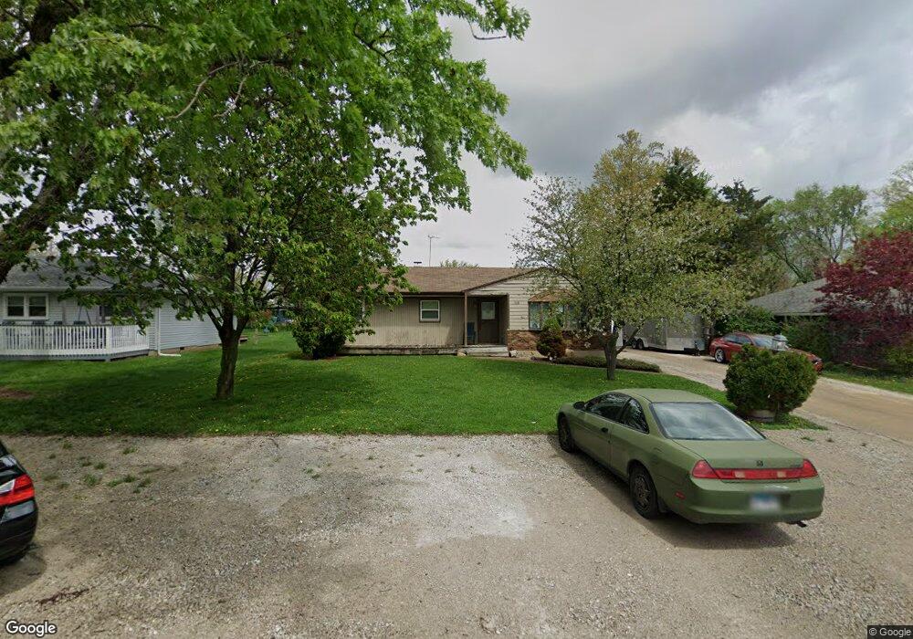
153 Michael Ln New Lenox, IL 60451
Estimated Value: $245,708 - $307,000
--
Bed
--
Bath
--
Sq Ft
10,019
Sq Ft Lot
About This Home
This home is located at 153 Michael Ln, New Lenox, IL 60451 and is currently estimated at $286,927. 153 Michael Ln is a home located in Will County with nearby schools including Oster-Oakview School, Haines Elementary School, and Lincoln Way West.
Ownership History
Date
Name
Owned For
Owner Type
Purchase Details
Closed on
Jul 28, 2000
Sold by
Koehler William L and Koehler Sabrina A
Bought by
Frederiksen William
Current Estimated Value
Home Financials for this Owner
Home Financials are based on the most recent Mortgage that was taken out on this home.
Original Mortgage
$119,350
Outstanding Balance
$43,428
Interest Rate
8.27%
Mortgage Type
FHA
Estimated Equity
$243,500
Create a Home Valuation Report for This Property
The Home Valuation Report is an in-depth analysis detailing your home's value as well as a comparison with similar homes in the area
Home Values in the Area
Average Home Value in this Area
Purchase History
| Date | Buyer | Sale Price | Title Company |
|---|---|---|---|
| Frederiksen William | $123,500 | -- |
Source: Public Records
Mortgage History
| Date | Status | Borrower | Loan Amount |
|---|---|---|---|
| Open | Frederiksen William | $119,350 |
Source: Public Records
Tax History Compared to Growth
Tax History
| Year | Tax Paid | Tax Assessment Tax Assessment Total Assessment is a certain percentage of the fair market value that is determined by local assessors to be the total taxable value of land and additions on the property. | Land | Improvement |
|---|---|---|---|---|
| 2024 | $5,836 | $82,584 | $20,237 | $62,347 |
| 2023 | $5,836 | $75,282 | $18,448 | $56,834 |
| 2022 | $5,284 | $69,352 | $16,995 | $52,357 |
| 2021 | $5,005 | $65,223 | $15,983 | $49,240 |
| 2020 | $4,854 | $62,896 | $15,413 | $47,483 |
| 2019 | $4,636 | $60,946 | $14,935 | $46,011 |
| 2018 | $4,520 | $58,845 | $14,420 | $44,425 |
| 2017 | $4,284 | $57,153 | $14,005 | $43,148 |
| 2016 | $4,152 | $55,623 | $13,630 | $41,993 |
| 2015 | $4,011 | $53,872 | $13,201 | $40,671 |
| 2014 | $4,011 | $53,207 | $13,038 | $40,169 |
| 2013 | $4,011 | $53,924 | $13,214 | $40,710 |
Source: Public Records
Map
Nearby Homes
- 1344 N Cedar Rd
- 133 Barbara Ln
- 200 Redwood Ave
- 208 Redwood Ave
- 1231 Town Crest Dr Unit E
- 1999 Silver Cross Blvd
- 0 Silver Cross Blvd
- 217 Aspen Dr
- 1301 Silver Cross Blvd
- 12001 W Route 6
- 338 Willow St
- 807 Picardy Place
- 224 Hauser Ct
- 125 Kimber Dr
- 1261 S Regan Rd
- 1920 Edmonds Ave
- 203 Fir St
- 331 Old Hickory Rd
- 13621 W Maple Rd
- 13741 Elizabeth Ln
- 153 Michael Ln
- 157 Michael Ln
- 149 Michael Ln
- 146 Terry Ellen Ln
- 145 Michael Ln
- 161 Michael Ln
- 138 Terry Ellen Ln
- 154 Michael Ln
- 150 Terry Ellen Ln
- 158 Michael Ln
- 150 Michael Ln
- 141 Michael Ln
- 146 Michael Ln
- 134 Terry Ellen Ln
- 1750 Elm Dr
- 142 Michael Ln
- 137 Michael Ln
- 130 Terry Ellen Ln
- 143 Terry Ellen Ln
- 149 Branchaw Blvd