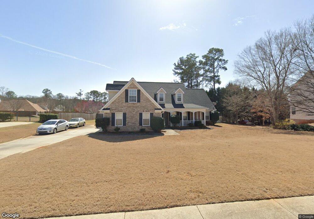
153 Moss Pointe Dr McDonough, GA 30253
Estimated Value: $314,116 - $375,000
3
Beds
2
Baths
2,180
Sq Ft
$157/Sq Ft
Est. Value
About This Home
This home is located at 153 Moss Pointe Dr, McDonough, GA 30253 and is currently estimated at $341,779, approximately $156 per square foot. 153 Moss Pointe Dr is a home located in Henry County with nearby schools including Union Grove Middle School, Union Grove High School, and Hickory Flat Elementary School.
Ownership History
Date
Name
Owned For
Owner Type
Purchase Details
Closed on
May 22, 2003
Sold by
Mnw Construction Co
Bought by
Burke Christopher J and Burke Natacha
Current Estimated Value
Home Financials for this Owner
Home Financials are based on the most recent Mortgage that was taken out on this home.
Original Mortgage
$169,679
Outstanding Balance
$73,746
Interest Rate
5.79%
Mortgage Type
FHA
Estimated Equity
$268,033
Purchase Details
Closed on
Jan 15, 2003
Sold by
Hudgins Communities Inc
Bought by
Mnw Const Co
Home Financials for this Owner
Home Financials are based on the most recent Mortgage that was taken out on this home.
Original Mortgage
$136,955
Interest Rate
6.01%
Mortgage Type
New Conventional
Create a Home Valuation Report for This Property
The Home Valuation Report is an in-depth analysis detailing your home's value as well as a comparison with similar homes in the area
Home Values in the Area
Average Home Value in this Area
Purchase History
| Date | Buyer | Sale Price | Title Company |
|---|---|---|---|
| Burke Christopher J | $171,200 | -- | |
| Mnw Const Co | $35,800 | -- |
Source: Public Records
Mortgage History
| Date | Status | Borrower | Loan Amount |
|---|---|---|---|
| Open | Burke Christopher J | $169,679 | |
| Previous Owner | Mnw Const Co | $136,955 |
Source: Public Records
Tax History Compared to Growth
Tax History
| Year | Tax Paid | Tax Assessment Tax Assessment Total Assessment is a certain percentage of the fair market value that is determined by local assessors to be the total taxable value of land and additions on the property. | Land | Improvement |
|---|---|---|---|---|
| 2025 | $4,227 | $126,280 | $18,000 | $108,280 |
| 2024 | $4,227 | $129,280 | $18,000 | $111,280 |
| 2023 | $4,051 | $135,240 | $18,000 | $117,240 |
| 2022 | $3,518 | $107,840 | $16,000 | $91,840 |
| 2021 | $3,022 | $86,880 | $12,000 | $74,880 |
| 2020 | $2,889 | $81,280 | $10,800 | $70,480 |
| 2019 | $2,652 | $74,600 | $10,800 | $63,800 |
| 2018 | $2,538 | $69,760 | $10,000 | $59,760 |
| 2016 | $2,460 | $66,520 | $10,000 | $56,520 |
| 2015 | $2,242 | $59,440 | $8,000 | $51,440 |
| 2014 | $2,183 | $57,440 | $8,000 | $49,440 |
Source: Public Records
Map
Nearby Homes
- 124 Crown Walk
- 466 Astoria Way
- 271 Mckinley Loop
- 479 Sawtooth Ln
- 1872 Hwy 42 N
- 172 Summit View Dr
- 345 Brannan Rd
- 209 Braemar Ct
- 221 Summit View Dr
- 176 Cranapple Ln
- 1181 Paramount Dr
- 113 Glenmore Ln
- 1739A Highway 42
- 245 Bald Ave
- 240 Brannan Rd
- 126 Country Acres Ct
- 441 Aviemore Loop
- 422 Old Ivy Path
- 168 Vintage Trail
- 309 Bowfin Trail
- 157 Moss Pointe Dr
- 149 Moss Pointe Dr
- 254 Whitney Ln
- 258 Whitney Ln
- 156 Moss Pointe Dr
- 262 Whitney Ln
- 152 Moss Pointe Dr
- 250 Whitney Ln
- 145 Moss Pointe Dr
- 160 Moss Pointe Dr
- 148 Moss Pointe Dr
- 500 Aaron Place
- 246 Whitney Ln
- 508 Aaron Place
- 144 Moss Pointe Dr
- 141 Moss Pointe Dr
- 362 Whitney Ln
- 370 Whitney Ln
- 257 Whitney Ln
- 253 Whitney Ln