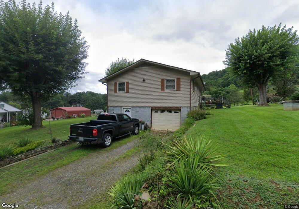
153 Shady Brook Rd Canton, NC 28716
Estimated Value: $306,262 - $357,000
3
Beds
2
Baths
1,288
Sq Ft
$252/Sq Ft
Est. Value
About This Home
This home is located at 153 Shady Brook Rd, Canton, NC 28716 and is currently estimated at $325,066, approximately $252 per square foot. 153 Shady Brook Rd is a home located in Haywood County with nearby schools including Bethel Elementary, Bethel Middle School, and Pisgah High School.
Ownership History
Date
Name
Owned For
Owner Type
Purchase Details
Closed on
Jun 16, 2008
Sold by
Earley Wiley Carroll
Bought by
Earley Rhonda L
Current Estimated Value
Home Financials for this Owner
Home Financials are based on the most recent Mortgage that was taken out on this home.
Original Mortgage
$123,660
Outstanding Balance
$77,092
Interest Rate
5.5%
Mortgage Type
Purchase Money Mortgage
Estimated Equity
$247,974
Create a Home Valuation Report for This Property
The Home Valuation Report is an in-depth analysis detailing your home's value as well as a comparison with similar homes in the area
Home Values in the Area
Average Home Value in this Area
Purchase History
| Date | Buyer | Sale Price | Title Company |
|---|---|---|---|
| Earley Rhonda L | -- | None Available |
Source: Public Records
Mortgage History
| Date | Status | Borrower | Loan Amount |
|---|---|---|---|
| Open | Earley Rhonda L | $123,660 |
Source: Public Records
Tax History Compared to Growth
Tax History
| Year | Tax Paid | Tax Assessment Tax Assessment Total Assessment is a certain percentage of the fair market value that is determined by local assessors to be the total taxable value of land and additions on the property. | Land | Improvement |
|---|---|---|---|---|
| 2025 | -- | $160,600 | $26,000 | $134,600 |
| 2024 | $1,195 | $160,600 | $26,000 | $134,600 |
| 2023 | $1,179 | $160,600 | $26,000 | $134,600 |
| 2022 | $1,155 | $160,600 | $26,000 | $134,600 |
| 2021 | $1,155 | $160,600 | $26,000 | $134,600 |
| 2020 | $1,011 | $127,200 | $26,000 | $101,200 |
| 2019 | $1,016 | $127,200 | $26,000 | $101,200 |
| 2018 | $1,016 | $127,200 | $26,000 | $101,200 |
| 2017 | $1,004 | $127,200 | $0 | $0 |
| 2016 | $962 | $124,500 | $0 | $0 |
| 2015 | $962 | $124,500 | $0 | $0 |
| 2014 | $859 | $124,500 | $0 | $0 |
Source: Public Records
Map
Nearby Homes
- 296 Matthew Ln
- 4 Mayapple Ln
- 21 Crooked Trail
- 286 Keith Dr
- 178 Keith Dr
- 1001 Mountain Glen Rd
- 27 Barkn Cove
- 32 Perseverance Dr
- TBD Mountain Glen Rd
- 495 Courtney Ln
- 1685 Queentown Rd
- 000 Sleepy Hollow Ln Unit 14
- 000 Sleepy Hollow Ln Unit 13
- 57 Eden Brook Dr
- 00 Promiseland Rd
- 50 Morning Star Rd
- 00 Aquarius Rd
- 160 Aquarius Rd
- 54 Bittersweet Trail
- 131 Tobacco Trail
- 167 Shady Brook Rd
- 129 Shady Brook Rd
- 99999 Old Henson Cove Rd Unit 2
- 3073 Old Henson Cove Rd
- 3188 Old Henson Cove Rd
- 0 Shady Brook Rd
- 66 Shady Brook Rd
- 85 Oriole Ln
- 57 Yonder Mountain Rd
- 3063 Old Henson Cove Rd
- 400 Shady Brook Rd
- 0 Matthew Ln Unit 5
- 3232 Old Henson Cove Rd
- 3029 Old Henson Cove Rd
- 28 Mease Farm Rd
- 42 Outback Trail
- 3296 Old Henson Cove Rd
- 00 Mease Farm Road 5
- 3240 Old Henson Cove Rd
- 136 Matthew Ln