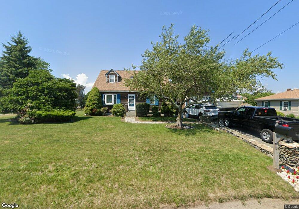
153 Stevens Rd Swansea, MA 02777
Northeast Swansea NeighborhoodEstimated Value: $426,000 - $547,000
3
Beds
2
Baths
1,149
Sq Ft
$426/Sq Ft
Est. Value
About This Home
This home is located at 153 Stevens Rd, Swansea, MA 02777 and is currently estimated at $489,658, approximately $426 per square foot. 153 Stevens Rd is a home located in Bristol County with nearby schools including Joseph Case High School, Swansea Wood School, and SCEC Life Academy.
Ownership History
Date
Name
Owned For
Owner Type
Purchase Details
Closed on
Mar 27, 2002
Sold by
Dasilva David and Dasilva Wendy L
Bought by
Camara Raul M and Camara Lisa Marie
Current Estimated Value
Home Financials for this Owner
Home Financials are based on the most recent Mortgage that was taken out on this home.
Original Mortgage
$221,450
Outstanding Balance
$92,260
Interest Rate
6.88%
Mortgage Type
Purchase Money Mortgage
Estimated Equity
$397,398
Purchase Details
Closed on
Jun 12, 1997
Sold by
Brouillard Milton J and Brouillard Randi
Bought by
Dasilva David F and Dasilva Wendy L
Home Financials for this Owner
Home Financials are based on the most recent Mortgage that was taken out on this home.
Original Mortgage
$125,400
Interest Rate
7.97%
Mortgage Type
Purchase Money Mortgage
Create a Home Valuation Report for This Property
The Home Valuation Report is an in-depth analysis detailing your home's value as well as a comparison with similar homes in the area
Home Values in the Area
Average Home Value in this Area
Purchase History
| Date | Buyer | Sale Price | Title Company |
|---|---|---|---|
| Camara Raul M | $215,000 | -- | |
| Dasilva David F | $132,000 | -- |
Source: Public Records
Mortgage History
| Date | Status | Borrower | Loan Amount |
|---|---|---|---|
| Open | Dasilva David F | $221,450 | |
| Previous Owner | Dasilva David F | $22,728 | |
| Previous Owner | Dasilva David F | $125,400 |
Source: Public Records
Tax History Compared to Growth
Tax History
| Year | Tax Paid | Tax Assessment Tax Assessment Total Assessment is a certain percentage of the fair market value that is determined by local assessors to be the total taxable value of land and additions on the property. | Land | Improvement |
|---|---|---|---|---|
| 2025 | $4,375 | $367,000 | $151,000 | $216,000 |
| 2024 | $4,352 | $363,000 | $151,000 | $212,000 |
| 2023 | $3,955 | $301,200 | $110,200 | $191,000 |
| 2022 | $3,833 | $266,400 | $100,200 | $166,200 |
| 2021 | $3,640 | $232,900 | $100,200 | $132,700 |
| 2020 | $3,682 | $236,300 | $100,200 | $136,100 |
| 2019 | $3,448 | $222,300 | $89,200 | $133,100 |
| 2018 | $3,362 | $220,000 | $86,900 | $133,100 |
| 2017 | $3,001 | $226,000 | $86,900 | $139,100 |
| 2016 | $2,745 | $203,000 | $74,900 | $128,100 |
| 2015 | $2,554 | $194,500 | $74,900 | $119,600 |
| 2014 | $2,459 | $191,500 | $74,900 | $116,600 |
Source: Public Records
Map
Nearby Homes