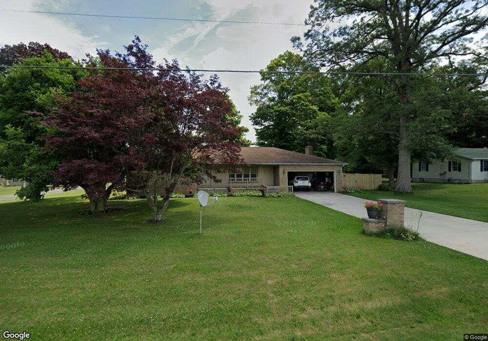
153 Wolf Rd Mansfield, OH 44903
Estimated Value: $238,165 - $274,000
3
Beds
2
Baths
1,700
Sq Ft
$151/Sq Ft
Est. Value
About This Home
This home is located at 153 Wolf Rd, Mansfield, OH 44903 and is currently estimated at $256,541, approximately $150 per square foot. 153 Wolf Rd is a home located in Richland County with nearby schools including Madison High School and St. Mary Catholic School.
Ownership History
Date
Name
Owned For
Owner Type
Purchase Details
Closed on
Nov 21, 1994
Sold by
Nelson Raymond R
Bought by
Lyons Scott B and Lyons Robin E
Current Estimated Value
Home Financials for this Owner
Home Financials are based on the most recent Mortgage that was taken out on this home.
Original Mortgage
$76,400
Interest Rate
8.5%
Mortgage Type
New Conventional
Purchase Details
Closed on
Sep 1, 1985
Create a Home Valuation Report for This Property
The Home Valuation Report is an in-depth analysis detailing your home's value as well as a comparison with similar homes in the area
Home Values in the Area
Average Home Value in this Area
Purchase History
| Date | Buyer | Sale Price | Title Company |
|---|---|---|---|
| Lyons Scott B | $84,900 | -- | |
| -- | $65,000 | -- |
Source: Public Records
Mortgage History
| Date | Status | Borrower | Loan Amount |
|---|---|---|---|
| Closed | Lyons Scott B | $76,400 |
Source: Public Records
Tax History
| Year | Tax Paid | Tax Assessment Tax Assessment Total Assessment is a certain percentage of the fair market value that is determined by local assessors to be the total taxable value of land and additions on the property. | Land | Improvement |
|---|---|---|---|---|
| 2025 | $3,210 | $64,940 | $6,750 | $58,190 |
| 2024 | $3,210 | $64,940 | $6,750 | $58,190 |
| 2023 | $3,280 | $64,940 | $6,750 | $58,190 |
| 2022 | $2,451 | $44,710 | $5,410 | $39,300 |
| 2021 | $2,450 | $44,710 | $5,410 | $39,300 |
| 2020 | $2,469 | $44,710 | $5,410 | $39,300 |
| 2019 | $2,223 | $37,580 | $4,540 | $33,040 |
| 2018 | $2,204 | $37,580 | $4,540 | $33,040 |
| 2017 | $2,194 | $37,580 | $4,540 | $33,040 |
| 2016 | $2,224 | $37,750 | $4,320 | $33,430 |
| 2015 | $2,224 | $37,750 | $4,320 | $33,430 |
| 2014 | $2,181 | $37,750 | $4,320 | $33,430 |
| 2012 | $1,051 | $39,730 | $4,540 | $35,190 |
Source: Public Records
Map
Nearby Homes
- 474 Biscayne Dr
- 2472 Wedgewood Dr
- 0 McBride Road Parcel # 1 Unit 9066028
- 754 Touby Ln
- 620 Running Brook Way
- 2264 Crider Rd
- 3390 Muskie Dr
- 945 Pike Dr
- 0 Mcelroy Rd
- 1674 Honeysuckle Dr
- 1544 Pear Place
- 1990 Woodmont Rd
- 0 Mount Zion Rd Unit 226009674
- 0 Mount Zion Rd Unit 9072801
- 690 Ashland Rd
- 1303 Park Ave E
- 684 N Mcelroy Rd
- 0 State Route 39 & I-71 Northeast Quadrant
- 59 Ridge Rd S
- 0 State Route 39 & I-71 Southeast Quadrant
Your Personal Tour Guide
Ask me questions while you tour the home.