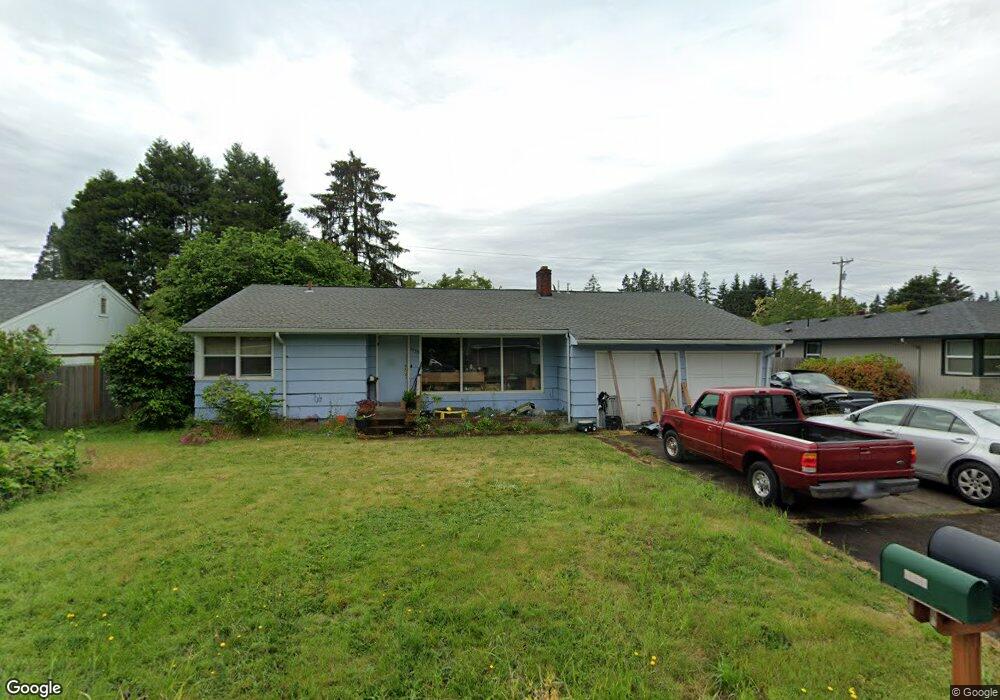
1530 Corum Ave Eugene, OR 97401
Cal Young NeighborhoodEstimated Value: $460,000 - $505,000
3
Beds
2
Baths
1,680
Sq Ft
$289/Sq Ft
Est. Value
About This Home
This home is located at 1530 Corum Ave, Eugene, OR 97401 and is currently estimated at $486,311, approximately $289 per square foot. 1530 Corum Ave is a home located in Lane County with nearby schools including Willagillespie Elementary School, Cal Young Middle School, and Sheldon High School.
Ownership History
Date
Name
Owned For
Owner Type
Purchase Details
Closed on
Jul 10, 2006
Sold by
Williams Della A and Williams Harold F
Bought by
Williams Harold F and Williams Della A
Current Estimated Value
Home Financials for this Owner
Home Financials are based on the most recent Mortgage that was taken out on this home.
Original Mortgage
$202,746
Interest Rate
6.57%
Mortgage Type
FHA
Create a Home Valuation Report for This Property
The Home Valuation Report is an in-depth analysis detailing your home's value as well as a comparison with similar homes in the area
Home Values in the Area
Average Home Value in this Area
Purchase History
| Date | Buyer | Sale Price | Title Company |
|---|---|---|---|
| Williams Harold F | -- | Fidelity National Title Insu |
Source: Public Records
Mortgage History
| Date | Status | Borrower | Loan Amount |
|---|---|---|---|
| Closed | Williams Harold F | $202,746 |
Source: Public Records
Tax History
| Year | Tax Paid | Tax Assessment Tax Assessment Total Assessment is a certain percentage of the fair market value that is determined by local assessors to be the total taxable value of land and additions on the property. | Land | Improvement |
|---|---|---|---|---|
| 2025 | $4,788 | $245,753 | -- | -- |
| 2024 | $4,729 | $238,596 | -- | -- |
| 2023 | $4,729 | $231,647 | $0 | $0 |
| 2022 | $4,430 | $224,900 | $0 | $0 |
| 2021 | $4,161 | $218,350 | $0 | $0 |
| 2020 | $4,175 | $211,991 | $0 | $0 |
| 2019 | $4,033 | $205,817 | $0 | $0 |
| 2018 | $3,796 | $194,003 | $0 | $0 |
| 2017 | $3,626 | $194,003 | $0 | $0 |
| 2016 | $3,478 | $188,352 | $0 | $0 |
| 2015 | $3,356 | $182,866 | $0 | $0 |
| 2014 | $3,286 | $177,540 | $0 | $0 |
Source: Public Records
Map
Nearby Homes
- 2291 Norkenzie Rd
- 1332 Jeppesen Ave
- 1810 Minda Dr
- 1901 Minda Dr
- 1625 Monterey Ln
- 2280 Tabor St
- 1697 Elanco Ave
- 1500 Norkenzie Rd Unit 12
- 2281 Ridgeway Dr
- 1943 Monterey Ln
- 0 Piper Ln Unit Lot 1
- 0 Piper Ln Unit Lot 3
- 0 Piper Ln Unit Lot 2
- 0 Piper Ln Unit Lot 5
- 1165 Skylark Ln
- 2132 Willona Dr
- 2134 Willona Dr
- 1455 Holly Ave
- 0 Cal Young Rd Unit Lot 4
- 1550 Green Acres Rd
- 1568 Corum Ave
- 1506 Corum Ave
- 1537 Goodpasture Island Rd
- 1577 Goodpasture Island Rd
- 1515 Goodpasture Island Rd
- 1582 Corum Ave
- 1498 Corum Ave
- 1555 Corum Ave
- 1527 Corum Ave
- 1495 Goodpasture Island Rd
- 1505 Corum Ave
- 1472 Corum Ave
- 1590 Corum Ave
- 2090 Norkenzie Rd
- 1487 Goodpasture Island Rd
- 1920 Norkenzie Rd
- 1491 Corum Ave
- 1530 Goodpasture Island Rd
- 1560 Goodpasture Island Rd
- 1464 Corum Ave
Your Personal Tour Guide
Ask me questions while you tour the home.