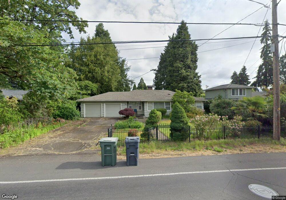
1530 Dalton Dr Eugene, OR 97404
River Road NeighborhoodEstimated Value: $447,000 - $487,000
4
Beds
2
Baths
1,668
Sq Ft
$280/Sq Ft
Est. Value
About This Home
This home is located at 1530 Dalton Dr, Eugene, OR 97404 and is currently estimated at $467,299, approximately $280 per square foot. 1530 Dalton Dr is a home located in Lane County with nearby schools including Howard Elementary School, Kelly Middle School, and North Eugene High School.
Ownership History
Date
Name
Owned For
Owner Type
Purchase Details
Closed on
Aug 3, 2021
Sold by
Cullen Rodney M
Bought by
Cullen Rodney M and Cullen Estefania
Current Estimated Value
Purchase Details
Closed on
Jun 29, 2001
Sold by
Sorric Richard J
Bought by
Cullen Rodney M
Home Financials for this Owner
Home Financials are based on the most recent Mortgage that was taken out on this home.
Original Mortgage
$136,500
Interest Rate
7.14%
Mortgage Type
Credit Line Revolving
Create a Home Valuation Report for This Property
The Home Valuation Report is an in-depth analysis detailing your home's value as well as a comparison with similar homes in the area
Home Values in the Area
Average Home Value in this Area
Purchase History
We collect this data history from publicly available records. To have your information removed, we recommend requesting removal directly through your county’s website.
| Date | Buyer | Sale Price | Title Company |
|---|---|---|---|
| Cullen Rodney M | -- | None Available | |
| Cullen Rodney M | $29,500 | Cascade Title Co |
Source: Public Records
Mortgage History
We collect this data history from publicly available records. To have your information removed, we recommend requesting removal directly through your county’s website.
| Date | Status | Borrower | Loan Amount |
|---|---|---|---|
| Closed | Cullen Rodney M | $136,500 |
Source: Public Records
Tax History
| Year | Tax Paid | Tax Assessment Tax Assessment Total Assessment is a certain percentage of the fair market value that is determined by local assessors to be the total taxable value of land and additions on the property. | Land | Improvement |
|---|---|---|---|---|
| 2025 | $5,133 | $263,457 | -- | -- |
| 2024 | $5,069 | $255,784 | -- | -- |
| 2023 | $5,069 | $248,334 | $0 | $0 |
| 2022 | $4,749 | $241,101 | $0 | $0 |
| 2021 | $4,461 | $234,079 | $0 | $0 |
| 2020 | $4,476 | $227,262 | $0 | $0 |
| 2019 | $4,323 | $220,643 | $0 | $0 |
| 2018 | $4,069 | $207,978 | $0 | $0 |
| 2017 | $3,797 | $207,978 | $0 | $0 |
| 2016 | $3,605 | $201,920 | $0 | $0 |
| 2015 | $3,448 | $196,039 | $0 | $0 |
| 2014 | $3,367 | $190,329 | $0 | $0 |
Source: Public Records
Map
Nearby Homes
- 1565 Linwood St
- 1565 Santa Rosa St
- 389 Maxwell Rd
- 1682 Hemlock St
- 233 Howard Ave
- 1755 Brentwood Ave
- 1880 Manihi Dr
- 903 Howard Ave
- 1348 Manzana St
- 1295 Betty Ln
- 811 Horn
- 1920 River Rd
- 1010 Horn Ln
- 788 Cornwall Ave
- 445 Sterling Dr
- 2301 Compton St
- 172 Norman Ave
- 325 Bushnell Ln
- 132 Formac Ave
- 2412 Dalton Dr
- 1534 Dalton Dr
- 563 Howard Ave
- 537 Howard Ave
- 540 Rosewood Ave
- 560 Rosewood Ave
- 583 Howard Ave
- 1538 Dalton Dr
- 1570 Dalton Dr
- 515 Howard Ave
- 580 Rosewood Ave
- 522 Rosewood Ave
- 605 Howard Ave
- 600 Rosewood Ave Unit VRM
- 600 Rosewood Ave Unit 32
- 1600 Dalton Dr
- 1565 Dalton Dr
- 485 Howard Ave
- 1533 Dalton Dr
- 1485 Oak Dr
- 1488 Oak Dr
Your Personal Tour Guide
Ask me questions while you tour the home.