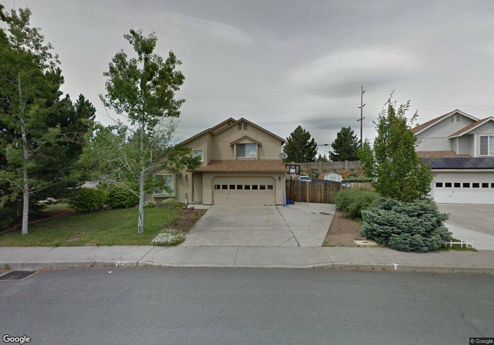
1530 NE Locksley Dr Bend, OR 97701
Mountain View NeighborhoodEstimated Value: $546,107 - $632,000
3
Beds
3
Baths
1,812
Sq Ft
$324/Sq Ft
Est. Value
About This Home
This home is located at 1530 NE Locksley Dr, Bend, OR 97701 and is currently estimated at $586,277, approximately $323 per square foot. 1530 NE Locksley Dr is a home located in Deschutes County with nearby schools including Buckingham Elementary School, Pilot Butte Middle School, and Mountain View Senior High School.
Ownership History
Date
Name
Owned For
Owner Type
Purchase Details
Closed on
Apr 22, 2004
Sold by
Overton Gregory Lynn
Bought by
Campuzano Larry David
Current Estimated Value
Home Financials for this Owner
Home Financials are based on the most recent Mortgage that was taken out on this home.
Original Mortgage
$116,900
Outstanding Balance
$49,624
Interest Rate
4.37%
Mortgage Type
Unknown
Estimated Equity
$536,653
Create a Home Valuation Report for This Property
The Home Valuation Report is an in-depth analysis detailing your home's value as well as a comparison with similar homes in the area
Home Values in the Area
Average Home Value in this Area
Purchase History
| Date | Buyer | Sale Price | Title Company |
|---|---|---|---|
| Campuzano Larry David | $179,900 | First Amer Title Ins Co Or | |
| Overton Gregory Lynn | $179,900 | First Amer Title Ins Co Or |
Source: Public Records
Mortgage History
| Date | Status | Borrower | Loan Amount |
|---|---|---|---|
| Open | Campuzano Larry David | $116,900 |
Source: Public Records
Tax History
| Year | Tax Paid | Tax Assessment Tax Assessment Total Assessment is a certain percentage of the fair market value that is determined by local assessors to be the total taxable value of land and additions on the property. | Land | Improvement |
|---|---|---|---|---|
| 2025 | $3,801 | $224,960 | -- | -- |
| 2024 | $3,657 | $218,410 | -- | -- |
| 2023 | $3,390 | $212,050 | $0 | $0 |
| 2022 | $3,163 | $199,890 | $0 | $0 |
| 2021 | $3,168 | $194,070 | $0 | $0 |
| 2020 | $3,005 | $194,070 | $0 | $0 |
| 2019 | $2,922 | $188,420 | $0 | $0 |
| 2018 | $2,839 | $182,940 | $0 | $0 |
| 2017 | $2,756 | $177,620 | $0 | $0 |
| 2016 | $2,628 | $172,450 | $0 | $0 |
| 2015 | $2,556 | $167,430 | $0 | $0 |
| 2014 | $2,480 | $162,560 | $0 | $0 |
Source: Public Records
Map
Nearby Homes
- 3023 NE Lansing Ct
- 1283 NE Providence Dr
- 3030 NE Stanton Ave
- 1310 NE Tucson Way
- 1152 NE Locksley Dr
- 1071 NE Locksley Dr
- 2934 NE Dogwood Dr
- 1761 NE Wichita Way
- 1188 NE 27th St Unit 71
- 1188 NE 27th St Unit 12
- 804 NE Providence Dr
- 21374 Starling Dr
- 2711 NE Yellow Ribbon Dr
- 21442 Belknap Dr
- 1420 NE Sharkey Terrace
- 21430 E Highway 20
- 62566 NE Loomis Ln Unit 55
- 21445 Bradetich Loop
- 62661 Hawkview Rd
- 21517 O'Connor Way
- 1536 NE Locksley Dr
- 1528 NE Locksley Dr
- 1522 NE Locksley Dr
- 1510 NE Boston Place
- 1544 NE Locksley Dr
- 1552 NE Locksley Dr
- 1521 NE Locksley Dr
- 1543 NE Locksley Dr
- 1557 NE Locksley Dr
- 1505 NE Locksley Dr
- 1482 NE Boston Place
- 1586 NE Providence Dr
- 1487 NE Boston Place
- 1510 NE Locksley Dr
- 1520 NE Providence Dr
- 1475 NE Locksley Dr
- 1500 NE Locksley Dr
- 1460 NE Boston Place
- 1484 NE Providence Dr
Your Personal Tour Guide
Ask me questions while you tour the home.