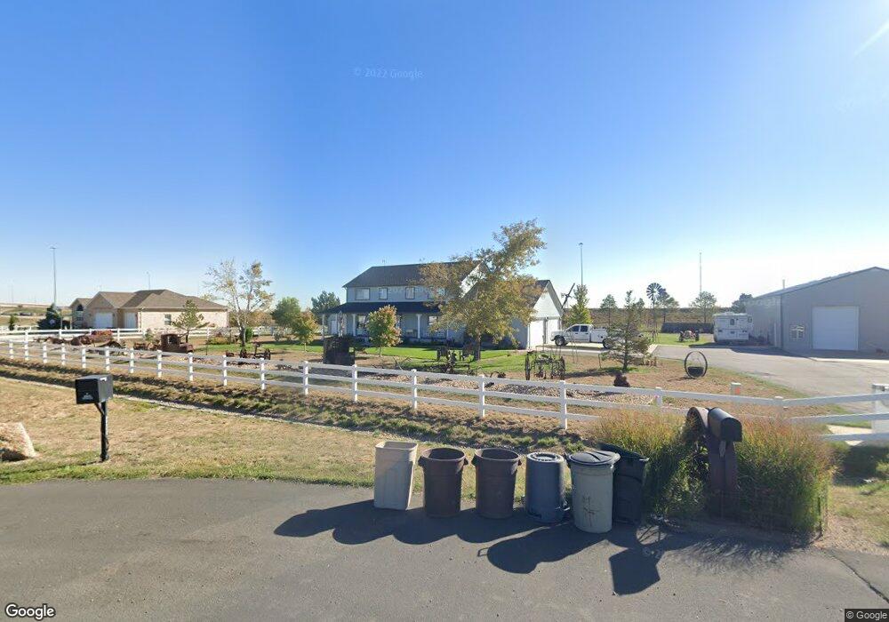
15300 Bannock St Broomfield, CO 80023
North Broomfield NeighborhoodEstimated Value: $951,000 - $1,415,000
3
Beds
3
Baths
2,816
Sq Ft
$419/Sq Ft
Est. Value
About This Home
This home is located at 15300 Bannock St, Broomfield, CO 80023 and is currently estimated at $1,179,609, approximately $418 per square foot. 15300 Bannock St is a home located in Adams County with nearby schools including Meridian Elementary School, Rocky Top Middle School, and Legacy High School.
Ownership History
Date
Name
Owned For
Owner Type
Purchase Details
Closed on
Jun 17, 2016
Sold by
George Dale H and George Linda K
Bought by
State Of Colorado For The Use And Benefi
Current Estimated Value
Purchase Details
Closed on
Apr 28, 2016
Sold by
Maclennan Dean K and Davis Allison
Bought by
Department Of Transportation State Of Co
Purchase Details
Closed on
May 14, 2004
Sold by
E & 470 Public Highway Authority
Bought by
George Dale H and George Linda K
Home Financials for this Owner
Home Financials are based on the most recent Mortgage that was taken out on this home.
Original Mortgage
$160,000
Interest Rate
5.81%
Mortgage Type
Unknown
Purchase Details
Closed on
Mar 12, 1999
Sold by
Langren Jack D and Langren Theresa L
Bought by
E & 470 Public Highway Authority
Create a Home Valuation Report for This Property
The Home Valuation Report is an in-depth analysis detailing your home's value as well as a comparison with similar homes in the area
Home Values in the Area
Average Home Value in this Area
Purchase History
| Date | Buyer | Sale Price | Title Company |
|---|---|---|---|
| State Of Colorado For The Use And Benefi | -- | None Available | |
| Department Of Transportation | $6,240 | None Available | |
| Department Of Transportation State Of Co | $5,954 | None Available | |
| George Dale H | $361,000 | Fahtco | |
| E & 470 Public Highway Authority | $320,000 | First American |
Source: Public Records
Mortgage History
| Date | Status | Borrower | Loan Amount |
|---|---|---|---|
| Previous Owner | George Dale H | $160,000 |
Source: Public Records
Tax History Compared to Growth
Tax History
| Year | Tax Paid | Tax Assessment Tax Assessment Total Assessment is a certain percentage of the fair market value that is determined by local assessors to be the total taxable value of land and additions on the property. | Land | Improvement |
|---|---|---|---|---|
| 2024 | $6,684 | $68,210 | $10,500 | $57,710 |
| 2023 | $6,616 | $72,410 | $10,550 | $61,860 |
| 2022 | $4,009 | $41,910 | $10,840 | $31,070 |
| 2021 | $4,140 | $41,910 | $10,840 | $31,070 |
| 2020 | $4,435 | $45,330 | $11,150 | $34,180 |
| 2019 | $4,438 | $45,330 | $11,150 | $34,180 |
| 2018 | $3,444 | $36,000 | $8,930 | $27,070 |
| 2017 | $3,143 | $36,000 | $8,930 | $27,070 |
| 2016 | $2,783 | $32,800 | $7,320 | $25,480 |
| 2015 | $3,668 | $32,800 | $7,320 | $25,480 |
| 2014 | $3,303 | $28,700 | $5,920 | $22,780 |
Source: Public Records
Map
Nearby Homes
- 15280 Bannock St
- 15211 Washington St
- 1777 W 156th Ave
- 15528 Navajo St
- 14870 Mariposa Ct
- 1545 W 148th Ave
- 1857 W 153rd Place
- 16130 Huron St
- 1981 W 149th Ave
- 1341 W 152nd Ave Unit 1
- 2370 W 152nd Ave
- 14325 N Santa fe St
- 124 Santa Fe Trail Ranches II
- 14310 Kalamath St
- 14650 Tejon St
- 1501 E 160th Ave
- 14370 Osage St
- 15355 Zuni St
- 2466 Spruce Meadows Dr
- 1685 E 160th Ave
- 15340 Bannock St
- 241 W 153rd Ave
- 15253 Bannock St
- 15361 Bannock St
- 15230 Bannock St
- 351 W 153rd Ave
- 15240 Delaware St
- 15370 Delaware St
- 15210 Delaware St
- 15241 Delaware St
- 15315 Delaware St
- 752 W 153 Place
- 431 W 152nd Ave
- 730 W 153rd Place
- 735 W 153rd Place
- 750 W 153rd Place
- 755 W 153rd Place
- 770 W 153rd Place
- 775 W 153rd Place
- 675 W 152nd Ave