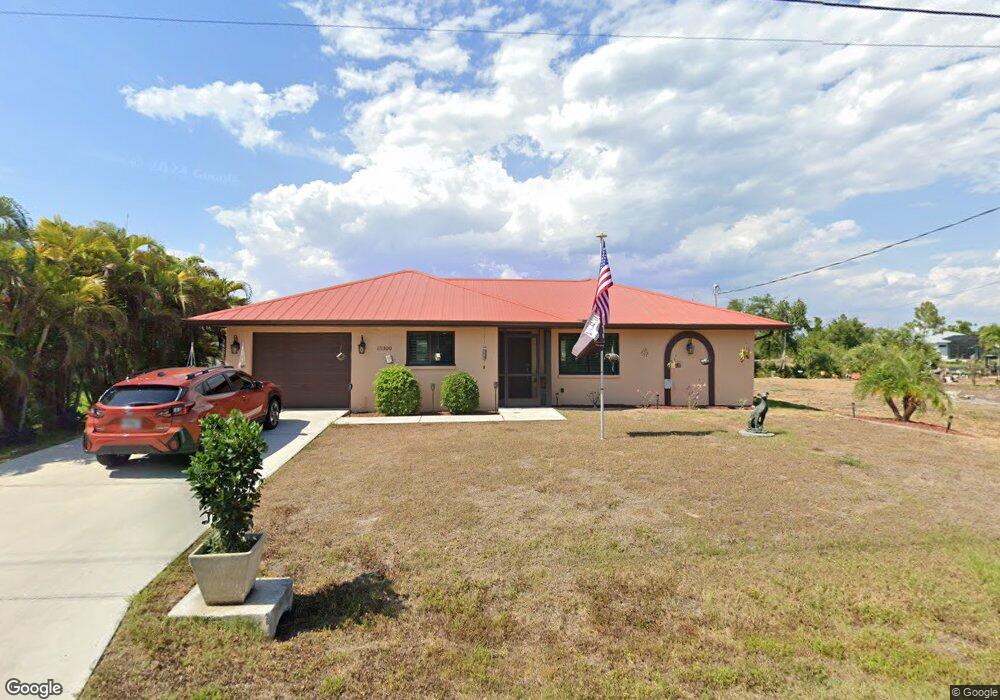
15300 Red Head Ave Port Charlotte, FL 33981
Gulf Cove NeighborhoodEstimated Value: $258,000 - $484,000
2
Beds
2
Baths
1,243
Sq Ft
$299/Sq Ft
Est. Value
About This Home
This home is located at 15300 Red Head Ave, Port Charlotte, FL 33981 and is currently estimated at $372,149, approximately $299 per square foot. 15300 Red Head Ave is a home located in Charlotte County with nearby schools including Myakka River Elementary School, L.A. Ainger Middle School, and Lemon Bay High School.
Ownership History
Date
Name
Owned For
Owner Type
Purchase Details
Closed on
Jun 15, 2018
Sold by
Frost William G and Lefrancois Kathy
Bought by
Lavin Alice M and Lavin Shawn M
Current Estimated Value
Purchase Details
Closed on
Sep 30, 2016
Sold by
Trieweller Alex
Bought by
Geriffith Daniel L and Geriffith Linda M
Purchase Details
Closed on
Nov 18, 2015
Sold by
Bank Of America Na
Bought by
Trieweiler Alex and Trieweiler T
Purchase Details
Closed on
Feb 26, 2015
Sold by
Onewest Bank Na
Bought by
Bank Of America National Association
Purchase Details
Closed on
Jan 13, 2015
Sold by
Call Willard J and Case #14000567Ca
Bought by
One West Bank Fsb
Create a Home Valuation Report for This Property
The Home Valuation Report is an in-depth analysis detailing your home's value as well as a comparison with similar homes in the area
Home Values in the Area
Average Home Value in this Area
Purchase History
| Date | Buyer | Sale Price | Title Company |
|---|---|---|---|
| Lavin Alice M | $190,000 | Coastal Security Title Inc | |
| Geriffith Daniel L | $240,000 | Stewart Title Co | |
| Trieweiler Alex | $131,500 | -- | |
| Bank Of America National Association | -- | Attorney | |
| One West Bank Fsb | $186,000 | None Available |
Source: Public Records
Tax History Compared to Growth
Tax History
| Year | Tax Paid | Tax Assessment Tax Assessment Total Assessment is a certain percentage of the fair market value that is determined by local assessors to be the total taxable value of land and additions on the property. | Land | Improvement |
|---|---|---|---|---|
| 2023 | $4,843 | $280,290 | $0 | $0 |
| 2022 | $5,026 | $273,285 | $0 | $0 |
| 2021 | $3,462 | $196,830 | $38,250 | $158,580 |
| 2020 | $3,399 | $195,238 | $0 | $0 |
| 2019 | $2,891 | $167,168 | $38,675 | $128,493 |
| 2018 | $3,525 | $175,963 | $41,650 | $134,313 |
| 2017 | $3,286 | $157,395 | $36,550 | $120,845 |
| 2016 | $2,913 | $132,439 | $0 | $0 |
| 2015 | $2,672 | $131,142 | $0 | $0 |
| 2014 | -- | $107,790 | $0 | $0 |
Source: Public Records
Map
Nearby Homes
- 15377 Red Head Ave
- 15249 Red Head Ave
- 15337 Red Head Ave
- 9582 Salt Lake St
- 15358 Ancel Cir
- 15350 Ancel Cir
- 9590 Little Rock St
- 9462 Little Rock St
- 9566 Little Rock St
- 9565 Little Rock St
- 9557 Little Rock St
- 9574 Little Rock St
- 9470 Little Rock St
- 9637 Arsipe Cir
- 9582 Arsipe Cir
- 9574 Honeymoon Dr
- 15374 Ancel Cir
- 14735 Keystone Blvd
- 9567 Honeymoon Dr
- 10098 Army Cir
- 15290 Red Head Ave
- 15308 Red Head Ave
- 15307 Red Head Ave
- 15321 Red Head Ave
- 15280 Red Head Ave
- 15486 Ancel Cir
- 15470 Ancel Cir
- 15324 Red Head Ave
- 15494 Ancel Cir
- 9506 Little Rock St
- 9557 Salt Lake St
- 15332 Red Head Ave
- 15406 Ancel Cir
- 15334 Ancel Cir
- 15505 Ancel Cir
- 15479, 15487 & 15495 Ancel Cir
- 15264 Red Head Ave
- 15329 Red Head Ave
- 9494 Little Rock St
- 9517 Little Rock St