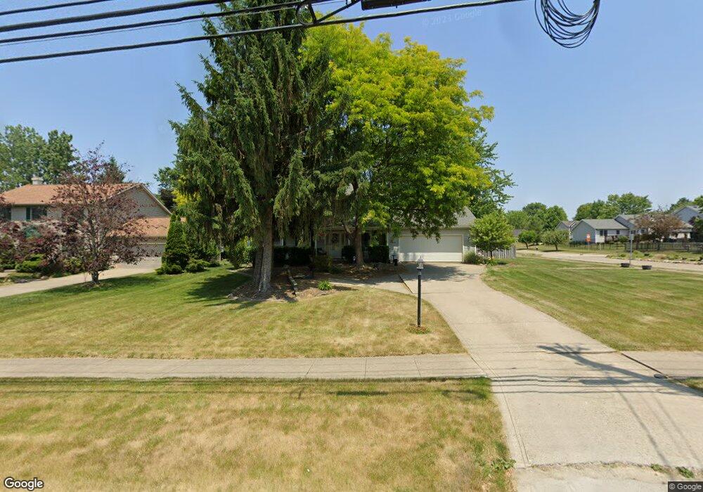
15308 Whitney Rd Strongsville, OH 44136
Estimated Value: $321,000 - $399,000
4
Beds
3
Baths
2,248
Sq Ft
$161/Sq Ft
Est. Value
About This Home
This home is located at 15308 Whitney Rd, Strongsville, OH 44136 and is currently estimated at $362,815, approximately $161 per square foot. 15308 Whitney Rd is a home located in Cuyahoga County with nearby schools including Strongsville High School, Bethel Christian Academy, and Sts Joseph & John Interparochial School.
Ownership History
Date
Name
Owned For
Owner Type
Purchase Details
Closed on
Jun 15, 1998
Sold by
Langes Paul R and Langes Rosalie R
Bought by
Patel Mited S and Patel Shefali M
Current Estimated Value
Home Financials for this Owner
Home Financials are based on the most recent Mortgage that was taken out on this home.
Original Mortgage
$132,000
Outstanding Balance
$26,683
Interest Rate
7.17%
Estimated Equity
$336,132
Purchase Details
Closed on
Sep 5, 1989
Bought by
Langes Paul R
Purchase Details
Closed on
Jan 1, 1988
Bought by
New Concord Homes
Create a Home Valuation Report for This Property
The Home Valuation Report is an in-depth analysis detailing your home's value as well as a comparison with similar homes in the area
Home Values in the Area
Average Home Value in this Area
Purchase History
| Date | Buyer | Sale Price | Title Company |
|---|---|---|---|
| Patel Mited S | $176,000 | -- | |
| Langes Paul R | $136,000 | -- | |
| The W. Bishop Co | $27,500 | -- | |
| New Concord Homes | -- | -- |
Source: Public Records
Mortgage History
| Date | Status | Borrower | Loan Amount |
|---|---|---|---|
| Open | Patel Mited S | $132,000 |
Source: Public Records
Tax History Compared to Growth
Tax History
| Year | Tax Paid | Tax Assessment Tax Assessment Total Assessment is a certain percentage of the fair market value that is determined by local assessors to be the total taxable value of land and additions on the property. | Land | Improvement |
|---|---|---|---|---|
| 2024 | $5,643 | $120,190 | $17,745 | $102,445 |
| 2023 | $5,721 | $91,360 | $21,810 | $69,550 |
| 2022 | $5,679 | $91,350 | $21,805 | $69,545 |
| 2021 | $5,634 | $91,350 | $21,810 | $69,550 |
| 2020 | $5,490 | $78,750 | $18,800 | $59,960 |
| 2019 | $5,329 | $225,000 | $53,700 | $171,300 |
| 2018 | $4,705 | $78,750 | $18,800 | $59,960 |
| 2017 | $4,658 | $70,210 | $16,730 | $53,480 |
| 2016 | $4,620 | $70,210 | $16,730 | $53,480 |
| 2015 | $4,550 | $70,210 | $16,730 | $53,480 |
| 2014 | $4,550 | $68,180 | $16,240 | $51,940 |
Source: Public Records
Map
Nearby Homes
- 9129 Tahoe Cir
- 9890 Webster Rd
- 10010 Chevy Chase
- 9531 Nicole Cir
- 9945 Twelve Oaks Cir
- 10369 Council Bluff
- 0 Webster Rd
- Buchanan Plan at The Enclave at Pine Lakes Crossing
- Belleville Plan at The Enclave at Pine Lakes Crossing
- 14015 Byron Blvd
- 15485 Albion Rd
- 13976 W Sprague Rd
- 7685 Saratoga Rd
- 14069 Basswood Cir
- 16519 Albion Rd
- 8761 Windfall Ct
- 7664 Gerald Dr
- 18203 Broxton Dr
- 14584 Baywood Ln
- 14557 Baywood Ln
- 15342 Whitney Rd
- 15281 Dewitt Dr
- 15376 Whitney Rd
- 15309 Dewitt Dr
- 15240 Whitney Rd
- 15337 Dewitt Dr
- 15261 Dewitt Dr
- 15357 Whitney Rd
- 15410 Whitney Rd
- 15317 Whitney Rd
- 15206 Whitney Rd
- 15273 Whitney Rd
- 15365 Dewitt Dr
- 15227 Dewitt Dr
- 15401 Whitney Rd
- 15444 Whitney Rd
- 15233 Whitney Rd
- 15172 Whitney Rd
- 15300 Dewitt Dr
- 15193 Dewitt Dr