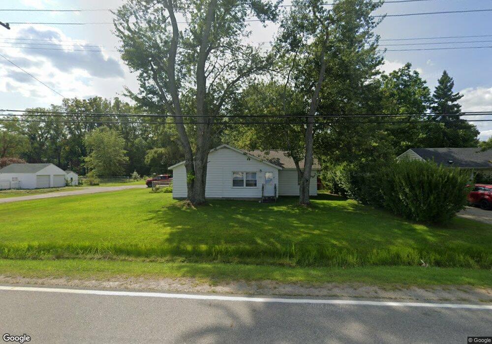
1531 Allen Rd Kimball, MI 48074
Estimated Value: $132,000 - $175,000
2
Beds
1
Bath
1,164
Sq Ft
$136/Sq Ft
Est. Value
About This Home
This home is located at 1531 Allen Rd, Kimball, MI 48074 and is currently estimated at $158,699, approximately $136 per square foot. 1531 Allen Rd is a home located in St. Clair County with nearby schools including Kimball Elementary School, Central Middle School, and Port Huron High School.
Ownership History
Date
Name
Owned For
Owner Type
Purchase Details
Closed on
Apr 29, 2013
Sold by
Frasier Frasier Harley L Harley L
Bought by
Frasier Travis
Current Estimated Value
Home Financials for this Owner
Home Financials are based on the most recent Mortgage that was taken out on this home.
Original Mortgage
$50,076
Interest Rate
3.87%
Mortgage Type
FHA
Purchase Details
Closed on
May 15, 2006
Sold by
Frasier Louis A and Fraiser Dorothy J
Bought by
Frasier Louis A and Frasier Dorothy J
Create a Home Valuation Report for This Property
The Home Valuation Report is an in-depth analysis detailing your home's value as well as a comparison with similar homes in the area
Home Values in the Area
Average Home Value in this Area
Purchase History
| Date | Buyer | Sale Price | Title Company |
|---|---|---|---|
| Frasier Travis | $51,000 | Liberty Title | |
| Frasier Louis A | -- | None Available |
Source: Public Records
Mortgage History
| Date | Status | Borrower | Loan Amount |
|---|---|---|---|
| Closed | Frasier Travis | $50,076 |
Source: Public Records
Tax History Compared to Growth
Tax History
| Year | Tax Paid | Tax Assessment Tax Assessment Total Assessment is a certain percentage of the fair market value that is determined by local assessors to be the total taxable value of land and additions on the property. | Land | Improvement |
|---|---|---|---|---|
| 2025 | $751 | $62,000 | $0 | $0 |
| 2024 | $425 | $58,800 | $0 | $0 |
| 2023 | $390 | $56,500 | $0 | $0 |
| 2022 | $671 | $51,300 | $0 | $0 |
| 2021 | $606 | $45,200 | $0 | $0 |
| 2020 | $606 | $45,700 | $45,700 | $0 |
| 2019 | $594 | $39,800 | $0 | $0 |
| 2018 | $580 | $36,200 | $0 | $0 |
| 2017 | $568 | $32,900 | $0 | $0 |
| 2016 | $317 | $32,900 | $0 | $0 |
| 2015 | -- | $31,200 | $31,200 | $0 |
| 2014 | -- | $22,300 | $22,300 | $0 |
| 2013 | -- | $34,100 | $0 | $0 |
Source: Public Records
Map
Nearby Homes
- 1604 Allen Rd
- 1701 Allen Rd
- V/L Allen
- 1830 Leland Rd
- 1979 Allen Rd
- 4632 Cloverdale Ln
- 1091 Allen Rd
- 00 Range Rd
- 1405 Range Rd
- 4595 Griswold Rd
- 0 Ravenswood Rd Unit 20251017048
- 0000 Ravenswood Rd
- 5510 Griswold Rd
- 00 Howard Rd
- 0000 Range Rd
- 1876 Morningstar Ave
- 0 Allen Rd Unit 20250008597
- 0 Allen Rd Unit 20250008612
- 174 Meadow Ln
- 183 Nevada Ave